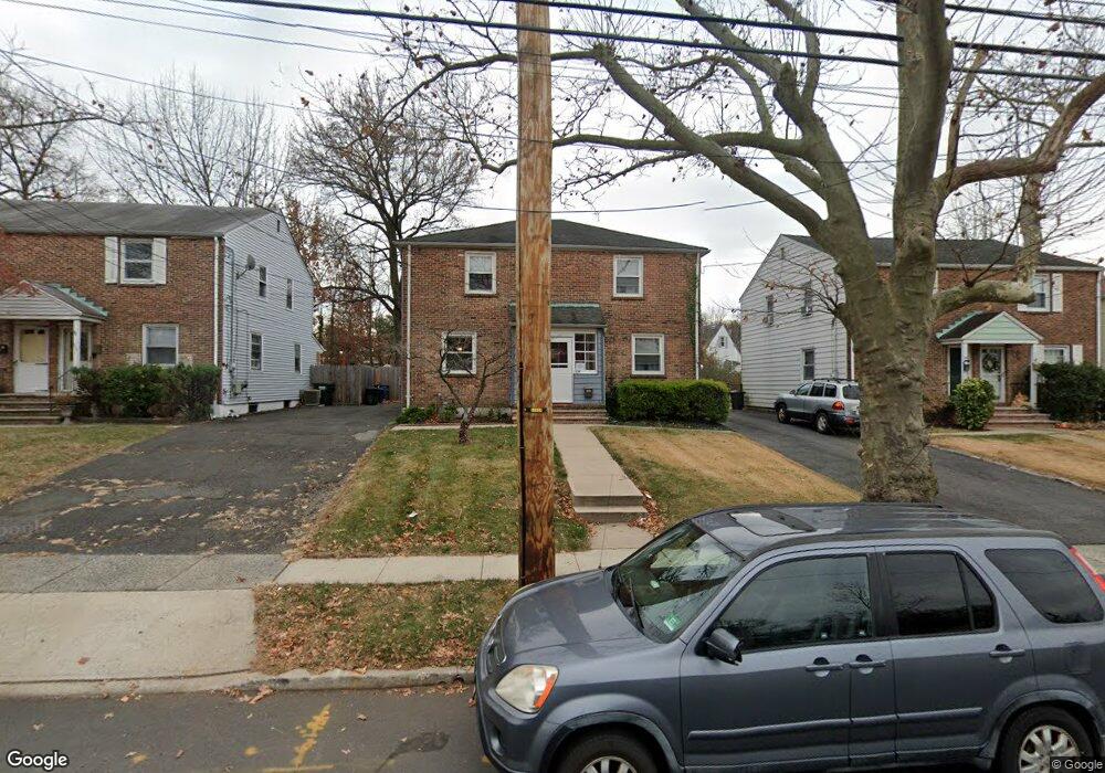
1139 South Ave W Westfield, NJ 07090
Estimated Value: $438,000 - $573,000
2
Beds
1
Bath
1,046
Sq Ft
$463/Sq Ft
Est. Value
About This Home
This home is located at 1139 South Ave W, Westfield, NJ 07090 and is currently estimated at $484,475, approximately $463 per square foot. 1139 South Ave W is a home located in Union County with nearby schools including McKinley Elementary School, Westfield Senior High School, and Holy Trinity School.
Ownership History
Date
Name
Owned For
Owner Type
Purchase Details
Closed on
Mar 11, 2002
Sold by
Connolly William
Bought by
Denning Paul and Denning Catherine
Current Estimated Value
Home Financials for this Owner
Home Financials are based on the most recent Mortgage that was taken out on this home.
Original Mortgage
$138,000
Outstanding Balance
$57,038
Interest Rate
6.91%
Estimated Equity
$427,437
Purchase Details
Closed on
Apr 14, 1998
Sold by
Newman William T and Newman Joan C
Bought by
Connolly William M and Connolly Ruth Erika
Create a Home Valuation Report for This Property
The Home Valuation Report is an in-depth analysis detailing your home's value as well as a comparison with similar homes in the area
Home Values in the Area
Average Home Value in this Area
Purchase History
| Date | Buyer | Sale Price | Title Company |
|---|---|---|---|
| Denning Paul | $72,500 | -- | |
| Denning Paul | $172,500 | Chicago Title Insurance Co | |
| Connolly William M | $91,750 | -- |
Source: Public Records
Mortgage History
| Date | Status | Borrower | Loan Amount |
|---|---|---|---|
| Open | Denning Paul | $138,000 | |
| Closed | Denning Paul | $138,000 |
Source: Public Records
Tax History Compared to Growth
Tax History
| Year | Tax Paid | Tax Assessment Tax Assessment Total Assessment is a certain percentage of the fair market value that is determined by local assessors to be the total taxable value of land and additions on the property. | Land | Improvement |
|---|---|---|---|---|
| 2025 | $6,060 | $269,100 | $168,300 | $100,800 |
| 2024 | $5,936 | $269,100 | $168,300 | $100,800 |
| 2023 | $5,936 | $269,100 | $168,300 | $100,800 |
| 2022 | $5,813 | $269,100 | $168,300 | $100,800 |
| 2021 | $5,821 | $269,100 | $168,300 | $100,800 |
| 2020 | $5,807 | $269,100 | $168,300 | $100,800 |
| 2019 | $5,786 | $269,100 | $168,300 | $100,800 |
| 2018 | $6,285 | $67,600 | $21,300 | $46,300 |
| 2017 | $6,250 | $67,600 | $21,300 | $46,300 |
| 2016 | $6,104 | $67,600 | $21,300 | $46,300 |
| 2015 | $5,982 | $67,600 | $21,300 | $46,300 |
| 2014 | $5,785 | $67,600 | $21,300 | $46,300 |
Source: Public Records
Map
Nearby Homes
- 350 W Dudley Ave
- 2314 Longfellow Ave
- 2116 Newark Ave
- 724 South Ave W Unit 724A
- 119 Lamberts Mill Rd
- 2154 W Broad St
- 524 Edgar Rd
- 2219 North Ave Unit 6
- 525 Edgar Rd
- 2286 Stocker Ln
- 869 Ternay Ave
- 143 Stanmore Place
- 303 Prospect St
- 314 Highgate Ave
- 260 Prospect St Unit C15
- 2406 Park Place
- 614 Dorian Rd
- 1466 Lamberts Mill Rd
- 538 Westfield Ave
- 2398 Hamlette Place
- 1137 South Ave W
- 1141 South Ave W
- 1135 South Ave W
- 1143 South Ave W
- 1145 South Ave W
- 1133 South Ave W
- 624 N Scotch Plains Ave
- 620 N Scotch Plains Ave
- 1131 South Ave W
- 1147 South Ave W
- 1129 South Ave W
- 616 N Scotch Plains Ave
- 1127 South Ave W
- 612 N Scotch Plains Ave
- 1125 South Ave W
- 1123 South Ave W
- 1121 South Ave W
- 632 Drake Place
- 636 Drake Place
- 625 N Scotch Plains Ave