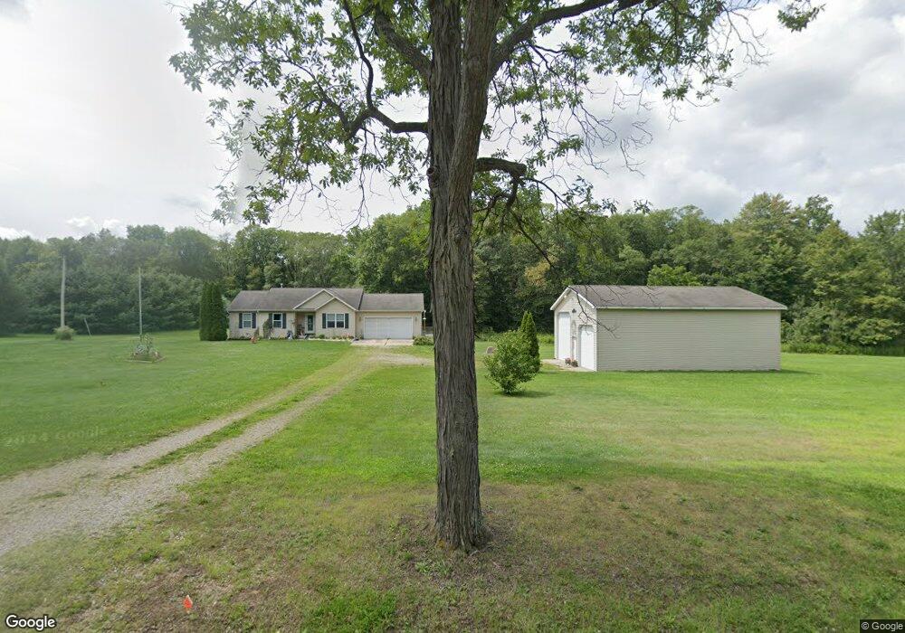
11391 Holibaugh Rd Springport, MI 49284
Estimated Value: $209,000 - $285,162
3
Beds
2
Baths
1,188
Sq Ft
$207/Sq Ft
Est. Value
About This Home
This home is located at 11391 Holibaugh Rd, Springport, MI 49284 and is currently estimated at $246,041, approximately $207 per square foot. 11391 Holibaugh Rd is a home located in Jackson County with nearby schools including Springport Elementary School, Springport Middle School, and Springport High School.
Ownership History
Date
Name
Owned For
Owner Type
Purchase Details
Closed on
Oct 1, 2020
Sold by
Hubbard Charles and Hubbard Edna M
Bought by
Hubbard Charles and Hubbard Edna M
Current Estimated Value
Purchase Details
Closed on
Nov 14, 2007
Sold by
Steward Phillip and Steward Marjorie
Bought by
Hubbard Edna M
Purchase Details
Closed on
Jul 25, 2005
Sold by
Haines Ricky L and Haines Ricky Lynn
Bought by
Steward Phillip and Steward Marjorie
Purchase Details
Closed on
Dec 12, 2002
Sold by
Adams Leilani
Bought by
Haines Ricky Lynn
Home Financials for this Owner
Home Financials are based on the most recent Mortgage that was taken out on this home.
Original Mortgage
$136,400
Interest Rate
6.01%
Mortgage Type
FHA
Create a Home Valuation Report for This Property
The Home Valuation Report is an in-depth analysis detailing your home's value as well as a comparison with similar homes in the area
Purchase History
| Date | Buyer | Sale Price | Title Company |
|---|---|---|---|
| Hubbard Charles | -- | None Available | |
| Hubbard Edna M | -- | None Available | |
| Hubbard Edna M | -- | None Available | |
| Steward Phillip | $161,000 | At | |
| Haines Ricky Lynn | -- | -- |
Source: Public Records
Mortgage History
| Date | Status | Borrower | Loan Amount |
|---|---|---|---|
| Previous Owner | Haines Ricky Lynn | $136,400 |
Source: Public Records
Tax History
| Year | Tax Paid | Tax Assessment Tax Assessment Total Assessment is a certain percentage of the fair market value that is determined by local assessors to be the total taxable value of land and additions on the property. | Land | Improvement |
|---|---|---|---|---|
| 2025 | $3,215 | $128,400 | $0 | $0 |
| 2024 | $10 | $117,200 | $0 | $0 |
| 2023 | $941 | $109,800 | $0 | $0 |
| 2022 | $2,011 | $99,800 | $0 | $0 |
| 2021 | $2,862 | $101,000 | $0 | $0 |
| 2020 | $867 | $102,100 | $0 | $0 |
| 2019 | $2,773 | $87,700 | $0 | $0 |
| 2018 | $2,718 | $74,900 | $0 | $0 |
| 2017 | $2,570 | $72,600 | $0 | $0 |
| 2016 | $815 | $72,600 | $0 | $72,600 |
| 2015 | -- | $81,900 | $81,900 | $0 |
| 2014 | -- | $83,200 | $0 | $0 |
| 2013 | -- | $83,200 | $83,200 | $0 |
Source: Public Records
Map
Nearby Homes
- 330 Grand St
- 10870 Eaton Rapids Rd
- 598 E Main St
- 216 Bayport Cir Unit 10
- 252 Bay Port Cir Unit 19
- 279 York Harbor Unit 34
- 29510 S Dr N
- 28660 E Baseline Hwy
- 9733 Blue Heron
- 16711 Stark Rd
- 13025 Pope Church Rd
- 19822 27 1 2 Mile Rd
- 8840 Houston Rd
- 7295 N Gibbs Rd
- 12261 Pope Church Rd
- 9761 Brown Rd
- Lot C Stoney Ln
- 26506 E Baseline Hwy
- 26854 Q-Drive N
- 26452 E Baseline Hwy
- 11383 Holibaugh Rd
- 11501 Holibaugh Rd
- 15961 Mcclellan Rd
- 11302 Holibaugh Rd
- 7.11 Ac Vl Mc Clellan Rd
- 11264 Holibaugh Rd
- 11259 Holibaugh Rd
- 11259 Holibaugh Rd
- 11300 Holibaugh Rd
- 11300 Holibaugh Rd
- 15886 Mcclellan Rd
- 15738 Mcclellan Rd
- 11162 Holibaugh Rd
- 15701 Mcclellan Rd
- 11669 Holibaugh Rd
- 0000 Holibaugh Rd
- 11290 Camm Rd
- 11021 Holibaugh Rd
- 11740 Holibaugh Rd
- 11012 Holibaugh Rd
Your Personal Tour Guide
Ask me questions while you tour the home.