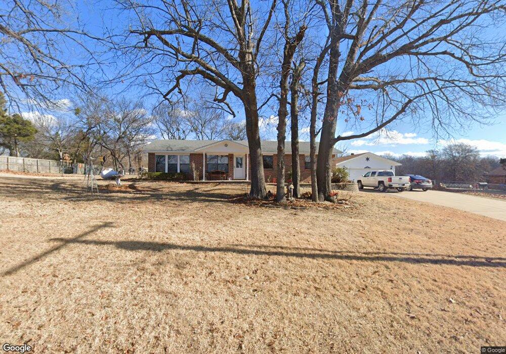
113961 S 4170 Rd Checotah, OK 74426
Estimated Value: $171,137 - $212,000
3
Beds
2
Baths
1,112
Sq Ft
$165/Sq Ft
Est. Value
About This Home
This home is located at 113961 S 4170 Rd, Checotah, OK 74426 and is currently estimated at $183,534, approximately $165 per square foot. 113961 S 4170 Rd is a home located in McIntosh County with nearby schools including Eufaula Elementary School, Eufaula Middle School, and Eufaula High School.
Ownership History
Date
Name
Owned For
Owner Type
Purchase Details
Closed on
Apr 29, 2005
Sold by
Miller Billy J and Miller Betty J
Bought by
Hill Mark E and Hill Chrystal E
Current Estimated Value
Home Financials for this Owner
Home Financials are based on the most recent Mortgage that was taken out on this home.
Original Mortgage
$19,300
Interest Rate
6.06%
Mortgage Type
Stand Alone Second
Purchase Details
Closed on
May 28, 2002
Sold by
Usa
Bought by
Miller
Purchase Details
Closed on
Dec 14, 1992
Create a Home Valuation Report for This Property
The Home Valuation Report is an in-depth analysis detailing your home's value as well as a comparison with similar homes in the area
Home Values in the Area
Average Home Value in this Area
Purchase History
| Date | Buyer | Sale Price | Title Company |
|---|---|---|---|
| Hill Mark E | $96,500 | None Available | |
| Miller | $31,000 | -- | |
| -- | $2,000 | -- |
Source: Public Records
Mortgage History
| Date | Status | Borrower | Loan Amount |
|---|---|---|---|
| Closed | Hill Mark E | $19,300 |
Source: Public Records
Tax History Compared to Growth
Tax History
| Year | Tax Paid | Tax Assessment Tax Assessment Total Assessment is a certain percentage of the fair market value that is determined by local assessors to be the total taxable value of land and additions on the property. | Land | Improvement |
|---|---|---|---|---|
| 2024 | $1,036 | $13,237 | $897 | $12,340 |
| 2023 | $1,036 | $12,477 | $897 | $11,580 |
| 2022 | $1,053 | $13,692 | $897 | $12,795 |
| 2021 | $1,065 | $13,692 | $897 | $12,795 |
| 2020 | $1,066 | $13,692 | $897 | $12,795 |
| 2019 | $1,069 | $13,692 | $897 | $12,795 |
| 2018 | $1,018 | $13,625 | $892 | $12,733 |
| 2017 | $987 | $12,843 | $822 | $12,021 |
| 2016 | $960 | $12,469 | $798 | $11,671 |
| 2015 | $917 | $12,106 | $1,300 | $10,806 |
| 2014 | $882 | $11,753 | $1,300 | $10,453 |
Source: Public Records
Map
Nearby Homes
- 114276 S 4170 Rd
- 114227 S 4172 Rd
- 417292 E 1145 Rd
- 417363 E 1145 Rd
- 417308 Bridgeport Rd
- 417394 E 1145
- 417377 Bridgeport Rd
- 114583 S 4172 Cir Unit 119
- 417601 E 1145 Rd
- 114516 Portside Dr
- 417717 E 1145 Rd
- 419086 E 1144 Rd
- 419036 E 1144 Rd
- 419124 E 1144 Rd
- 114572 Woodside Dr
- 114399 Oak Rd
- 1 E Lakeview Dr
- 418294 E 1140 Rd
- 114537 Spring Creek Rd
- 0 S 4176 Rd
- 113919 S 4170 Rd
- 113919 S 4170 Rd
- 113946 S 4170 Rd
- 113846 S 4170 Rd
- 113846 S 4170 Rd
- 113857 S 4170 Rd
- 113980 S 4170 Rd
- 0 N 4170 Rd Unit 1606272
- 113869 S 4169 Rd
- 0 4170 Rd Unit 1929178
- 417141 E 1141 Rd
- 417047 E 1141 Rd
- 113836 S 4169 Rd
- 417031 E 1141 Rd
- 114064 S 4172 Rd
- 113828 S 4169 Rd
- 417013 E 1141 Rd
- 113781 S 4170 Rd
- 417082 E 1141 Rd
- 417005 E 1141 Rd