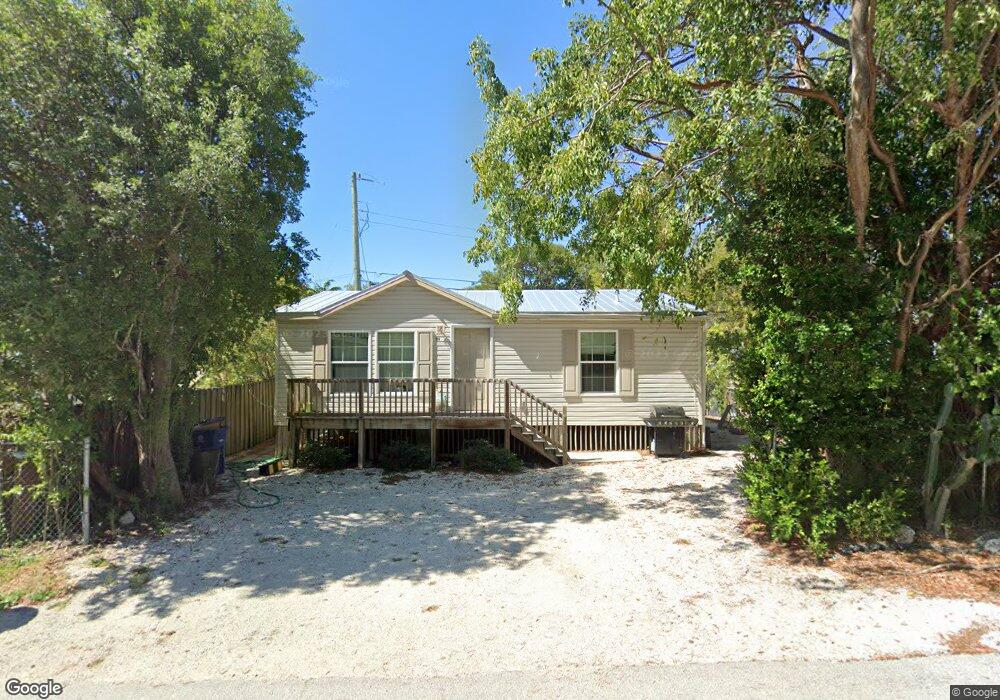
114 Atlantic Dr Key Largo, FL 33037
Estimated Value: $459,340 - $844,000
2
Beds
2
Baths
884
Sq Ft
$709/Sq Ft
Est. Value
About This Home
This home is located at 114 Atlantic Dr, Key Largo, FL 33037 and is currently estimated at $627,085, approximately $709 per square foot. 114 Atlantic Dr is a home located in Monroe County with nearby schools including Key Largo School, Coral Shores High School, and Dolphin Montessori Children's House.
Ownership History
Date
Name
Owned For
Owner Type
Purchase Details
Closed on
Apr 5, 2007
Sold by
Dowell Gregory Leon
Bought by
Peifer Ronald P
Current Estimated Value
Purchase Details
Closed on
Apr 18, 2005
Sold by
Ross Erwin Linda H and Erwin Rodney Stephen
Bought by
Dowell Gregory Leon
Home Financials for this Owner
Home Financials are based on the most recent Mortgage that was taken out on this home.
Original Mortgage
$366,400
Interest Rate
7.45%
Mortgage Type
Fannie Mae Freddie Mac
Purchase Details
Closed on
May 25, 2000
Bought by
Peifer Ronald P
Purchase Details
Closed on
Feb 1, 1977
Bought by
Peifer Ronald P
Create a Home Valuation Report for This Property
The Home Valuation Report is an in-depth analysis detailing your home's value as well as a comparison with similar homes in the area
Home Values in the Area
Average Home Value in this Area
Purchase History
| Date | Buyer | Sale Price | Title Company |
|---|---|---|---|
| Peifer Ronald P | -- | Attorney | |
| Dowell Gregory Leon | $458,000 | Coral Reef Title Company | |
| Peifer Ronald P | $6,000 | -- | |
| Peifer Ronald P | $1,800 | -- |
Source: Public Records
Mortgage History
| Date | Status | Borrower | Loan Amount |
|---|---|---|---|
| Previous Owner | Dowell Gregory Leon | $366,400 | |
| Closed | Dowell Gregory Leon | $91,600 |
Source: Public Records
Tax History
| Year | Tax Paid | Tax Assessment Tax Assessment Total Assessment is a certain percentage of the fair market value that is determined by local assessors to be the total taxable value of land and additions on the property. | Land | Improvement |
|---|---|---|---|---|
| 2025 | $1,965 | $187,948 | -- | -- |
| 2024 | $1,847 | $182,652 | -- | -- |
| 2023 | $1,847 | $177,333 | $0 | $0 |
| 2022 | $1,769 | $172,168 | $0 | $0 |
| 2021 | $1,769 | $167,154 | $0 | $0 |
| 2020 | $1,761 | $164,847 | $0 | $0 |
| 2019 | $1,735 | $161,141 | $0 | $0 |
| 2018 | $1,727 | $158,137 | $0 | $0 |
| 2017 | $1,695 | $154,885 | $0 | $0 |
| 2016 | $1,711 | $151,700 | $0 | $0 |
| 2015 | $1,742 | $150,645 | $0 | $0 |
| 2014 | $1,780 | $149,449 | $0 | $0 |
Source: Public Records
Map
Nearby Homes
- 109 Jasmine Dr
- 101 Poinsetta Dr
- 50 Oleander Dr
- 108 Poinciana Dr
- 113 Poinciana Dr
- 300 Ocean Dr Unit 23
- 300 Ocean Dr Unit 22
- 501 Caribbean Dr
- 0 Poinsetta Dr Unit 615501
- 00 Poinsetta Dr
- 392 Laguna Ave
- 235 Buttonwood Shores Dr
- 545 Ocean Cay
- 2 Buttonwood Dr
- 301 Buttonwood Cir
- 30 Coconut Dr
- 259 Saint Thomas Ave
- 258 Caribbean Dr
- 238 Atlantic Blvd
- 356 Buttonwood Shores Dr
- 150 Atlantic Dr
- 150 Atlantic Dr
- 140 Atlantic Dr
- 154 Atlantic Dr
- 156 Atlantic Dr
- 134 Atlantic Dr
- 158 Atlantic Dr
- 128 Atlantic Dr
- 124 Atlantic Dr
- 122 Atlantic Dr
- 170 Atlantic Dr
- 116 Jasmine Dr
- 178 Atlantic Dr
- 117 Jasmine Dr
- 50 Jasmine Dr
- 208 Ocean Dr
- 210 Ocean Dr
- 116 Atlantic Dr
- 121 Jasmine Dr
- 203 Silver Lake Dr
Your Personal Tour Guide
Ask me questions while you tour the home.