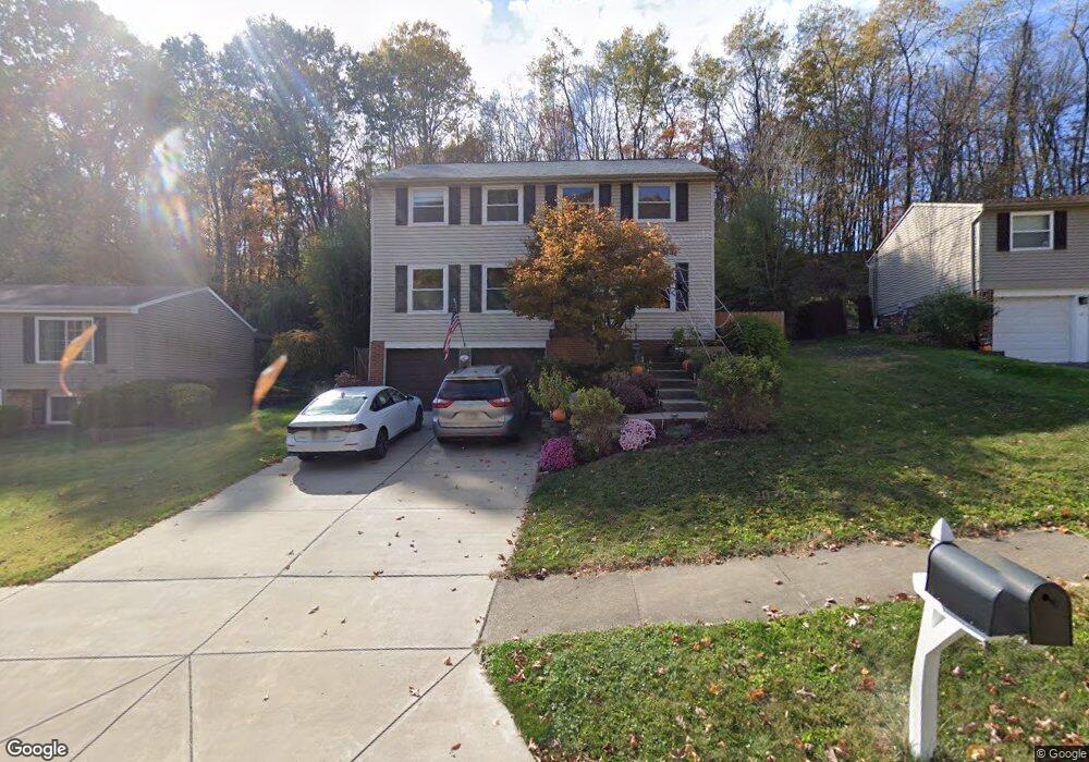
114 Bashford Dr Coraopolis, PA 15108
Estimated Value: $343,710 - $375,000
4
Beds
3
Baths
2,016
Sq Ft
$177/Sq Ft
Est. Value
About This Home
This home is located at 114 Bashford Dr, Coraopolis, PA 15108 and is currently estimated at $356,428, approximately $176 per square foot. 114 Bashford Dr is a home located in Allegheny County with nearby schools including Moon Area High School.
Ownership History
Date
Name
Owned For
Owner Type
Purchase Details
Closed on
Mar 31, 2003
Sold by
Cadman Roberta A M and Cadman Bailey C
Bought by
Depner Devin G and Depner Christie B
Current Estimated Value
Purchase Details
Closed on
Mar 27, 2001
Sold by
Sherrill Robynne L and Sherrill Vernon D
Bought by
Cendant Mobility Financial Corp
Purchase Details
Closed on
Mar 26, 2001
Sold by
Cendant Mobility Services Corp
Bought by
Cadman Bailey C and Cadman Roberta A M
Purchase Details
Closed on
Apr 1, 1997
Sold by
Pompeo Anthony F and Pompeo Sandra K
Bought by
Sherrill Robynne L and Sherrill Vernon D
Create a Home Valuation Report for This Property
The Home Valuation Report is an in-depth analysis detailing your home's value as well as a comparison with similar homes in the area
Home Values in the Area
Average Home Value in this Area
Purchase History
| Date | Buyer | Sale Price | Title Company |
|---|---|---|---|
| Depner Devin G | $167,900 | -- | |
| Cendant Mobility Financial Corp | $149,900 | -- | |
| Cadman Bailey C | $149,900 | -- | |
| Sherrill Robynne L | $138,500 | -- |
Source: Public Records
Tax History Compared to Growth
Tax History
| Year | Tax Paid | Tax Assessment Tax Assessment Total Assessment is a certain percentage of the fair market value that is determined by local assessors to be the total taxable value of land and additions on the property. | Land | Improvement |
|---|---|---|---|---|
| 2025 | $4,185 | $133,900 | $43,300 | $90,600 |
| 2024 | $4,185 | $133,900 | $43,300 | $90,600 |
| 2023 | $4,036 | $133,900 | $43,300 | $90,600 |
| 2022 | $4,036 | $133,900 | $43,300 | $90,600 |
| 2021 | $4,334 | $133,900 | $43,300 | $90,600 |
| 2020 | $3,935 | $133,900 | $43,300 | $90,600 |
| 2019 | $3,828 | $133,900 | $43,300 | $90,600 |
| 2017 | $3,619 | $133,900 | $43,300 | $90,600 |
Source: Public Records
Map
Nearby Homes
- 464 Malcolm Dr
- 603 Meade Dr
- 121 Shelbourne Dr
- 1490 Olde Stable Ln
- 120 Scottsdale Dr
- 168 Victoria Dr
- 1703 Wheatland Ct
- Somerset Plan at Victoria Ridge
- Rockford Plan at Victoria Ridge
- Birmingham Plan at Victoria Ridge
- Eisenhower Plan at Victoria Ridge
- Carlisle Plan at Victoria Ridge
- Truman Plan at Victoria Ridge
- Chattanooga Plan at Victoria Ridge
- Cleveland Plan at Victoria Ridge
- 140 Victoria Dr
- 208 Kenrich Dr
- 105 Springwater Ct
- 001 Spring Run Road Extension
- 122 Heldon Dr
- 112 Bashford Dr
- 116 Bashford Dr
- 118 Bashford Dr
- 110 Bashford Dr
- 108 Bashford Dr
- 120 Bashford Dr
- 111 Bashford Dr
- 109 Bashford Dr
- 113 Bashford Dr
- 115 Bashford Dr
- 107 Bashford Dr
- 106 Bashford Dr
- 122 Bashford Dr
- 221 Inverness Dr
- 117 Bashford Dr
- 219 Inverness Dr
- 105 Bashford Dr
- 223 Inverness Dr
- 217 Inverness Dr
- 104 Bashford Dr