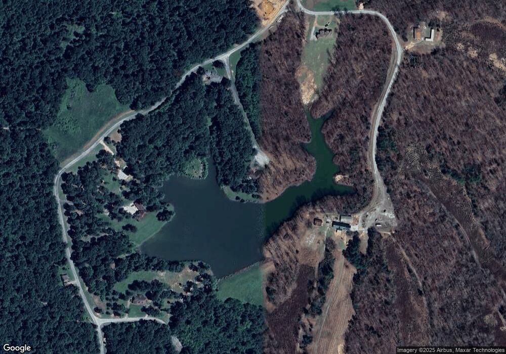
114 Bluff Point Cedar Grove, TN 38321
Estimated Value: $509,000 - $627,000
--
Bed
3
Baths
3,545
Sq Ft
$156/Sq Ft
Est. Value
About This Home
This home is located at 114 Bluff Point, Cedar Grove, TN 38321 and is currently estimated at $552,478, approximately $155 per square foot. 114 Bluff Point is a home located in Henderson County.
Ownership History
Date
Name
Owned For
Owner Type
Purchase Details
Closed on
Jun 20, 2017
Sold by
Gremmels Ollie R
Bought by
Ritenour Jacob V and Ritenour Lawanda A
Current Estimated Value
Home Financials for this Owner
Home Financials are based on the most recent Mortgage that was taken out on this home.
Original Mortgage
$566,250
Outstanding Balance
$552,730
Interest Rate
3.95%
Mortgage Type
Reverse Mortgage Home Equity Conversion Mortgage
Estimated Equity
-$252
Purchase Details
Closed on
Apr 7, 2004
Sold by
Gremmels Charles A
Bought by
Gremmels Charles A
Home Financials for this Owner
Home Financials are based on the most recent Mortgage that was taken out on this home.
Original Mortgage
$70,000
Interest Rate
5.63%
Create a Home Valuation Report for This Property
The Home Valuation Report is an in-depth analysis detailing your home's value as well as a comparison with similar homes in the area
Home Values in the Area
Average Home Value in this Area
Purchase History
| Date | Buyer | Sale Price | Title Company |
|---|---|---|---|
| Ritenour Jacob V | $377,500 | -- | |
| Gremmels Charles A | -- | -- |
Source: Public Records
Mortgage History
| Date | Status | Borrower | Loan Amount |
|---|---|---|---|
| Open | Ritenour Jacob V | $566,250 | |
| Previous Owner | Gremmels Charles A | $70,000 |
Source: Public Records
Tax History Compared to Growth
Tax History
| Year | Tax Paid | Tax Assessment Tax Assessment Total Assessment is a certain percentage of the fair market value that is determined by local assessors to be the total taxable value of land and additions on the property. | Land | Improvement |
|---|---|---|---|---|
| 2024 | $1,742 | $110,150 | $3,625 | $106,525 |
| 2023 | $1,742 | $110,150 | $3,625 | $106,525 |
| 2022 | $1,998 | $84,300 | $9,750 | $74,550 |
| 2021 | $1,998 | $84,300 | $9,750 | $74,550 |
| 2020 | $2,036 | $84,300 | $9,750 | $74,550 |
| 2019 | $2,925 | $123,400 | $9,750 | $113,650 |
| 2018 | $1,928 | $84,425 | $9,750 | $74,675 |
| 2017 | $1,928 | $84,425 | $9,750 | $74,675 |
| 2016 | $1,920 | $80,800 | $9,750 | $71,050 |
| 2015 | $1,920 | $80,800 | $9,750 | $71,050 |
| 2014 | $1,919 | $80,790 | $0 | $0 |
Source: Public Records
Map
Nearby Homes
- 400 Summit Chase Rd
- 00 Royal Fox Point
- 878 Palmer Rd
- 0 Daws Ln
- 4555 Rue Hamner Rd
- 155 Fire Tower Rd
- 5300 Mount Gilead Rd
- 0 Union Cross Rd
- 0 Pearson Rd
- 935 Pearson Rd
- 115 Baudy James Rd
- 151 Williams Ln
- 57 Scarlet Ln
- 000 Mt Gilead
- 2438 Leo Woods Rd
- 000 Hart Cemetery Rd
- Lot 5 Jason Hollow Rd
- 5 Jason Hollow Rd
- 213 Jason Hollow Rd
- 255 Jason Hollow Rd
- 26 Bluff Point
- 21 Bluff Point
- 605 Peregrine Place
- 16 Summit Chase Rd
- 45 Woodsedge
- 862 Peregrine Place
- 000 Summit Chase Lot 4
- 0 Royal Fox Point Unit RTC2681963
- 0 Royal Fox Point Unit RTC2577786
- 0 Royal Fox Point Unit RTC2442091
- Tract 3 Peregrine Place
- 56 Royal Fox Pointe
- Tract 2 Peregrine Place
- 00 Royal Fox Pointe
- 0 Mount Gilead Rd
- Lot 46 Peregrine Place
- 0 Falcon View Rd Unit 133790
- 2940 Mount Gilead Rd
- 000 Chip Shot
- 3050 Mount Gilead Rd
