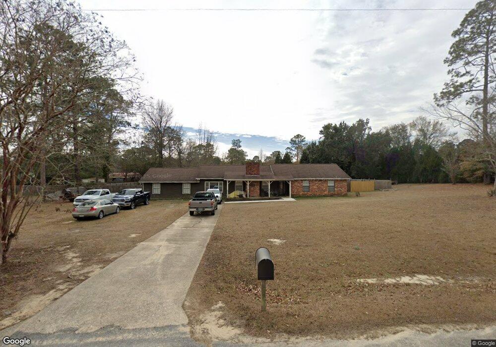
114 Brock St Bainbridge, GA 39817
Estimated Value: $256,962 - $350,000
4
Beds
3
Baths
2,383
Sq Ft
$123/Sq Ft
Est. Value
About This Home
This home is located at 114 Brock St, Bainbridge, GA 39817 and is currently estimated at $292,241, approximately $122 per square foot. 114 Brock St is a home located in Decatur County with nearby schools including Bainbridge High School.
Ownership History
Date
Name
Owned For
Owner Type
Purchase Details
Closed on
May 11, 2018
Sold by
Clemons Denisha Y
Bought by
Clemons Denisha Y and Lewis Jawarn Ferris
Current Estimated Value
Purchase Details
Closed on
Dec 21, 2011
Sold by
Fannie Mae
Bought by
Clemons Denisha Y
Purchase Details
Closed on
Jun 7, 2011
Sold by
Wells Fargo Bank Na
Bought by
Federal National Mortgage Association
Purchase Details
Closed on
Mar 19, 2010
Sold by
Reynolds John B
Bought by
Chambers Anthony K and Chambers Heidi L
Create a Home Valuation Report for This Property
The Home Valuation Report is an in-depth analysis detailing your home's value as well as a comparison with similar homes in the area
Home Values in the Area
Average Home Value in this Area
Purchase History
| Date | Buyer | Sale Price | Title Company |
|---|---|---|---|
| Clemons Denisha Y | -- | -- | |
| Clemons Denisha Y | $78,000 | -- | |
| Federal National Mortgage Association | $97,750 | -- | |
| Wells Fargo Bank Na | $97,750 | -- | |
| Chambers Anthony K | $20,000 | -- |
Source: Public Records
Tax History Compared to Growth
Tax History
| Year | Tax Paid | Tax Assessment Tax Assessment Total Assessment is a certain percentage of the fair market value that is determined by local assessors to be the total taxable value of land and additions on the property. | Land | Improvement |
|---|---|---|---|---|
| 2024 | $2,124 | $70,532 | $4,800 | $65,732 |
| 2023 | $2,124 | $70,532 | $4,800 | $65,732 |
| 2022 | $2,047 | $70,334 | $4,800 | $65,534 |
| 2021 | $1,838 | $61,993 | $4,800 | $57,193 |
| 2020 | $1,713 | $54,843 | $4,800 | $50,043 |
| 2019 | $1,670 | $51,485 | $4,800 | $46,685 |
| 2018 | $1,649 | $51,485 | $4,800 | $46,685 |
| 2017 | $1,616 | $51,485 | $4,800 | $46,685 |
| 2016 | $1,616 | $51,485 | $4,800 | $46,685 |
| 2015 | $1,638 | $51,485 | $4,800 | $46,685 |
| 2014 | $1,429 | $51,485 | $4,800 | $46,685 |
| 2013 | -- | $51,485 | $4,800 | $46,685 |
Source: Public Records
Map
Nearby Homes
- 104 Brock St
- 186 Aryola Dr
- 116 Flint River Heights Rd
- Tract 1 Rivervale Dr
- 150 Rivervale Dr
- 0 Pine St Unit 10993
- 116 Rivervale Dr
- 757 Manhole Rd
- 00 Manhole Rd
- 533 Flint River Heights Rd
- 2137 Pondtown Rd
- 287 Cloverleaf Cir
- 000 E River Rd
- 467 745 Lot St N
- 604 Martin St
- 1302 Majestic Ave
- 1603 Plantation Rd
- 2036 Lexington Ave
- 2032 Lexington Ave
- 1302 Talmadge St