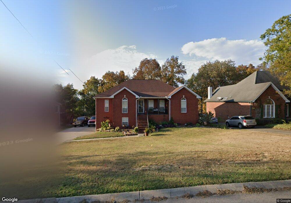
114 Cedar Forest Dr Smyrna, TN 37167
Estimated Value: $365,000 - $460,000
--
Bed
3
Baths
1,770
Sq Ft
$226/Sq Ft
Est. Value
About This Home
This home is located at 114 Cedar Forest Dr, Smyrna, TN 37167 and is currently estimated at $399,321, approximately $225 per square foot. 114 Cedar Forest Dr is a home located in Rutherford County with nearby schools including Rocky Fork Elementary School, Rocky Fork Middle School, and Smyrna High School.
Ownership History
Date
Name
Owned For
Owner Type
Purchase Details
Closed on
Jun 6, 2014
Sold by
Swaby Wendy
Bought by
Taylor David P Lisa
Current Estimated Value
Purchase Details
Closed on
Apr 14, 2006
Sold by
Finney Robert J
Bought by
Taylor David P
Home Financials for this Owner
Home Financials are based on the most recent Mortgage that was taken out on this home.
Original Mortgage
$140,000
Interest Rate
6.31%
Purchase Details
Closed on
Aug 4, 1997
Sold by
Nigbur and Kevin
Bought by
Finney Robert J and Finney Marleen
Purchase Details
Closed on
Oct 8, 1996
Sold by
Lewis James H
Bought by
Nigbur and Kevin
Home Financials for this Owner
Home Financials are based on the most recent Mortgage that was taken out on this home.
Original Mortgage
$134,995
Interest Rate
8.05%
Mortgage Type
Purchase Money Mortgage
Purchase Details
Closed on
Apr 19, 1995
Sold by
Dan Duer
Bought by
Lewis James H
Create a Home Valuation Report for This Property
The Home Valuation Report is an in-depth analysis detailing your home's value as well as a comparison with similar homes in the area
Home Values in the Area
Average Home Value in this Area
Purchase History
| Date | Buyer | Sale Price | Title Company |
|---|---|---|---|
| Taylor David P Lisa | $43,875 | -- | |
| Taylor David P | $175,000 | -- | |
| Finney Robert J | $144,000 | -- | |
| Nigbur | $142,100 | -- | |
| Lewis James H | $126,900 | -- |
Source: Public Records
Mortgage History
| Date | Status | Borrower | Loan Amount |
|---|---|---|---|
| Previous Owner | Lewis James H | $140,000 | |
| Previous Owner | Lewis James H | $134,995 |
Source: Public Records
Tax History Compared to Growth
Tax History
| Year | Tax Paid | Tax Assessment Tax Assessment Total Assessment is a certain percentage of the fair market value that is determined by local assessors to be the total taxable value of land and additions on the property. | Land | Improvement |
|---|---|---|---|---|
| 2025 | $2,277 | $94,800 | $13,750 | $81,050 |
| 2024 | $2,277 | $94,800 | $13,750 | $81,050 |
| 2023 | $2,277 | $94,800 | $13,750 | $81,050 |
| 2022 | $2,030 | $94,800 | $13,750 | $81,050 |
| 2021 | $1,920 | $65,725 | $12,500 | $53,225 |
| 2020 | $1,920 | $65,725 | $12,500 | $53,225 |
| 2019 | $1,920 | $65,725 | $12,500 | $53,225 |
| 2018 | $1,841 | $65,725 | $0 | $0 |
| 2017 | $1,739 | $48,800 | $0 | $0 |
| 2016 | $1,739 | $48,800 | $0 | $0 |
| 2015 | $1,739 | $48,800 | $0 | $0 |
| 2014 | $1,214 | $48,800 | $0 | $0 |
| 2013 | -- | $44,275 | $0 | $0 |
Source: Public Records
Map
Nearby Homes
- 407 Shadowood Dr
- 806 Enon Springs Rd W
- 505 Spinnaker Ct
- 508 Spinnaker Ct
- 499 Williamsport Dr
- 1307 Talia Trace Plan at Talia Trace
- 1781-3 Talia Trace Town Home Plan at Talia Trace
- 1723-2 Talia Trace Town Home Plan at Talia Trace
- 1306 Talia Trace Plan at Talia Trace
- 1703-3 Talia Trace Plan at Talia Trace
- 1603 Talia Trace Plan at Talia Trace
- 143 Stokes Dr
- 107 Irish Place
- 0 Bonifay Dr
- 120 Ace Ave
- 130 Ace Ave
- 140 Ace Ave
- 110 Ace Ave
- 101 Annleeken Dr
- 445 Slugger St
- 112 Cedar Forest Dr
- 116 Cedar Forest Dr
- 309 Shadowood Dr
- 110 Cedar Forest Dr
- 118 Cedar Forest Dr
- 311 Shadowood Dr
- 307 Shadowood Dr
- 115 Cedar Forest Dr
- 117 Cedar Forest Dr
- 313 Shadowood Dr
- 113 Cedar Forest Dr
- 120 Cedar Forest Dr
- 108 Cedar Forest Dr
- 305 Shadowood Dr
- 119 Cedar Forest Dr
- 111 Cedar Forest Dr
- 315 Shadowood Dr
- 121 Cedar Forest Dr
- 122 Cedar Forest Dr
- 106 Cedar Forest Dr