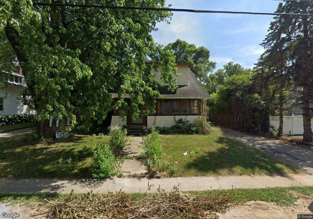
114 E Division St Rockford, MI 49341
Estimated Value: $271,000 - $341,000
3
Beds
1
Bath
1,428
Sq Ft
$214/Sq Ft
Est. Value
About This Home
This home is located at 114 E Division St, Rockford, MI 49341 and is currently estimated at $306,193, approximately $214 per square foot. 114 E Division St is a home located in Kent County with nearby schools including Meadow Ridge Elementary School, North Rockford Middle School, and Rockford High School Freshman Center.
Ownership History
Date
Name
Owned For
Owner Type
Purchase Details
Closed on
Oct 8, 2008
Sold by
Brown Stephanie and Brown Russell
Bought by
Deutsche Bank National Trust Co
Current Estimated Value
Purchase Details
Closed on
Mar 23, 2004
Sold by
Layton Scott E and Layton Lisa M
Bought by
Brown Stephanie
Home Financials for this Owner
Home Financials are based on the most recent Mortgage that was taken out on this home.
Original Mortgage
$119,500
Interest Rate
5.65%
Mortgage Type
Purchase Money Mortgage
Purchase Details
Closed on
Apr 4, 2001
Sold by
Johnson Bradley A and Johnson Heather A
Bought by
Accredited Home Lenders Inc
Create a Home Valuation Report for This Property
The Home Valuation Report is an in-depth analysis detailing your home's value as well as a comparison with similar homes in the area
Home Values in the Area
Average Home Value in this Area
Purchase History
| Date | Buyer | Sale Price | Title Company |
|---|---|---|---|
| Deutsche Bank National Trust Co | $58,800 | None Available | |
| Brown Stephanie | $119,500 | Metropolitan Title Company | |
| Accredited Home Lenders Inc | $110,032 | -- |
Source: Public Records
Mortgage History
| Date | Status | Borrower | Loan Amount |
|---|---|---|---|
| Previous Owner | Brown Stephanie | $119,500 |
Source: Public Records
Tax History
| Year | Tax Paid | Tax Assessment Tax Assessment Total Assessment is a certain percentage of the fair market value that is determined by local assessors to be the total taxable value of land and additions on the property. | Land | Improvement |
|---|---|---|---|---|
| 2025 | $2,212 | $120,600 | $0 | $0 |
| 2024 | $22 | $105,800 | $0 | $0 |
| 2023 | $2,112 | $100,400 | $0 | $0 |
| 2022 | $2,445 | $86,300 | $0 | $0 |
| 2021 | $2,377 | $77,500 | $0 | $0 |
| 2020 | $1,936 | $71,100 | $0 | $0 |
| 2019 | $2,316 | $65,700 | $0 | $0 |
| 2018 | $2,321 | $63,700 | $0 | $0 |
| 2017 | $2,263 | $59,900 | $0 | $0 |
| 2016 | $2,094 | $53,200 | $0 | $0 |
| 2015 | -- | $53,200 | $0 | $0 |
| 2013 | -- | $50,200 | $0 | $0 |
Source: Public Records
Map
Nearby Homes
- 178 Maple St NE
- 126 N Monroe St
- 145 Rollingwood Dr
- 182 Hunters Ln NE Unit 56
- 206 Hunters Ln NE Unit 30
- 144 Tamarack Ln NE Unit 1B
- 177 Prospect St
- 321 Adolph Ave
- 4916 Castle Hill Ct NE
- 78 Rockview Dr NE
- 237 Young Ct
- 675 Elstar Dr NE
- Unit 79 Rose Ridge Dr NE
- 3155 House St NE
- 663 Orchard Ct NE
- 3459 Wolven Ridge Dr
- 8050 Oakview Ridge Dr NE
- 7384 Rezen Dr NE
- 4341 Kroes St NE
- 5700 Kies St NE
- 120 E Division St
- 100 E Division St
- 30 E Division St NE
- 120 S Main St
- 109 S Monroe St
- 126 E Division St
- 119 S Monroe St
- 0 10 Mile Rd NE Unit M21000895
- 1307 10 Mile Rd NE
- 0 10 Mile Rd NE Unit PAR B 3591037
- 0 10 Mile Rd NE Unit LOT 1 3434513
- 0 10 Mile Rd NE Unit PAR A 3399404
- 0 10 Mile Rd NE Unit Parce 3285505
- 6560 10 Mile Rd NE
- 7910 10 Mile Rd NE
- 112455 10 Mile Rd NE Unit C
- 0 10 Mile Rd NE Unit APP B 3244016
- 7177 10 Mile Rd NE Unit D
- 0 10 Mile Rd NE Unit APP A 3235039
- 0 10 Mile Rd NE Unit APP 3 3232076
Your Personal Tour Guide
Ask me questions while you tour the home.