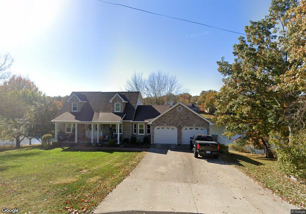
114 Eider Ct Georgetown, KY 40324
Estimated Value: $434,000 - $475,000
3
Beds
3
Baths
2,783
Sq Ft
$164/Sq Ft
Est. Value
About This Home
This home is located at 114 Eider Ct, Georgetown, KY 40324 and is currently estimated at $456,902, approximately $164 per square foot. 114 Eider Ct is a home located in Scott County with nearby schools including Northern Elementary School, Royal Spring Middle School, and Scott County High School.
Ownership History
Date
Name
Owned For
Owner Type
Purchase Details
Closed on
Mar 11, 2016
Sold by
Ladenburger Dale Allen
Bought by
Deskins Ronnie G and Deskins Joyce G
Current Estimated Value
Home Financials for this Owner
Home Financials are based on the most recent Mortgage that was taken out on this home.
Original Mortgage
$305,200
Outstanding Balance
$239,482
Interest Rate
3.72%
Mortgage Type
New Conventional
Estimated Equity
$217,420
Purchase Details
Closed on
Jul 22, 2014
Sold by
Ladenburger Dianna Maxey
Bought by
Ladenburger Dale Allen
Create a Home Valuation Report for This Property
The Home Valuation Report is an in-depth analysis detailing your home's value as well as a comparison with similar homes in the area
Purchase History
| Date | Buyer | Sale Price | Title Company |
|---|---|---|---|
| Deskins Ronnie G | $339,000 | Attorney | |
| Ladenburger Dale Allen | -- | Attorney |
Source: Public Records
Mortgage History
| Date | Status | Borrower | Loan Amount |
|---|---|---|---|
| Open | Deskins Ronnie G | $305,200 |
Source: Public Records
Tax History
| Year | Tax Paid | Tax Assessment Tax Assessment Total Assessment is a certain percentage of the fair market value that is determined by local assessors to be the total taxable value of land and additions on the property. | Land | Improvement |
|---|---|---|---|---|
| 2025 | $3,490 | $391,801 | $0 | $0 |
| 2024 | $3,137 | $348,801 | $0 | $0 |
| 2023 | $3,137 | $346,001 | $89,001 | $257,000 |
| 2022 | $2,942 | $346,001 | $75,001 | $271,000 |
| 2021 | $3,034 | $346,001 | $75,001 | $271,000 |
| 2020 | $2,913 | $339,001 | $75,001 | $264,000 |
| 2019 | $2,959 | $339,001 | $0 | $0 |
| 2018 | $2,942 | $339,001 | $0 | $0 |
| 2017 | $2,956 | $339,001 | $0 | $0 |
| 2016 | $2,059 | $255,677 | $0 | $0 |
| 2015 | $1,946 | $243,200 | $0 | $0 |
| 2014 | -- | $200,600 | $0 | $0 |
| 2011 | $1,474 | $202,696 | $0 | $0 |
Source: Public Records
Map
Nearby Homes
- 101 Sheldrake Ct
- 108 Teal Ct
- 107 Blackberry Ln
- 107 Bufflehead Ct
- 111 Blackberry Ln
- 107 Mallard Point Ct
- 1 Mallard Point Dr
- 115 Blackberry Ln
- 126 Hickory Grove Ct
- 117 Blackberry Ln
- 129 Hickory Grove Ct
- 122 Hickory Grove Ct
- 119 Blackberry Ln
- 118 Hickory Grove Ct
- 121 Blackberry Ln
- 123 Hickory Grove Ct
- 107 Pinnacle Point
- 116 Hickory Grove Ct
- 106 Pinnacle Point
- 105 Pinnacle Point
Your Personal Tour Guide
Ask me questions while you tour the home.