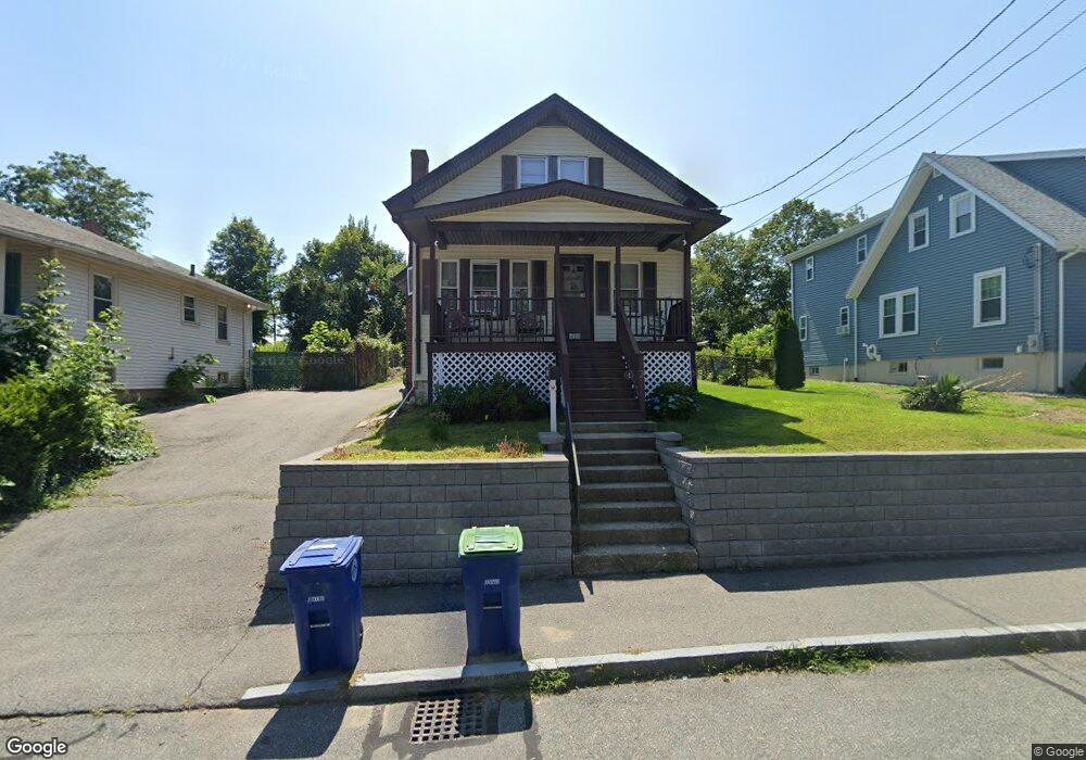
114 Elmlawn Rd Braintree, MA 02184
East Braintree NeighborhoodEstimated Value: $530,000 - $638,000
3
Beds
1
Bath
1,252
Sq Ft
$469/Sq Ft
Est. Value
About This Home
This home is located at 114 Elmlawn Rd, Braintree, MA 02184 and is currently estimated at $587,591, approximately $469 per square foot. 114 Elmlawn Rd is a home located in Norfolk County with nearby schools including Braintree High School, Meeting House Montessori School, and Step Ahead Kindergarten.
Ownership History
Date
Name
Owned For
Owner Type
Purchase Details
Closed on
Aug 23, 2005
Sold by
Sennott Ruth E
Bought by
Kilduff Edward and Kilduff Joyce
Current Estimated Value
Home Financials for this Owner
Home Financials are based on the most recent Mortgage that was taken out on this home.
Original Mortgage
$240,000
Outstanding Balance
$126,075
Interest Rate
5.66%
Mortgage Type
Purchase Money Mortgage
Estimated Equity
$461,516
Create a Home Valuation Report for This Property
The Home Valuation Report is an in-depth analysis detailing your home's value as well as a comparison with similar homes in the area
Home Values in the Area
Average Home Value in this Area
Purchase History
| Date | Buyer | Sale Price | Title Company |
|---|---|---|---|
| Kilduff Edward | $300,000 | -- |
Source: Public Records
Mortgage History
| Date | Status | Borrower | Loan Amount |
|---|---|---|---|
| Open | Kilduff Edward | $240,000 |
Source: Public Records
Tax History
| Year | Tax Paid | Tax Assessment Tax Assessment Total Assessment is a certain percentage of the fair market value that is determined by local assessors to be the total taxable value of land and additions on the property. | Land | Improvement |
|---|---|---|---|---|
| 2025 | $5,126 | $513,600 | $307,500 | $206,100 |
| 2024 | $4,565 | $481,500 | $279,100 | $202,400 |
| 2023 | $4,358 | $446,500 | $250,800 | $195,700 |
| 2022 | $4,201 | $422,200 | $226,500 | $195,700 |
| 2021 | $3,719 | $373,800 | $204,700 | $169,100 |
| 2020 | $3,436 | $348,500 | $186,100 | $162,400 |
| 2019 | $3,228 | $319,900 | $178,000 | $141,900 |
| 2018 | $3,145 | $298,400 | $161,800 | $136,600 |
| 2017 | $3,118 | $290,300 | $153,700 | $136,600 |
| 2016 | $3,004 | $273,600 | $145,600 | $128,000 |
| 2015 | $2,709 | $244,700 | $121,400 | $123,300 |
| 2014 | $2,739 | $239,800 | $116,500 | $123,300 |
Source: Public Records
Map
Nearby Homes
- 17 White Rd
- 342 Elm St
- 9 Independence Ave Unit 307
- 192 Federal Ave Unit B
- 30 Church St Unit 4
- 99 Verchild St
- 20 Vine St
- 155 Kendrick Ave Unit 502
- 255 River St
- 177 Franklin St
- 166 Phipps St
- 26 Tingley Rd
- 63 Dickerman Ln
- 30 Skyline Dr Unit 6
- 50 N Payne St Unit 6
- 37 Skyline Dr Unit 11
- 25 W Howard St Unit C3
- 200 Falls Blvd Unit B305
- 200 Falls Blvd Unit I301
- 87 Franklin St Unit 105
- 120 Elmlawn Rd
- 110 Elmlawn Rd
- 124 Elmlawn Rd
- 106 Elmlawn Rd
- 121 Lawnview Dr
- 127 Lawnview Dr
- 128 Elmlawn Rd
- 102 Elmlawn Rd
- 115 Lawnview Dr
- 115 Elmlawn Rd
- 111 Elmlawn Rd
- 119 Elmlawn Rd
- 107 Elmlawn Rd
- 123 Elmlawn Rd
- 132 Elmlawn Rd
- 98 Elmlawn Rd
- 103 Elmlawn Rd
- 107 Lawnview Dr
- 133 Lawnview Dr
- 127 Elmlawn Rd
Your Personal Tour Guide
Ask me questions while you tour the home.