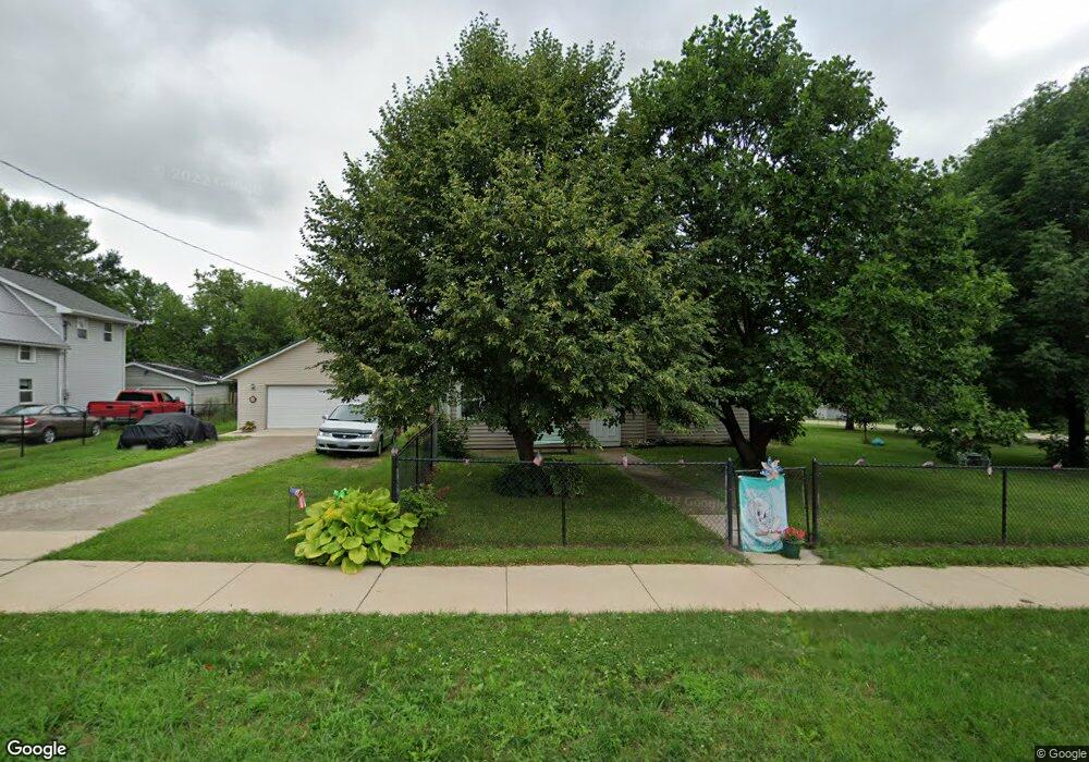
114 Green St Center Point, IA 52213
Estimated Value: $204,000 - $229,000
5
Beds
1
Bath
2,089
Sq Ft
$103/Sq Ft
Est. Value
About This Home
This home is located at 114 Green St, Center Point, IA 52213 and is currently estimated at $216,177, approximately $103 per square foot. 114 Green St is a home located in Linn County with nearby schools including Center Point-Urbana Primary School, Center Point-Urbana Intermediate School, and Center Point-Urbana Middle School.
Ownership History
Date
Name
Owned For
Owner Type
Purchase Details
Closed on
Nov 16, 2011
Sold by
Dundee Gary R and Dundee Carol A
Bought by
Saltou Stuert R and Saltou Rebecca M
Current Estimated Value
Home Financials for this Owner
Home Financials are based on the most recent Mortgage that was taken out on this home.
Original Mortgage
$92,018
Interest Rate
4.08%
Mortgage Type
Future Advance Clause Open End Mortgage
Purchase Details
Closed on
Apr 19, 2005
Sold by
Federal National Mortgage Association
Bought by
Dundee Gary R and Dundee Carol A
Home Financials for this Owner
Home Financials are based on the most recent Mortgage that was taken out on this home.
Original Mortgage
$78,400
Interest Rate
5.89%
Mortgage Type
Purchase Money Mortgage
Create a Home Valuation Report for This Property
The Home Valuation Report is an in-depth analysis detailing your home's value as well as a comparison with similar homes in the area
Home Values in the Area
Average Home Value in this Area
Purchase History
| Date | Buyer | Sale Price | Title Company |
|---|---|---|---|
| Saltou Stuert R | $97,500 | None Available | |
| Dundee Gary R | -- | -- |
Source: Public Records
Mortgage History
| Date | Status | Borrower | Loan Amount |
|---|---|---|---|
| Closed | Saltou Stuert R | $92,018 | |
| Previous Owner | Dundee Gary R | $78,400 |
Source: Public Records
Tax History Compared to Growth
Tax History
| Year | Tax Paid | Tax Assessment Tax Assessment Total Assessment is a certain percentage of the fair market value that is determined by local assessors to be the total taxable value of land and additions on the property. | Land | Improvement |
|---|---|---|---|---|
| 2025 | $3,282 | $183,600 | $24,800 | $158,800 |
| 2024 | $3,102 | $191,100 | $24,800 | $166,300 |
| 2023 | $3,102 | $191,100 | $24,800 | $166,300 |
| 2022 | $3,094 | $152,900 | $24,800 | $128,100 |
| 2021 | $2,800 | $152,900 | $24,800 | $128,100 |
| 2020 | $2,800 | $132,300 | $24,800 | $107,500 |
| 2019 | $2,550 | $124,200 | $24,800 | $99,400 |
| 2018 | $2,490 | $124,200 | $24,800 | $99,400 |
| 2017 | $2,286 | $111,500 | $24,800 | $86,700 |
| 2016 | $2,390 | $111,500 | $24,800 | $86,700 |
| 2015 | $2,392 | $111,500 | $24,800 | $86,700 |
| 2014 | $2,392 | $111,500 | $24,800 | $86,700 |
| 2013 | $2,376 | $111,500 | $24,800 | $86,700 |
Source: Public Records
Map
Nearby Homes
- 718 Pointer Cir
- 120 Green St
- 717 Pointer Cir
- 132 Green St
- 708 Rogers Ln
- 603 Pointer Cir
- 523 Rogers Ln
- 316 E Washington St
- 0 Iowa St
- 508 Vine St
- 1208 Franklin St
- 115 Main St
- 702 Central Ave
- 1120 Central Ave
- 920 E Washington St
- 809 Iowa St
- 318 Crestview Dr
- 507 Maplewood Dr
- 4505 Urbana Rd Unit West Parcel
- 4505 Urbana Rd Unit East Parcel