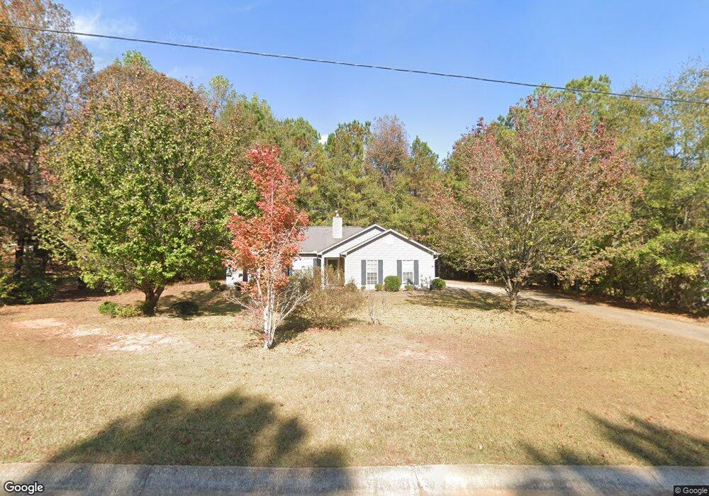
114 Hampton Green Dr Lagrange, GA 30240
Estimated Value: $211,000 - $237,000
3
Beds
2
Baths
1,333
Sq Ft
$170/Sq Ft
Est. Value
About This Home
This home is located at 114 Hampton Green Dr, Lagrange, GA 30240 and is currently estimated at $226,618, approximately $170 per square foot. 114 Hampton Green Dr is a home located in Troup County with nearby schools including Hillcrest Elementary School, Franklin Forest Elementary School, and Hollis Hand Elementary School.
Ownership History
Date
Name
Owned For
Owner Type
Purchase Details
Closed on
Aug 5, 2019
Sold by
Barnes James C
Bought by
Barnes James C and Gilbert Jennifer Joy
Current Estimated Value
Purchase Details
Closed on
Apr 12, 2018
Sold by
Barnes James Clemis
Bought by
Barnes James C and Barnes Linda M
Purchase Details
Closed on
May 4, 2001
Sold by
Dri Hampton Green Llc
Bought by
Mary Ellaweese Barnes
Purchase Details
Closed on
Jan 20, 1999
Sold by
Dan-Ric Inc
Bought by
Dri Hampton Green Llc
Purchase Details
Closed on
Jun 25, 1997
Sold by
Holland Ware
Bought by
Dan-Ric Inc
Create a Home Valuation Report for This Property
The Home Valuation Report is an in-depth analysis detailing your home's value as well as a comparison with similar homes in the area
Purchase History
| Date | Buyer | Sale Price | Title Company |
|---|---|---|---|
| Barnes James C | -- | -- | |
| Barnes James C | -- | -- | |
| Mary Ellaweese Barnes | $103,900 | -- | |
| Dri Hampton Green Llc | -- | -- | |
| Dan-Ric Inc | -- | -- |
Source: Public Records
Tax History
| Year | Tax Paid | Tax Assessment Tax Assessment Total Assessment is a certain percentage of the fair market value that is determined by local assessors to be the total taxable value of land and additions on the property. | Land | Improvement |
|---|---|---|---|---|
| 2025 | $2,025 | $74,240 | $10,000 | $64,240 |
| 2024 | $1,535 | $56,280 | $10,000 | $46,280 |
| 2023 | $1,549 | $56,800 | $10,000 | $46,800 |
| 2022 | $1,527 | $54,720 | $10,000 | $44,720 |
| 2021 | $1,466 | $48,600 | $10,000 | $38,600 |
| 2020 | $1,405 | $46,600 | $8,000 | $38,600 |
| 2019 | $1,258 | $41,720 | $6,000 | $35,720 |
| 2018 | $1,258 | $41,720 | $6,000 | $35,720 |
| 2017 | $1,258 | $41,720 | $6,000 | $35,720 |
| 2016 | $1,136 | $37,653 | $4,000 | $33,653 |
| 2015 | $967 | $37,653 | $4,000 | $33,653 |
| 2014 | $1,086 | $35,882 | $4,000 | $31,882 |
| 2013 | -- | $37,874 | $4,000 | $33,874 |
Source: Public Records
Map
Nearby Homes
- 114 Taylor Len Dr
- 143 Taylor Len Dr
- 178 Waterview Dr
- 113 Wellington Dr
- 166 Lakemont Dr
- 24 N Brooks Rd
- 0 Waterview Dr Unit 10558462
- 107 Edgemont Ct
- 111 Copper Creek Dr
- 120 Copper Creek Dr
- 64 Waterview Ct
- 219 E Yorktown Dr
- 135 Copper Creek Dr
- 207 N View Pointe Dr
- 206 Sturbridge Dr
- 106 Jandale Dr
- 11.62+/- AC New Franklin Rd
- 130 Sunny Point Cir
- 0 River Club Dr Unit 10311961
- 109 Windridge
- 116 Hampton Green Dr
- 112 Hampton Green Dr
- 200 Hampton Green Dr
- 101 Chapman Ct
- 107 Hampton Green Dr
- 202 Hampton Green Dr
- 100 Chapman Ct
- 110 Hampton Green Dr
- 105 Hampton Green Dr
- 103 Chapman Ct
- 204 Hampton Green Dr
- 102 Chapman Ct
- 108 Hampton Green Dr
- 206 Hampton Green Dr
- 104 Chapman Ct
- 106 Hampton Green Dr
- 103 Hampton Green Dr
- 104 Hampton Green Dr
- 101 Yarmouth Ct
- 105 Chapman Ct
Your Personal Tour Guide
Ask me questions while you tour the home.