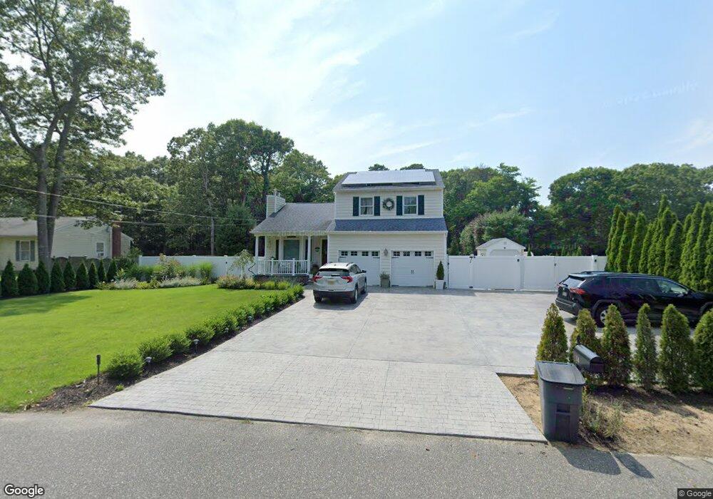
114 Hawthorne St Mastic, NY 11950
Estimated Value: $546,000 - $582,000
3
Beds
1
Bath
1,586
Sq Ft
$359/Sq Ft
Est. Value
About This Home
This home is located at 114 Hawthorne St, Mastic, NY 11950 and is currently estimated at $569,500, approximately $359 per square foot. 114 Hawthorne St is a home located in Suffolk County with nearby schools including Nathaniel Woodhull Elementary School, William Floyd Middle School, and William Floyd High School.
Ownership History
Date
Name
Owned For
Owner Type
Purchase Details
Closed on
Jul 27, 2004
Sold by
Quartuccio Nina M
Bought by
Locaso Louis A
Current Estimated Value
Purchase Details
Closed on
Feb 23, 1998
Sold by
Jenna Organization Inc
Bought by
Quartuccio Nina M
Home Financials for this Owner
Home Financials are based on the most recent Mortgage that was taken out on this home.
Original Mortgage
$79,000
Interest Rate
6.85%
Purchase Details
Closed on
Dec 9, 1997
Sold by
Caccia Albert P
Bought by
Jenna Organization Inc
Create a Home Valuation Report for This Property
The Home Valuation Report is an in-depth analysis detailing your home's value as well as a comparison with similar homes in the area
Home Values in the Area
Average Home Value in this Area
Purchase History
| Date | Buyer | Sale Price | Title Company |
|---|---|---|---|
| Locaso Louis A | $320,000 | Fidelity National Title Insu | |
| Quartuccio Nina M | $134,000 | -- | |
| Jenna Organization Inc | $25,000 | -- |
Source: Public Records
Mortgage History
| Date | Status | Borrower | Loan Amount |
|---|---|---|---|
| Previous Owner | Quartuccio Nina M | $79,000 |
Source: Public Records
Tax History Compared to Growth
Tax History
| Year | Tax Paid | Tax Assessment Tax Assessment Total Assessment is a certain percentage of the fair market value that is determined by local assessors to be the total taxable value of land and additions on the property. | Land | Improvement |
|---|---|---|---|---|
| 2024 | $10,363 | $2,600 | $300 | $2,300 |
| 2023 | $10,363 | $2,600 | $300 | $2,300 |
| 2022 | $10,691 | $2,600 | $300 | $2,300 |
| 2021 | $10,691 | $2,400 | $300 | $2,100 |
| 2020 | $10,921 | $2,400 | $300 | $2,100 |
| 2019 | $10,921 | $0 | $0 | $0 |
| 2018 | $10,499 | $2,400 | $300 | $2,100 |
| 2017 | $10,499 | $2,400 | $300 | $2,100 |
| 2016 | $10,554 | $2,600 | $300 | $2,300 |
| 2015 | -- | $2,400 | $300 | $2,100 |
| 2014 | -- | $2,400 | $300 | $2,100 |
Source: Public Records
Map
Nearby Homes
- 123 Hawthorne St
- 120 Somerset Ave
- 139 Madison St
- 5 Ormond Place
- 70 Patchogue Ave
- 107 Shinnecock Ave
- 43 Hampton Ave
- 66 Wood Ave
- 123 Patchogue Ave
- 0 Van Buren St
- 114 Bedford Ave
- 0 Bedford Ave Unit KEYL3488158
- 72 Clinton Ave
- 150 Moriches Ave
- 33 Wood Ave
- 19 Hawthorne St
- 29 Wood Ave
- 14 Hawthorne St
- 24 Dover Ave
- 169 Pawnee Ave
- 112 Hawthorne St
- 128 Hawthorne St
- 108 Hawthorne St
- 122 Hawthorne St
- 78 Shinnecock Ave
- 6 Jefferson Place
- 119 Hawthorne St
- 126 Hawthorne St
- 77 Shinnecock Ave
- 106 Hawthorne St
- 11 Reeves Place
- 80 Shinnecock Ave
- 70 Southaven Ave
- 78 Southaven Ave
- 87 Somerset Ave
- 79 Shinnecock Ave
- 91 Somerset Ave
- 0 Jefferson Place
- 85 Somerset Ave
- 130 Hawthorne St