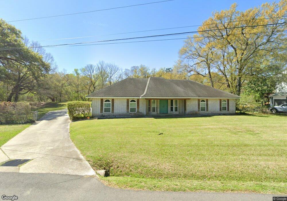
114 Hiawatha Rd Lafayette, LA 70501
River Oaks NeighborhoodEstimated Value: $200,000 - $230,000
4
Beds
2
Baths
2,020
Sq Ft
$104/Sq Ft
Est. Value
About This Home
This home is located at 114 Hiawatha Rd, Lafayette, LA 70501 and is currently estimated at $209,511, approximately $103 per square foot. 114 Hiawatha Rd is a home located in Lafayette Parish with nearby schools including Dr. Raphael A. Baranco Elementary School, Paul Breaux Middle School, and Northside High School.
Ownership History
Date
Name
Owned For
Owner Type
Purchase Details
Closed on
Jul 21, 2011
Sold by
Wells Fargo Financial Louisiana Inc
Bought by
Crossley Sam Amy and Dane Sam
Current Estimated Value
Home Financials for this Owner
Home Financials are based on the most recent Mortgage that was taken out on this home.
Original Mortgage
$108,070
Outstanding Balance
$74,454
Interest Rate
4.54%
Mortgage Type
FHA
Estimated Equity
$135,057
Purchase Details
Closed on
Mar 31, 2006
Sold by
Babineaux Mary Linda Klumpp and Babineaux Billy John
Bought by
Babineaux Buller Robert John and Babineaux Buller Nicole Marie
Create a Home Valuation Report for This Property
The Home Valuation Report is an in-depth analysis detailing your home's value as well as a comparison with similar homes in the area
Home Values in the Area
Average Home Value in this Area
Purchase History
| Date | Buyer | Sale Price | Title Company |
|---|---|---|---|
| Crossley Sam Amy | $115,000 | None Available | |
| Babineaux Buller Robert John | $152,000 | None Available |
Source: Public Records
Mortgage History
| Date | Status | Borrower | Loan Amount |
|---|---|---|---|
| Open | Crossley Sam Amy | $108,070 |
Source: Public Records
Tax History
| Year | Tax Paid | Tax Assessment Tax Assessment Total Assessment is a certain percentage of the fair market value that is determined by local assessors to be the total taxable value of land and additions on the property. | Land | Improvement |
|---|---|---|---|---|
| 2024 | $1,152 | $17,126 | $2,380 | $14,746 |
| 2023 | $1,152 | $15,510 | $2,380 | $13,130 |
| 2022 | $1,497 | $14,310 | $2,380 | $11,930 |
| 2021 | $1,502 | $14,310 | $2,380 | $11,930 |
| 2020 | $1,497 | $14,310 | $2,380 | $11,930 |
| 2019 | $561 | $14,310 | $2,380 | $11,930 |
| 2018 | $828 | $14,310 | $2,380 | $11,930 |
| 2017 | $828 | $14,310 | $2,380 | $11,930 |
| 2015 | $828 | $14,310 | $2,380 | $11,930 |
| 2013 | -- | $14,310 | $2,380 | $11,930 |
Source: Public Records
Map
Nearby Homes
- 335 Indian Mound Rd
- 108 Homas Rd
- 109 Plaquemine Rd
- 101 Vinemont Dr
- 220 Attakapas Rd
- 201 Vinemont Dr
- 3500 E SiMcOe St Unit 69
- 3500 E SiMcOe St Unit 30
- 200 Vennard Ave
- 210 Lilly St
- 102 Rimwood Ave
- 404 Attakapas Rd
- 329 Gauthier Rd
- 1300 S Orange St
- 154 Champagne St
- 156 Champagne St
- 144 Champagne St
- 2100 Blk E Pinhook Rd
- 2200 Blk E Pinhook Rd
- 3605 E SiMcOe St
Your Personal Tour Guide
Ask me questions while you tour the home.