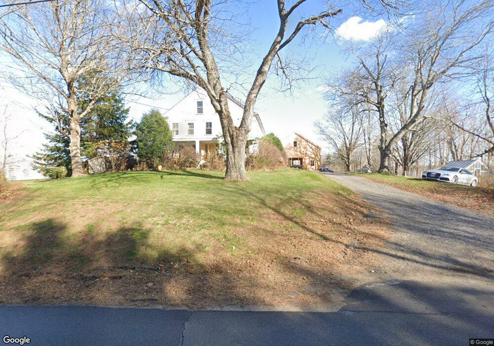
114 Hurricane Rd Gorham, ME 04038
North Gorham NeighborhoodEstimated Value: $531,033 - $655,000
3
Beds
2
Baths
2,574
Sq Ft
$235/Sq Ft
Est. Value
About This Home
This home is located at 114 Hurricane Rd, Gorham, ME 04038 and is currently estimated at $605,508, approximately $235 per square foot. 114 Hurricane Rd is a home with nearby schools including Great Falls Elementary School, Gorham Middle School, and Gorham High School.
Ownership History
Date
Name
Owned For
Owner Type
Purchase Details
Closed on
Jul 8, 2019
Sold by
Juliano Monica A
Bought by
Juliano Monica A and Bertin Henry S
Current Estimated Value
Home Financials for this Owner
Home Financials are based on the most recent Mortgage that was taken out on this home.
Original Mortgage
$150,000
Outstanding Balance
$130,221
Interest Rate
3.9%
Mortgage Type
New Conventional
Estimated Equity
$475,287
Purchase Details
Closed on
Jun 30, 2019
Sold by
Juliano Nadine J
Bought by
Juliano Monica A
Home Financials for this Owner
Home Financials are based on the most recent Mortgage that was taken out on this home.
Original Mortgage
$150,000
Outstanding Balance
$130,221
Interest Rate
3.9%
Mortgage Type
New Conventional
Estimated Equity
$475,287
Create a Home Valuation Report for This Property
The Home Valuation Report is an in-depth analysis detailing your home's value as well as a comparison with similar homes in the area
Home Values in the Area
Average Home Value in this Area
Purchase History
| Date | Buyer | Sale Price | Title Company |
|---|---|---|---|
| Juliano Monica A | -- | -- | |
| Juliano Monica A | -- | -- |
Source: Public Records
Mortgage History
| Date | Status | Borrower | Loan Amount |
|---|---|---|---|
| Open | Juliano Monica A | $150,000 |
Source: Public Records
Tax History
| Year | Tax Paid | Tax Assessment Tax Assessment Total Assessment is a certain percentage of the fair market value that is determined by local assessors to be the total taxable value of land and additions on the property. | Land | Improvement |
|---|---|---|---|---|
| 2024 | $6,046 | $411,300 | $109,500 | $301,800 |
| 2023 | $5,827 | $423,800 | $109,500 | $314,300 |
| 2022 | $5,446 | $423,800 | $109,500 | $314,300 |
| 2021 | $5,609 | $289,100 | $89,900 | $199,200 |
| 2020 | $5,493 | $289,100 | $89,900 | $199,200 |
| 2019 | $5,478 | $289,100 | $89,900 | $199,200 |
| 2018 | $5,262 | $289,100 | $89,900 | $199,200 |
| 2017 | $4,944 | $289,100 | $89,900 | $199,200 |
| 2016 | $4,918 | $289,300 | $90,100 | $199,200 |
| 2015 | $4,716 | $289,300 | $90,100 | $199,200 |
| 2014 | $4,614 | $265,200 | $82,400 | $182,800 |
| 2013 | $4,588 | $265,200 | $82,400 | $182,800 |
Source: Public Records
Map
Nearby Homes
- 594 River Rd
- 81 N Gorham Rd
- 8 Beaulieu Dr
- 21 Shyannes Way
- 18 Cook Rd
- 21 Cook Rd
- 215 N Gorham Rd
- 12 Dolley Farm Rd Unit 6
- 236 Main St
- 42 Barnes Rd
- 0 Meredith Dr
- 32 Middle Jam Rd
- 29 Victoria Ln
- 20 Revolution Dr
- 17 Betty Ln
- 32 Patriot Place
- 46 Sebago Lake Rd
- 7 Magnolia Ln Unit 2
- 761 Fort Hill Rd
- 324 Roosevelt Trail
- 110 Hurricane Rd
- 3 Cummings Dr
- 4 Cummings Dr
- 138 Hurricane Rd
- 140 Wilson Rd
- 141 Hurricane Rd
- 9 Cummings Dr
- 137 Wilson Rd
- 15 Sawyer Farm Rd
- 145 Hurricane Rd
- 5 Dundee Rd
- 144 Hurricane Rd
- Lot 101 Hurricane Rd
- 33 Sawyer Farm Rd
- 36 Sawyer Farm Rd
- 00 Hurricane Rd
- 10 Dundee Rd
- 25 Dundee Rd
- 122 Wilson Rd
- 148 Hurricane Rd
Your Personal Tour Guide
Ask me questions while you tour the home.