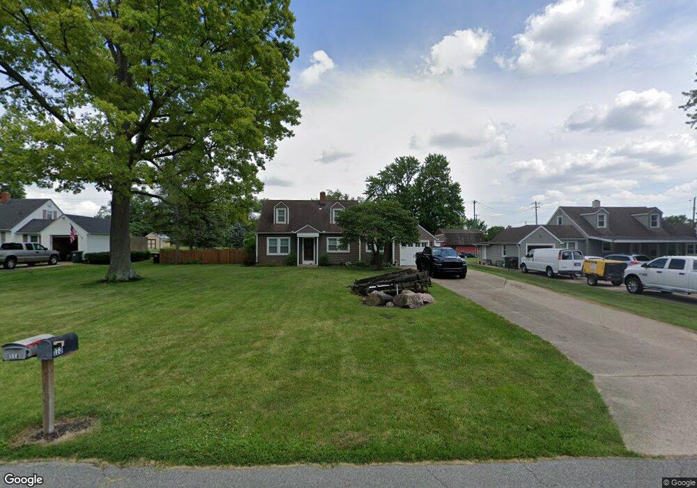
114 Lindy Dr Middletown, OH 45044
Estimated Value: $200,688 - $274,000
2
Beds
2
Baths
1,296
Sq Ft
$178/Sq Ft
Est. Value
About This Home
This home is located at 114 Lindy Dr, Middletown, OH 45044 and is currently estimated at $230,672, approximately $177 per square foot. 114 Lindy Dr is a home located in Butler County with nearby schools including Monroe Primary School, Monroe Elementary School, and Monroe Junior High School.
Ownership History
Date
Name
Owned For
Owner Type
Purchase Details
Closed on
Dec 11, 2003
Sold by
Mcintosh Roy D
Bought by
Mcintosh Roy D and Mcintosh Kathy J
Current Estimated Value
Home Financials for this Owner
Home Financials are based on the most recent Mortgage that was taken out on this home.
Original Mortgage
$114,000
Outstanding Balance
$58,711
Interest Rate
7.5%
Mortgage Type
Stand Alone Refi Refinance Of Original Loan
Estimated Equity
$171,961
Purchase Details
Closed on
May 13, 1994
Purchase Details
Closed on
May 1, 1988
Create a Home Valuation Report for This Property
The Home Valuation Report is an in-depth analysis detailing your home's value as well as a comparison with similar homes in the area
Home Values in the Area
Average Home Value in this Area
Purchase History
| Date | Buyer | Sale Price | Title Company |
|---|---|---|---|
| Mcintosh Roy D | -- | Pure Title Agency Ltd | |
| -- | $82,500 | -- | |
| -- | $63,500 | -- |
Source: Public Records
Mortgage History
| Date | Status | Borrower | Loan Amount |
|---|---|---|---|
| Open | Mcintosh Roy D | $114,000 |
Source: Public Records
Tax History Compared to Growth
Tax History
| Year | Tax Paid | Tax Assessment Tax Assessment Total Assessment is a certain percentage of the fair market value that is determined by local assessors to be the total taxable value of land and additions on the property. | Land | Improvement |
|---|---|---|---|---|
| 2024 | $2,029 | $45,030 | $12,160 | $32,870 |
| 2023 | $2,016 | $45,030 | $12,160 | $32,870 |
| 2022 | $1,697 | $33,400 | $12,160 | $21,240 |
| 2021 | $1,635 | $33,400 | $12,160 | $21,240 |
| 2020 | $1,694 | $33,400 | $12,160 | $21,240 |
| 2019 | $2,047 | $29,860 | $12,080 | $17,780 |
| 2018 | $1,635 | $29,860 | $12,080 | $17,780 |
| 2017 | $1,669 | $29,860 | $12,080 | $17,780 |
| 2016 | $1,588 | $27,240 | $12,080 | $15,160 |
| 2015 | $1,571 | $27,240 | $12,080 | $15,160 |
| 2014 | $2,095 | $27,240 | $12,080 | $15,160 |
| 2013 | $2,095 | $36,450 | $12,080 | $24,370 |
Source: Public Records
Map
Nearby Homes
- 176 Lakeview Dr
- 75 Bayberry Ln
- 27 Kameron Dr
- 401 Granny Smith Ln
- 2043 Bridgewater Ln
- 5346 Roden Park Dr
- 912 Morgan Dr
- 389 David Lee Ct
- 2064 Bridgewater Ln
- 393 David Lee Ct
- 395 David Lee Ct
- 390 David Lee Ct
- 404 David Lee Ct
- 511 Shawn Dr
- 925 Morgan Dr
- STRATTON Plan at Estates of Monroe Crossings
- VALE Plan at Estates of Monroe Crossings
- VANDERBURGH Plan at Estates of Monroe Crossings
- PARKETTE Plan at Estates of Monroe Crossings
- LYNDHURST Plan at Estates of Monroe Crossings