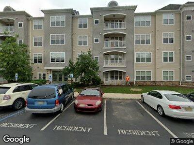
114 Masterson Ct Trenton, NJ 08618
Ewingville NeighborhoodEstimated Value: $328,000 - $352,000
--
Bed
--
Bath
1,573
Sq Ft
$216/Sq Ft
Est. Value
About This Home
This home is located at 114 Masterson Ct, Trenton, NJ 08618 and is currently estimated at $340,219, approximately $216 per square foot. 114 Masterson Ct is a home located in Mercer County with nearby schools including Ewing High School, Trenton Stem-To-Civics Charter School, and The Laurel School of Princeton.
Ownership History
Date
Name
Owned For
Owner Type
Purchase Details
Closed on
Aug 17, 2010
Sold by
Rosenthal Robert
Bought by
Rosenthal Huguette
Current Estimated Value
Purchase Details
Closed on
Mar 26, 2008
Sold by
Fed Natl Mtg Assn
Bought by
Rosenthal Robert
Home Financials for this Owner
Home Financials are based on the most recent Mortgage that was taken out on this home.
Original Mortgage
$201,400
Outstanding Balance
$133,961
Interest Rate
6.1%
Mortgage Type
New Conventional
Purchase Details
Closed on
Nov 30, 2007
Sold by
Kevin C Larkin Sheriff Of Mercer
Bought by
Federal Natl Mtg Assoc
Purchase Details
Closed on
Nov 30, 2005
Sold by
American Properties
Bought by
Lee Sam
Home Financials for this Owner
Home Financials are based on the most recent Mortgage that was taken out on this home.
Original Mortgage
$214,232
Interest Rate
6.34%
Mortgage Type
Purchase Money Mortgage
Create a Home Valuation Report for This Property
The Home Valuation Report is an in-depth analysis detailing your home's value as well as a comparison with similar homes in the area
Home Values in the Area
Average Home Value in this Area
Purchase History
| Date | Buyer | Sale Price | Title Company |
|---|---|---|---|
| Rosenthal Huguette | -- | None Available | |
| Rosenthal Robert | $212,000 | -- | |
| Federal Natl Mtg Assoc | -- | -- | |
| Lee Sam | $267,790 | -- |
Source: Public Records
Mortgage History
| Date | Status | Borrower | Loan Amount |
|---|---|---|---|
| Open | Rosenthal Robert | $201,400 | |
| Previous Owner | Lee Sam | $214,232 |
Source: Public Records
Tax History Compared to Growth
Tax History
| Year | Tax Paid | Tax Assessment Tax Assessment Total Assessment is a certain percentage of the fair market value that is determined by local assessors to be the total taxable value of land and additions on the property. | Land | Improvement |
|---|---|---|---|---|
| 2024 | $6,107 | $165,200 | $36,000 | $129,200 |
| 2023 | $6,107 | $165,200 | $36,000 | $129,200 |
| 2022 | $5,942 | $165,200 | $36,000 | $129,200 |
| 2021 | $5,797 | $165,200 | $36,000 | $129,200 |
| 2020 | $5,714 | $165,200 | $36,000 | $129,200 |
| 2019 | $5,566 | $165,200 | $36,000 | $129,200 |
| 2018 | $6,301 | $119,300 | $25,000 | $94,300 |
| 2017 | $6,448 | $119,300 | $25,000 | $94,300 |
| 2016 | $6,361 | $119,300 | $25,000 | $94,300 |
| 2015 | $6,276 | $119,300 | $25,000 | $94,300 |
| 2014 | $6,260 | $119,300 | $25,000 | $94,300 |
Source: Public Records
Map
Nearby Homes
- 121 Masterson Ct Unit 121
- 326 Masterson Ct
- 413 Masterson Ct
- 525 Masterson Ct
- 614 Masterson Ct
- 1341 Lower Ferry Rd
- 1028 Timberlake Dr Unit 1028
- 218 Timberlake Dr Unit 218
- 16 Fran Ave
- 35 Bayberry Rd
- 2115 Pennington Rd
- 28 Kyle Way
- 2264 Pennington Rd
- 4 Blue Ridge Dr
- 1218 Lower Ferry Rd
- 34 Chelmsford Ct
- 27 Farm Rd
- 192 Bull Run Rd
- 44 Lanning St
- 17 Acton Ave
- 114 Masterson Ct
- 124 Masterson Ct
- 134 Masterson Ct
- 144 Masterson Ct
- 113 Masterson Ct
- 123 Masterson Ct
- 126 Masterson Ct
- 116 Masterson Ct
- 112 Masterson Ct
- 136 Masterson Ct
- 122 Masterson Ct
- 133 Masterson Ct
- 146 Masterson Ct
- 132 Masterson Ct
- 142 Masterson Ct
- 115 Masterson Ct Unit 115
- 111 Masterson Ct
- 125 Masterson Ct
- 125 Masterson Ct
- 143 Masterson Ct