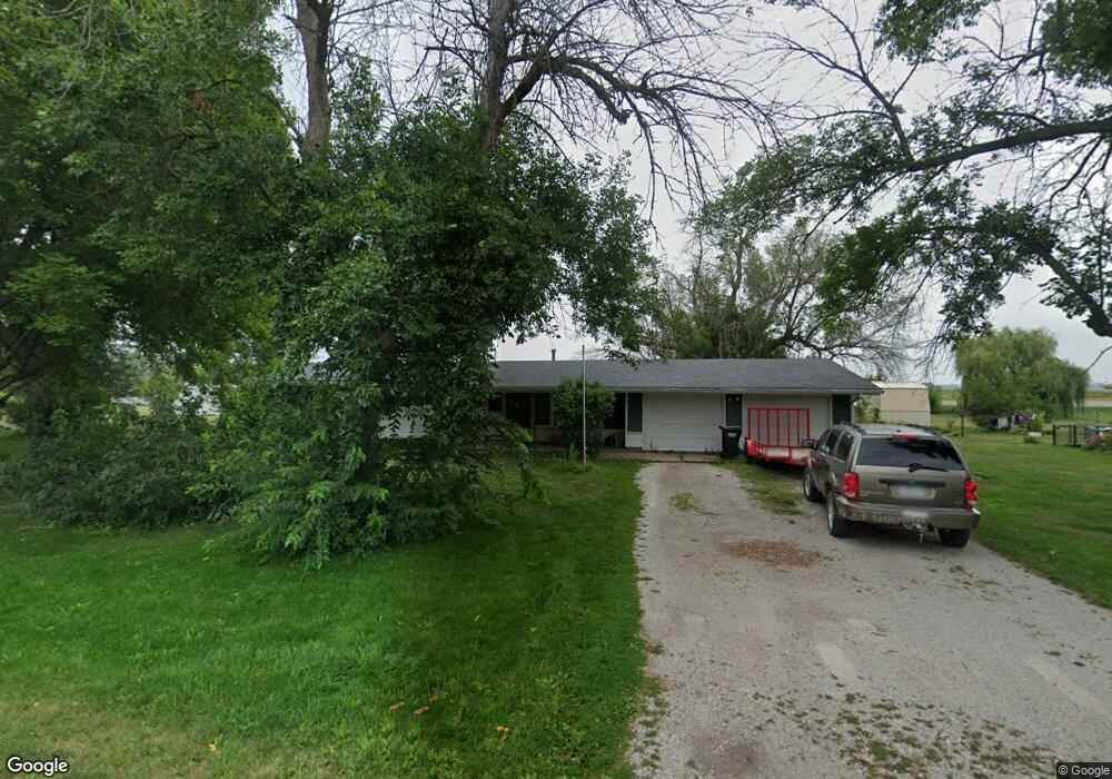
114 Mckinley St Nichols, IA 52766
Estimated Value: $126,000 - $156,000
3
Beds
2
Baths
1,248
Sq Ft
$111/Sq Ft
Est. Value
About This Home
This home is located at 114 Mckinley St, Nichols, IA 52766 and is currently estimated at $138,154, approximately $110 per square foot. 114 Mckinley St is a home located in Muscatine County with nearby schools including Early Childhood Center, West Liberty Middle School, and West Liberty High School.
Ownership History
Date
Name
Owned For
Owner Type
Purchase Details
Closed on
Dec 27, 2023
Sold by
Honts Michael J and Honts Bethie Kpj
Bought by
Crabtree Amanda and Crabtree Dustin E
Current Estimated Value
Home Financials for this Owner
Home Financials are based on the most recent Mortgage that was taken out on this home.
Original Mortgage
$88,000
Outstanding Balance
$87,343
Interest Rate
7.44%
Mortgage Type
New Conventional
Estimated Equity
$50,811
Purchase Details
Closed on
Jan 10, 2018
Sold by
Muscatine County
Bought by
Honts Michael
Purchase Details
Closed on
Nov 10, 2008
Sold by
Hsbc Mortgage Services Inc
Bought by
Nonts Michael and Nonts Michael J
Home Financials for this Owner
Home Financials are based on the most recent Mortgage that was taken out on this home.
Original Mortgage
$76,584
Interest Rate
6.04%
Mortgage Type
FHA
Create a Home Valuation Report for This Property
The Home Valuation Report is an in-depth analysis detailing your home's value as well as a comparison with similar homes in the area
Home Values in the Area
Average Home Value in this Area
Purchase History
| Date | Buyer | Sale Price | Title Company |
|---|---|---|---|
| Crabtree Amanda | $110,000 | None Listed On Document | |
| Honts Michael | -- | None Available | |
| Nonts Michael | $77,000 | None Available |
Source: Public Records
Mortgage History
| Date | Status | Borrower | Loan Amount |
|---|---|---|---|
| Open | Crabtree Amanda | $88,000 | |
| Previous Owner | Nonts Michael | $76,584 |
Source: Public Records
Tax History Compared to Growth
Tax History
| Year | Tax Paid | Tax Assessment Tax Assessment Total Assessment is a certain percentage of the fair market value that is determined by local assessors to be the total taxable value of land and additions on the property. | Land | Improvement |
|---|---|---|---|---|
| 2025 | $1,776 | $127,080 | $24,280 | $102,800 |
| 2024 | $1,776 | $127,790 | $24,280 | $103,510 |
| 2023 | $746 | $118,328 | $24,221 | $94,107 |
| 2022 | $2,374 | $115,980 | $22,850 | $93,130 |
| 2021 | $2,367 | $103,510 | $22,850 | $80,660 |
| 2020 | $2,424 | $98,620 | $22,850 | $75,770 |
| 2019 | $2,567 | $98,680 | $0 | $0 |
| 2018 | $1,962 | $98,680 | $0 | $0 |
Source: Public Records
Map
Nearby Homes
- 1679 160th St
- 0 Iron City Ave
- 407 E Elm St
- 1443 Bunker Dr
- 1241 Eagle Ct
- 500 S Center St
- 106 Dorothy Ln
- 201 N Devoe St
- 112 W Linn St
- 1210 Davis Ave
- 221 W Commercial St
- 1444 121st St
- 745 N Perkins St
- 1118 120th St
- 0000 TBD E A St
- 0000 Tbd E A St
- 510 E 1st St
- 25736 Golden Pond Ln Se Lot 17
- 25738 Golden Pond Ln Se Lot 16
- 25838 Golden Oak Ln Lot 7