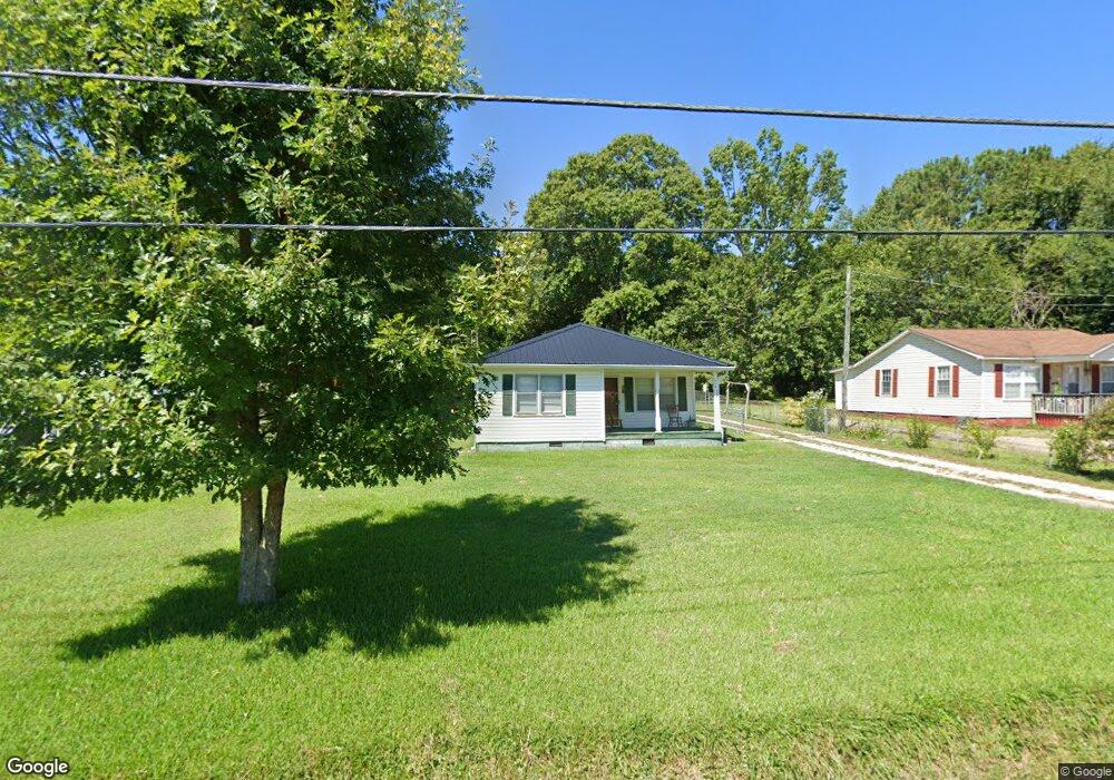
114 Pine Cir Lagrange, GA 30241
Estimated Value: $135,000 - $166,459
3
Beds
2
Baths
1,456
Sq Ft
$106/Sq Ft
Est. Value
About This Home
This home is located at 114 Pine Cir, Lagrange, GA 30241 and is currently estimated at $154,365, approximately $106 per square foot. 114 Pine Cir is a home located in Troup County with nearby schools including Hollis Hand Elementary School, Franklin Forest Elementary School, and Ethel W. Kight Elementary School.
Ownership History
Date
Name
Owned For
Owner Type
Purchase Details
Closed on
Oct 3, 2023
Sold by
Butler Minnie Ruth
Bought by
Hunt Linda Kathy
Current Estimated Value
Purchase Details
Closed on
Jun 6, 2018
Sold by
Us Bank National Associati
Bought by
Butler Minnie R
Purchase Details
Closed on
Apr 3, 2018
Sold by
Carter Jeff
Bought by
Us Bank National Association T and American General Mtg Loan Trus
Purchase Details
Closed on
Oct 9, 2002
Sold by
Faye Carter
Bought by
Carter Faye A and Carter Jeff
Purchase Details
Closed on
Jun 26, 1997
Sold by
Turner J W
Bought by
Faye Carter
Purchase Details
Closed on
Jun 12, 1958
Sold by
Norred J H
Bought by
Turner J W
Create a Home Valuation Report for This Property
The Home Valuation Report is an in-depth analysis detailing your home's value as well as a comparison with similar homes in the area
Purchase History
| Date | Buyer | Sale Price | Title Company |
|---|---|---|---|
| Hunt Linda Kathy | -- | -- | |
| Butler Minnie R | $55,125 | -- | |
| Us Bank National Association T | $42,569 | -- | |
| Carter Faye A | -- | -- | |
| Faye Carter | $68,400 | -- | |
| Turner J W | -- | -- |
Source: Public Records
Tax History
| Year | Tax Paid | Tax Assessment Tax Assessment Total Assessment is a certain percentage of the fair market value that is determined by local assessors to be the total taxable value of land and additions on the property. | Land | Improvement |
|---|---|---|---|---|
| 2025 | $1,261 | $46,240 | $10,000 | $36,240 |
| 2024 | $1,013 | $37,132 | $10,000 | $27,132 |
| 2023 | $1,013 | $2,690 | $0 | $2,690 |
| 2022 | $913 | $32,696 | $8,000 | $24,696 |
| 2021 | $696 | $23,076 | $4,000 | $19,076 |
| 2020 | $696 | $23,076 | $4,000 | $19,076 |
| 2019 | $665 | $22,776 | $4,000 | $18,776 |
| 2018 | $626 | $22,740 | $2,400 | $20,340 |
| 2017 | $626 | $22,740 | $2,400 | $20,340 |
| 2016 | $595 | $21,728 | $1,840 | $19,888 |
| 2015 | $614 | $22,296 | $2,409 | $19,888 |
| 2014 | $586 | $21,350 | $2,409 | $18,941 |
| 2013 | -- | $23,506 | $2,280 | $21,226 |
Source: Public Records
Map
Nearby Homes
- 113 Pine Cir
- 129 Mallory Dr
- 100 Dove Creek Ct
- 507 Headwater Ct Unit 6
- 503 Headwater Ct Unit 4D
- 302 Glenhaven Dr Unit 2D
- 502 Headwater Ct Unit 8D
- 311 Mourning Ct Unit LOT 33
- 200 River Meadow Dr
- 109 Shenandoah Ln
- 106 Shenandoah Ln Unit 26E
- 106 Shenandoah Ln
- 117 Shenandoah Ln Unit 22D
- 15 Fulton St
- 114 Shenandoah Ln
- 249 River Meadow Dr
- 240 River Meadow Dr
- 242 River Meadow Dr
- 2 Louise St
- 206 Freshwater Ct Unit 34E
- 112 Pine Cir
- 116 Pine Cir
- 118 Pine Cir
- 115 Pine Cir
- 120 Pine Cir
- 119 Pine Cir
- 126 Pine Cir
- 121 Pine Cir
- 117 Pine Cir
- 2 Short St
- 127 Pine Cir
- 0 Durand Rd Unit 10416016
- 0 Durand Rd Unit 7379317
- 0 Durand Rd Unit 20004468
- 0 Durand Rd Unit 1305118
- 0 Durand Rd Unit 20004279
- 0 Durand Rd Unit 8983395
- 0 Durand Rd Unit 8661670
- 128 Pine Cir
- 119 Mallory Dr
Your Personal Tour Guide
Ask me questions while you tour the home.