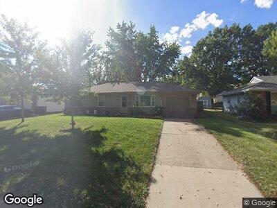
114 S Queen Ridge Dr Independence, MO 64050
Valley View NeighborhoodEstimated Value: $195,000 - $216,000
3
Beds
2
Baths
1,215
Sq Ft
$167/Sq Ft
Est. Value
About This Home
This home is located at 114 S Queen Ridge Dr, Independence, MO 64050 and is currently estimated at $202,575, approximately $166 per square foot. 114 S Queen Ridge Dr is a home located in Jackson County with nearby schools including Ott Elementary School, Bridger Middle School, and Bingham Middle School.
Ownership History
Date
Name
Owned For
Owner Type
Purchase Details
Closed on
Jan 24, 2014
Sold by
Palmer Mary Roberta
Bought by
Palmer Kevin M and Burch John Eric
Current Estimated Value
Purchase Details
Closed on
Apr 6, 2007
Sold by
Palmer Robert Joseph and Palmer Virginia M
Bought by
Palmer Mary Roberta
Home Financials for this Owner
Home Financials are based on the most recent Mortgage that was taken out on this home.
Original Mortgage
$96,000
Interest Rate
6.19%
Mortgage Type
Purchase Money Mortgage
Purchase Details
Closed on
Sep 26, 1996
Sold by
Mihelic Anthony and Mihelic Marie
Bought by
Palmer Robert J
Create a Home Valuation Report for This Property
The Home Valuation Report is an in-depth analysis detailing your home's value as well as a comparison with similar homes in the area
Home Values in the Area
Average Home Value in this Area
Purchase History
| Date | Buyer | Sale Price | Title Company |
|---|---|---|---|
| Palmer Mary Roberta | -- | Chicago Title | |
| Palmer Robert J | -- | -- |
Source: Public Records
Mortgage History
| Date | Status | Borrower | Loan Amount |
|---|---|---|---|
| Open | Palmer Mary Roberta | $90,348 | |
| Closed | Palmer Mary Roberta | $96,000 | |
| Closed | Palmer Robert Joseph | $41,000 |
Source: Public Records
Tax History Compared to Growth
Tax History
| Year | Tax Paid | Tax Assessment Tax Assessment Total Assessment is a certain percentage of the fair market value that is determined by local assessors to be the total taxable value of land and additions on the property. | Land | Improvement |
|---|---|---|---|---|
| 2024 | $1,519 | $22,435 | $3,247 | $19,188 |
| 2023 | $1,519 | $22,435 | $3,061 | $19,374 |
| 2022 | $1,530 | $20,710 | $4,912 | $15,798 |
| 2021 | $1,529 | $20,710 | $4,912 | $15,798 |
| 2020 | $1,468 | $19,319 | $4,912 | $14,407 |
| 2019 | $1,444 | $19,319 | $4,912 | $14,407 |
| 2018 | $1,441 | $18,401 | $3,767 | $14,634 |
| 2017 | $1,441 | $18,401 | $3,767 | $14,634 |
| 2016 | $1,419 | $17,940 | $3,131 | $14,809 |
| 2014 | $1,348 | $17,417 | $3,040 | $14,377 |
Source: Public Records
Map
Nearby Homes
- 120 S Ellison Way
- 101 S Lacy Rd
- 15810 E 2 St S
- 300 N M 291 Hwy
- 15817 E 3rd Terrace Ct S
- 124 N Peck Dr
- 329 S Kendall Ave
- 408 Broad St
- 15501 E 3rd Terrace S
- 209 N Gilbert St
- 15717 E Independence Ave
- 339 N Downey Ave
- 805 N 3rd St
- 704 N Apache Dr
- 714 N Rogers St
- 501 N Westwood Dr
- 514 N Westwood Dr
- 18000 E Dakota Dr
- 17907 E Redwood Dr
- 16404 E 16th St S
- 114 S Queen Ridge Dr
- 118 S Queen Ridge Dr
- 110 S Queen Ridge Dr
- 115 Lacy Rd
- 115 S Lacy Rd
- 111 S Queen Ridge Dr
- 122 S Queen Ridge Dr
- 115 S Queen Ridge Dr
- 107 S Lacy Rd
- 119 S Queen Ridge Dr
- 121 Lacy Rd
- 121 S Queen Ridge Dr
- 124 S Queen Ridge Dr
- 16206 E 1st St S
- 125 Lacy Rd
- 105 S Lacy Rd
- 16208 E 1st St S
- 123 S Queen Ridge Dr
- 116 S Lacy Rd
- 114 S Ellison Way