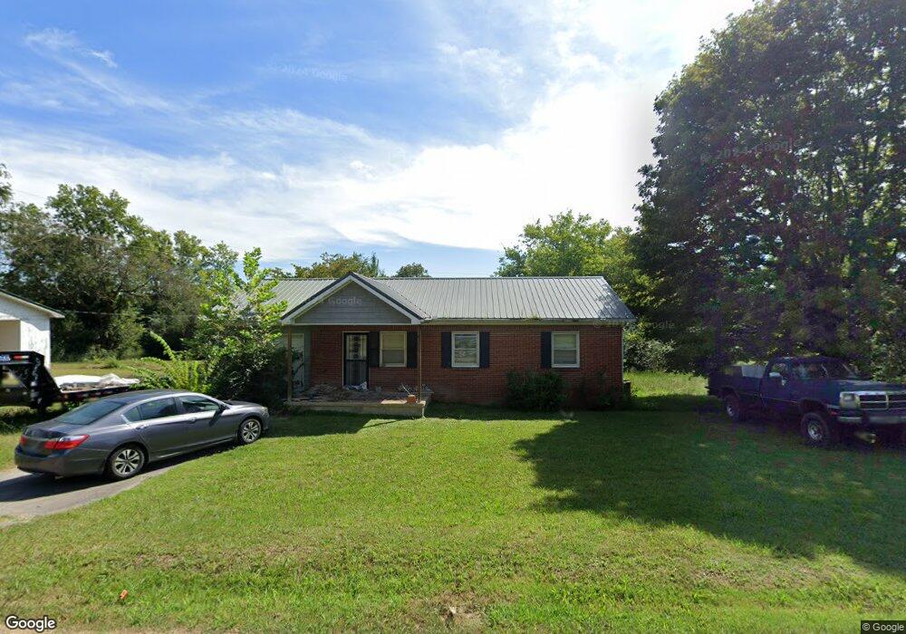
114 W Brooklyn St Linden, TN 37096
Estimated Value: $104,000 - $253,000
--
Bed
1
Bath
1,081
Sq Ft
$137/Sq Ft
Est. Value
About This Home
This home is located at 114 W Brooklyn St, Linden, TN 37096 and is currently estimated at $148,163, approximately $137 per square foot. 114 W Brooklyn St is a home located in Perry County.
Ownership History
Date
Name
Owned For
Owner Type
Purchase Details
Closed on
Oct 15, 2001
Bought by
Pratt Stanley Paul
Current Estimated Value
Purchase Details
Closed on
Nov 15, 2000
Bought by
Tinin Randal Gene and Kristi Leann
Purchase Details
Closed on
Dec 28, 1999
Bought by
Reeves Tony Scott and Reeves Lisa K
Purchase Details
Closed on
Apr 26, 1960
Bought by
Westbrooks Cecil
Purchase Details
Closed on
Apr 12, 1960
Create a Home Valuation Report for This Property
The Home Valuation Report is an in-depth analysis detailing your home's value as well as a comparison with similar homes in the area
Home Values in the Area
Average Home Value in this Area
Purchase History
| Date | Buyer | Sale Price | Title Company |
|---|---|---|---|
| Pratt Stanley Paul | $44,000 | -- | |
| Tinin Randal Gene | $40,000 | -- | |
| Reeves Tony Scott | $40,000 | -- | |
| Westbrooks Cecil | -- | -- | |
| -- | -- | -- |
Source: Public Records
Tax History Compared to Growth
Tax History
| Year | Tax Paid | Tax Assessment Tax Assessment Total Assessment is a certain percentage of the fair market value that is determined by local assessors to be the total taxable value of land and additions on the property. | Land | Improvement |
|---|---|---|---|---|
| 2025 | $422 | $15,075 | $0 | $0 |
| 2024 | $422 | $15,075 | $1,500 | $13,575 |
| 2023 | $408 | $15,075 | $1,500 | $13,575 |
| 2022 | $408 | $14,600 | $1,500 | $13,100 |
| 2021 | $408 | $14,600 | $1,500 | $13,100 |
| 2020 | $335 | $14,600 | $1,500 | $13,100 |
| 2019 | $439 | $14,725 | $1,500 | $13,225 |
| 2018 | $439 | $14,725 | $1,500 | $13,225 |
| 2017 | $435 | $14,725 | $1,500 | $13,225 |
| 2016 | $435 | $14,725 | $1,500 | $13,225 |
| 2015 | $428 | $14,725 | $1,500 | $13,225 |
| 2014 | $428 | $14,725 | $1,500 | $13,225 |
| 2013 | $430 | $14,817 | $0 | $0 |
Source: Public Records
Map
Nearby Homes
- 122 Shelton St
- 130 Elm Ln
- 245 S Mill St
- 141 Maple St
- 218 Cedar Ave
- 107 Possum Trot Ln
- 0 Church St
- 0 Treadwell Prong Unit RTC2707562
- 628 Starlight Dr
- 8884 U S Highway 412
- Lot 5 Campers Ln
- Lot 4 Campers Ln
- Lot 8 Campers Ln
- Lot 9 Campers Ln
- Lot 7 Campers Ln
- Lot 6 Campers Ln
- Lot 15 Campers Ln
- Lot 10 Campers Ln
- Lot 11 Campers Ln
- Lot 17 Campers Ln
- 110 W Brooklyn St
- 118 W Brooklyn St
- 115 College Ave
- 113 College Ave
- 121 College Ave
- 113 W Brooklyn St
- 117 W Brooklyn St
- 106 W Brooklyn St
- 124 W Brooklyn St
- 119 W Brooklyn Ave
- 119 W Brooklyn St
- 109 W Brooklyn St
- 107 College Ave
- 123 College Ave
- 127 College Ave
- 125 W Brooklyn St
- 100 W Brooklyn St
- 101 W Brooklyn St
- 321 S Mill St
- 130 W Brooklyn St