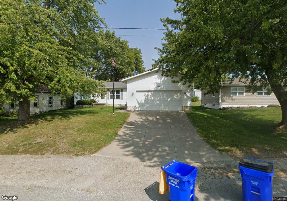
114 W Linn St Lone Tree, IA 52755
Estimated Value: $263,000 - $289,300
4
Beds
4
Baths
1,621
Sq Ft
$172/Sq Ft
Est. Value
About This Home
This home is located at 114 W Linn St, Lone Tree, IA 52755 and is currently estimated at $278,325, approximately $171 per square foot. 114 W Linn St is a home located in Johnson County with nearby schools including Lone Tree Elementary School and Lone Tree Junior/Senior High School.
Ownership History
Date
Name
Owned For
Owner Type
Purchase Details
Closed on
Apr 23, 2007
Sold by
Thomas Jeffrey J and Thomas Tina R
Bought by
Abbott Andrew D and Abbott Dixie J
Current Estimated Value
Create a Home Valuation Report for This Property
The Home Valuation Report is an in-depth analysis detailing your home's value as well as a comparison with similar homes in the area
Home Values in the Area
Average Home Value in this Area
Purchase History
| Date | Buyer | Sale Price | Title Company |
|---|---|---|---|
| Abbott Andrew D | $164,000 | None Available |
Source: Public Records
Tax History Compared to Growth
Tax History
| Year | Tax Paid | Tax Assessment Tax Assessment Total Assessment is a certain percentage of the fair market value that is determined by local assessors to be the total taxable value of land and additions on the property. | Land | Improvement |
|---|---|---|---|---|
| 2025 | $3,220 | $252,400 | $34,900 | $217,500 |
| 2024 | $3,126 | $243,200 | $34,900 | $208,300 |
| 2023 | $2,986 | $243,200 | $34,900 | $208,300 |
| 2022 | $2,952 | $198,400 | $27,600 | $170,800 |
| 2021 | $3,094 | $198,400 | $27,600 | $170,800 |
| 2020 | $3,094 | $198,400 | $27,600 | $170,800 |
| 2019 | $2,774 | $198,400 | $27,600 | $170,800 |
| 2018 | $2,724 | $175,600 | $27,600 | $148,000 |
| 2017 | $2,724 | $175,600 | $27,600 | $148,000 |
| 2016 | $2,596 | $164,700 | $27,600 | $137,100 |
| 2015 | $2,596 | $164,700 | $27,600 | $137,100 |
| 2014 | $2,910 | $194,500 | $27,600 | $166,900 |
Source: Public Records
Map
Nearby Homes
- 201 N Devoe St
- 221 W Commercial St
- 500 S Center St
- 407 E Elm St
- 106 Dorothy Ln
- 745 N Perkins St
- 5888 Sand Rd SE
- 25840 Golden Oak Ln Lot 1
- 25838 Golden Oak Ln Lot 7
- 25836 Golden Oak Ln Lot 8
- 25832 Golden Oak Ln Lot 12
- 25736 Golden Pond Ln Se Lot 17
- 25738 Golden Pond Ln Se Lot 16
- 25824 Golden Oak Ln Lot 9
- 1092 Walnut Ave Unit 209
- 1092 Walnut Ave Unit 114 Bld D
- Lot 2 116th Cir
- Lot 39 Walter Mapp Dr
- 2 Commercial Dr
- 1436 Vine Ave