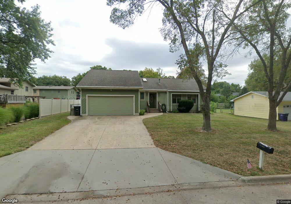
114 Warnow Cir Wamego, KS 66547
Estimated Value: $237,829 - $259,000
3
Beds
2
Baths
1,240
Sq Ft
$203/Sq Ft
Est. Value
About This Home
This home is located at 114 Warnow Cir, Wamego, KS 66547 and is currently estimated at $252,207, approximately $203 per square foot. 114 Warnow Cir is a home located in Pottawatomie County with nearby schools including Central Elementary School, West Elementary School, and Wamego Middle School.
Ownership History
Date
Name
Owned For
Owner Type
Purchase Details
Closed on
Dec 3, 2010
Sold by
Campanella Walton R and Campanella Diane B
Bought by
Campanella Diane B and Campanella Walton R
Current Estimated Value
Home Financials for this Owner
Home Financials are based on the most recent Mortgage that was taken out on this home.
Original Mortgage
$75,525
Outstanding Balance
$1,689
Interest Rate
4.22%
Mortgage Type
New Conventional
Estimated Equity
$250,518
Create a Home Valuation Report for This Property
The Home Valuation Report is an in-depth analysis detailing your home's value as well as a comparison with similar homes in the area
Home Values in the Area
Average Home Value in this Area
Purchase History
| Date | Buyer | Sale Price | Title Company |
|---|---|---|---|
| Campanella Diane B | -- | None Available | |
| Campanella Walton R | -- | None Available | |
| Campanella Walton R | -- | None Available | |
| Campanella Walton R | -- | None Available |
Source: Public Records
Mortgage History
| Date | Status | Borrower | Loan Amount |
|---|---|---|---|
| Open | Campanella Walton R | $75,525 | |
| Open | Campanella Walton R | $112,000 |
Source: Public Records
Tax History Compared to Growth
Tax History
| Year | Tax Paid | Tax Assessment Tax Assessment Total Assessment is a certain percentage of the fair market value that is determined by local assessors to be the total taxable value of land and additions on the property. | Land | Improvement |
|---|---|---|---|---|
| 2025 | $2,951 | $24,970 | $2,070 | $22,900 |
| 2024 | $30 | $24,444 | $1,818 | $22,626 |
| 2023 | $3,043 | $24,222 | $1,808 | $22,414 |
| 2022 | $2,461 | $21,770 | $1,816 | $19,954 |
| 2021 | $2,461 | $20,114 | $1,761 | $18,353 |
| 2020 | $2,461 | $19,869 | $1,712 | $18,157 |
| 2019 | $2,455 | $19,757 | $1,712 | $18,045 |
| 2018 | $2,386 | $19,261 | $1,712 | $17,549 |
| 2017 | $2,378 | $19,182 | $1,704 | $17,478 |
| 2016 | $2,288 | $18,710 | $1,550 | $17,160 |
| 2015 | -- | $18,297 | $1,507 | $16,790 |
| 2014 | -- | $17,813 | $1,535 | $16,278 |
Source: Public Records
Map
Nearby Homes
- 503 Parkview Dr
- 205 Sandbar Dr
- 206 Sandbar Dr
- 2008 Arbor Ln
- 2010 Arbor Ln
- 2001 Arbor Ln
- 2002 Arbor Ln
- 1905 Arbor Ln
- 205 Overbrook Dr
- 300 Overbrook Dr
- 2002 Scenic Dr
- 302 Sandbar Dr
- 207 Ruth's Ln
- 509 Chestnut St
- 701 Parkview Dr
- 401 Overbrook Dr
- 411 Vine St
- 609 Spruce St
- 2203 Country Club Dr
- 601 Poplar St