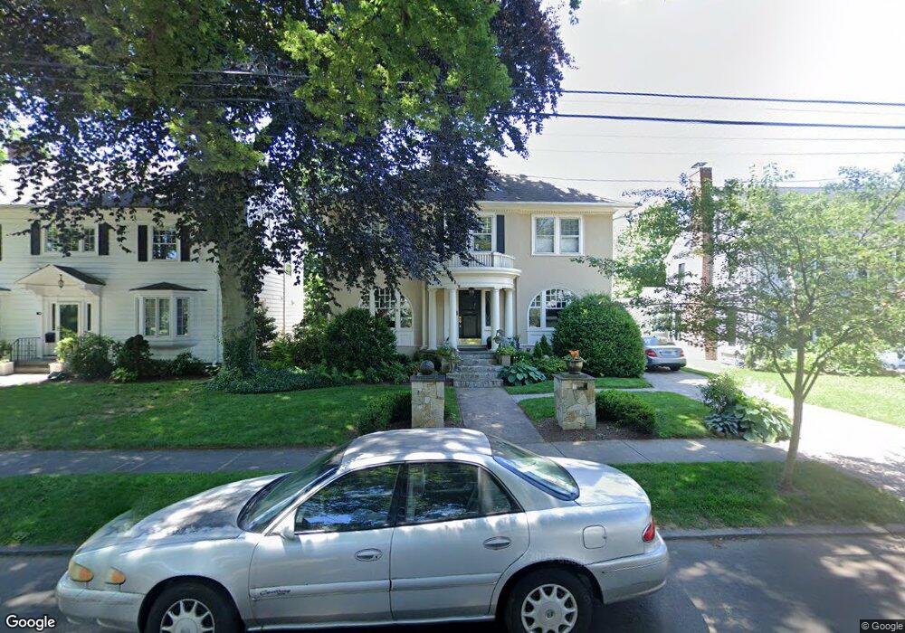
114 Westwood Rd New Haven, CT 06515
Westville NeighborhoodEstimated Value: $579,000 - $650,000
3
Beds
2
Baths
2,052
Sq Ft
$293/Sq Ft
Est. Value
About This Home
This home is located at 114 Westwood Rd, New Haven, CT 06515 and is currently estimated at $601,260, approximately $293 per square foot. 114 Westwood Rd is a home located in New Haven County with nearby schools including Elm City Montessori School and Hopkins School.
Ownership History
Date
Name
Owned For
Owner Type
Purchase Details
Closed on
Sep 30, 2003
Sold by
Perroti Wendy R
Bought by
Acabbo Gary J and Balzano Anthony J
Current Estimated Value
Home Financials for this Owner
Home Financials are based on the most recent Mortgage that was taken out on this home.
Original Mortgage
$185,000
Interest Rate
6.29%
Purchase Details
Closed on
Apr 27, 1998
Sold by
Stoller Joan P
Bought by
Perrotti Wendy R
Create a Home Valuation Report for This Property
The Home Valuation Report is an in-depth analysis detailing your home's value as well as a comparison with similar homes in the area
Home Values in the Area
Average Home Value in this Area
Purchase History
| Date | Buyer | Sale Price | Title Company |
|---|---|---|---|
| Acabbo Gary J | $365,000 | -- | |
| Perrotti Wendy R | $160,000 | -- |
Source: Public Records
Mortgage History
| Date | Status | Borrower | Loan Amount |
|---|---|---|---|
| Closed | Perrotti Wendy R | $173,840 | |
| Closed | Perrotti Wendy R | $25,000 | |
| Closed | Perrotti Wendy R | $185,000 |
Source: Public Records
Tax History Compared to Growth
Tax History
| Year | Tax Paid | Tax Assessment Tax Assessment Total Assessment is a certain percentage of the fair market value that is determined by local assessors to be the total taxable value of land and additions on the property. | Land | Improvement |
|---|---|---|---|---|
| 2025 | $9,863 | $250,320 | $73,640 | $176,680 |
| 2024 | $9,637 | $250,320 | $73,640 | $176,680 |
| 2023 | $9,312 | $250,320 | $73,640 | $176,680 |
| 2022 | $9,950 | $250,320 | $73,640 | $176,680 |
| 2021 | $8,665 | $197,470 | $57,400 | $140,070 |
| 2020 | $8,665 | $197,470 | $57,400 | $140,070 |
| 2019 | $8,487 | $197,470 | $57,400 | $140,070 |
| 2018 | $8,487 | $197,470 | $57,400 | $140,070 |
| 2017 | $7,638 | $197,470 | $57,400 | $140,070 |
| 2016 | $8,455 | $203,490 | $67,970 | $135,520 |
| 2015 | $8,455 | $203,490 | $67,970 | $135,520 |
| 2014 | $8,455 | $203,490 | $67,970 | $135,520 |
Source: Public Records
Map
Nearby Homes
- 1975 Chapel St
- 119 Westwood Rd
- 55 Marvel Rd
- 206 W Rock Ave
- 699 Forest Rd
- 690 Forest Rd Unit 702
- 690 Forest Rd Unit 392
- 690 Forest Rd Unit 511
- 96 Hubinger St
- 126 Willard St
- 595 Central Ave
- 907 Elm St
- 55 Irving St
- 868 Elm St
- 865 Elm St
- 30 Ellsworth Ave
- 11 Priscilla Rd
- 168 Ellsworth Ave
- 56 Highview Ave
- 36 Forest Hills Rd
- 120 Westwood Rd
- 126 Westwood Rd
- 1965 Chapel St
- 240 Central Ave
- 1971 Chapel St
- 1955 Chapel St
- 115 Westwood Rd
- 105 Westwood Rd
- 125 Westwood Rd
- 96 Westwood Rd
- 253 Central Ave
- 1985 Chapel St
- 245 Central Ave
- 275 Central Ave
- 249 Central Ave
- 239 Central Ave
- 1995 Chapel St
- 279 Central Ave
- 86 Westwood Rd
- 1945 Chapel St