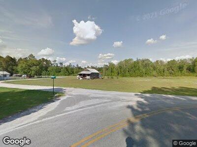
114 Winston Ln Du Pont, GA 31630
Estimated Value: $82,422 - $157,000
--
Bed
1
Bath
1,404
Sq Ft
$85/Sq Ft
Est. Value
About This Home
This home is located at 114 Winston Ln, Du Pont, GA 31630 and is currently estimated at $119,606, approximately $85 per square foot. 114 Winston Ln is a home located in Echols County with nearby schools including Echols County Elementary/Middle School.
Ownership History
Date
Name
Owned For
Owner Type
Purchase Details
Closed on
Feb 7, 2023
Sold by
Troublesome Creek Investment Properties
Bought by
Covington Jimmy Leland and Covington Gabrielle Alexis
Current Estimated Value
Home Financials for this Owner
Home Financials are based on the most recent Mortgage that was taken out on this home.
Original Mortgage
$112,207
Outstanding Balance
$108,418
Interest Rate
6.33%
Mortgage Type
New Conventional
Estimated Equity
$17,140
Purchase Details
Closed on
Nov 16, 2011
Sold by
Everette Anthony and Everette Linda
Bought by
Troublesome Creek
Purchase Details
Closed on
May 21, 2010
Sold by
Mullis Joshua B
Bought by
Everette Anthony and Everette Linda
Purchase Details
Closed on
Aug 7, 2006
Sold by
Everette Dolores
Bought by
Everette Anthony
Home Financials for this Owner
Home Financials are based on the most recent Mortgage that was taken out on this home.
Original Mortgage
$67,500
Interest Rate
6.71%
Mortgage Type
New Conventional
Create a Home Valuation Report for This Property
The Home Valuation Report is an in-depth analysis detailing your home's value as well as a comparison with similar homes in the area
Home Values in the Area
Average Home Value in this Area
Purchase History
| Date | Buyer | Sale Price | Title Company |
|---|---|---|---|
| Covington Jimmy Leland | $117,207 | -- | |
| Troublesome Creek | -- | -- | |
| Everette Anthony | -- | -- | |
| Everette Anthony | -- | -- | |
| Mullis Joshua B | $72,500 | -- |
Source: Public Records
Mortgage History
| Date | Status | Borrower | Loan Amount |
|---|---|---|---|
| Open | Covington Jimmy Leland | $112,207 | |
| Previous Owner | Mullis Joshua B | $67,500 |
Source: Public Records
Tax History Compared to Growth
Tax History
| Year | Tax Paid | Tax Assessment Tax Assessment Total Assessment is a certain percentage of the fair market value that is determined by local assessors to be the total taxable value of land and additions on the property. | Land | Improvement |
|---|---|---|---|---|
| 2024 | $1,096 | $26,128 | $3,800 | $22,328 |
| 2023 | $698 | $16,128 | $2,240 | $13,888 |
| 2022 | $558 | $16,128 | $2,240 | $13,888 |
| 2021 | $559 | $16,128 | $2,240 | $13,888 |
| 2020 | $558 | $16,128 | $2,240 | $13,888 |
| 2019 | $559 | $16,128 | $2,240 | $13,888 |
| 2018 | $642 | $18,540 | $2,240 | $16,300 |
| 2017 | $643 | $18,568 | $2,240 | $16,328 |
| 2016 | $643 | $18,568 | $2,240 | $16,328 |
| 2015 | -- | $18,568 | $2,240 | $16,328 |
| 2014 | -- | $18,568 | $2,240 | $16,328 |
| 2013 | -- | $18,568 | $2,240 | $16,328 |
Source: Public Records
Map
Nearby Homes
- 9098 Withers Rd
- 44 Altman Dr
- 110 Valentine Rd
- 28 River Trail
- LT 95G River Trail
- TBA Us 129
- 1 Red Oak Point
- 0 Red Oak Point
- 5994 Lake Shore Dr
- LT 85 B River Trail
- 5904 Nature's Way
- 5913 Mariners Way
- Lot #41 Natures Way
- 6377 Lake Alapaha Blvd
- 6410 Lake Alapaha Blvd
- 6345 Lake Alapaha Blvd
- TBD Church Rd
- 6452 Lake Alapaha Blvd
- 6470 Lake Alapaha Blvd
- 6570 Good Hope Rd
