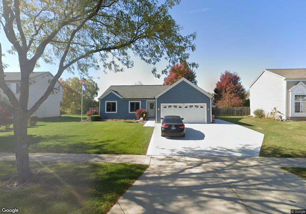
1140 Dawson Ln Algonquin, IL 60102
Estimated Value: $318,775 - $470,000
3
Beds
2
Baths
1,333
Sq Ft
$291/Sq Ft
Est. Value
About This Home
This home is located at 1140 Dawson Ln, Algonquin, IL 60102 and is currently estimated at $387,944, approximately $291 per square foot. 1140 Dawson Ln is a home located in McHenry County with nearby schools including Westfield Community School, Kenneth E Neubert Elementary School, and Harry D Jacobs High School.
Ownership History
Date
Name
Owned For
Owner Type
Purchase Details
Closed on
Nov 21, 2002
Sold by
Sheldon Michael A and Sheldon Kimberly
Bought by
Self Mark and Self Christine
Current Estimated Value
Home Financials for this Owner
Home Financials are based on the most recent Mortgage that was taken out on this home.
Original Mortgage
$201,450
Outstanding Balance
$84,751
Interest Rate
6.08%
Estimated Equity
$303,193
Purchase Details
Closed on
Oct 26, 2001
Sold by
Sheldon Michael A
Bought by
Sheldon Michael A and Sheldon Kimberly
Home Financials for this Owner
Home Financials are based on the most recent Mortgage that was taken out on this home.
Original Mortgage
$143,500
Interest Rate
6.68%
Purchase Details
Closed on
Jun 29, 1998
Sold by
Barnicke Lynn N and Sheldon Lynn N
Bought by
Sheldon Michael A
Purchase Details
Closed on
May 1, 1998
Sold by
Barnicke Lynn N
Bought by
Sheldon Michael A
Purchase Details
Closed on
Dec 22, 1995
Sold by
Pulte Home Corp
Bought by
Sheldon Michael A and Sheldon Lynn N
Home Financials for this Owner
Home Financials are based on the most recent Mortgage that was taken out on this home.
Original Mortgage
$148,500
Interest Rate
7.43%
Mortgage Type
FHA
Create a Home Valuation Report for This Property
The Home Valuation Report is an in-depth analysis detailing your home's value as well as a comparison with similar homes in the area
Home Values in the Area
Average Home Value in this Area
Purchase History
| Date | Buyer | Sale Price | Title Company |
|---|---|---|---|
| Self Mark | $237,000 | Chicago Title Insurance Co | |
| Sheldon Michael A | -- | First American Title | |
| Sheldon Michael A | -- | -- | |
| Sheldon Michael A | -- | -- | |
| Sheldon Michael A | $154,000 | -- |
Source: Public Records
Mortgage History
| Date | Status | Borrower | Loan Amount |
|---|---|---|---|
| Open | Self Mark | $201,450 | |
| Previous Owner | Sheldon Michael A | $143,500 | |
| Previous Owner | Sheldon Michael A | $148,500 |
Source: Public Records
Tax History Compared to Growth
Tax History
| Year | Tax Paid | Tax Assessment Tax Assessment Total Assessment is a certain percentage of the fair market value that is determined by local assessors to be the total taxable value of land and additions on the property. | Land | Improvement |
|---|---|---|---|---|
| 2024 | $6,622 | $92,657 | $27,085 | $65,572 |
| 2023 | $6,267 | $82,870 | $24,224 | $58,646 |
| 2022 | $6,950 | $87,040 | $22,602 | $64,438 |
| 2021 | $6,663 | $81,088 | $21,056 | $60,032 |
| 2020 | $6,485 | $78,218 | $20,311 | $57,907 |
| 2019 | $6,323 | $74,864 | $19,440 | $55,424 |
| 2018 | $6,020 | $69,158 | $17,958 | $51,200 |
| 2017 | $5,890 | $65,152 | $16,918 | $48,234 |
| 2016 | $5,795 | $61,107 | $15,868 | $45,239 |
| 2013 | -- | $57,844 | $14,803 | $43,041 |
Source: Public Records
Map
Nearby Homes
- 2235 Dawson Ln
- 2248 Dawson Ln Unit 272
- 661 Majestic Dr
- 741 Regal Ln
- 1820 Crofton Dr
- 2161 Burnham Ct
- 000 County Line Rd
- 2043 Peach Tree Ln Unit 4122
- 700 Fairfield Ln
- 2101 Peach Tree Ln Unit 4094
- 12 White Oak Ct
- 1971 Peach Tree Ln
- 2601 Harnish Dr
- 2611 Harnish Dr
- DOVER Plan at Grand Reserve - Algonquin
- CLIFTON Plan at Grand Reserve - Algonquin
- 2631 Harnish Dr
- 601 Woods Creek Ln
- 2801 Waterfront Ave
- 30 Arbordale Ct Unit 4284
- 1130 Dawson Ln
- 1150 Dawson Ln
- 1144 Sawmill Ln
- 1120 Dawson Ln
- 1146 Sawmill Ln
- 1136 Sawmill Ln
- 1142 Sawmill Ln
- 1138 Sawmill Ln
- 1151 Dawson Ln
- 1161 Dawson Ln
- 1140 Sawmill Ln
- 1148 Sawmill Ln
- 1141 Dawson Ln
- 1110 Dawson Ln
- 1131 Dawson Ln
- 1132 Sawmill Ln
- 1121 Dawson Ln
- 1150 Sawmill Ln
- 1100 Dawson Ln
- 1170 Millcreek Ln