1140 Sand Drift Way Unit B West Palm Beach, FL 33411
Breakers West NeighborhoodEstimated payment $4,832/month
Highlights
- Waterfront
- Canal Width 1-80 Feet
- Roman Tub
- Canal View
- Vaulted Ceiling
- Main Floor Primary Bedroom
About This Home
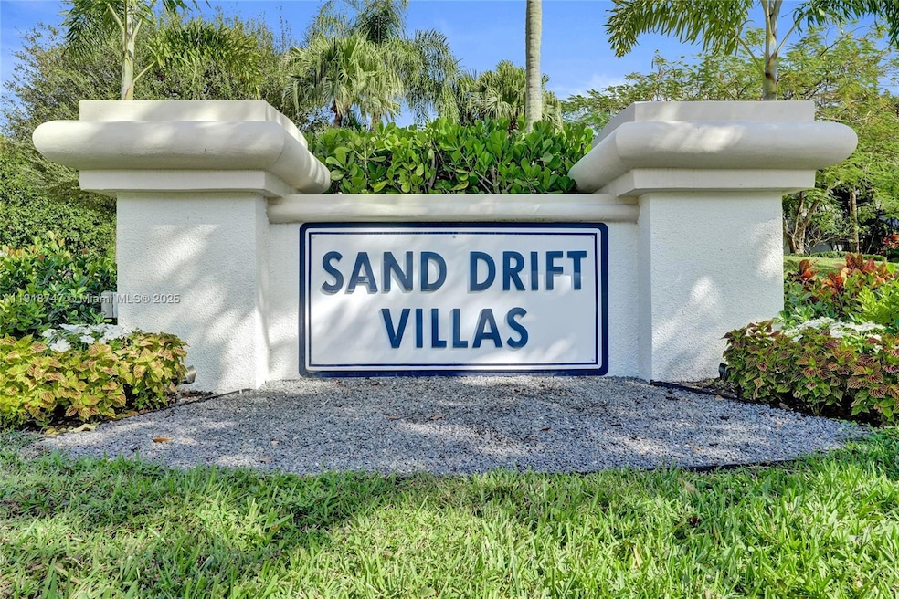
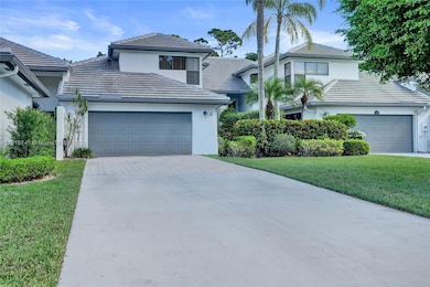
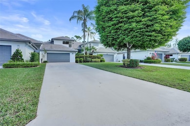
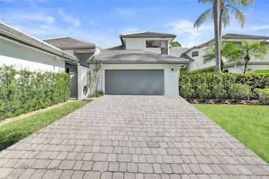
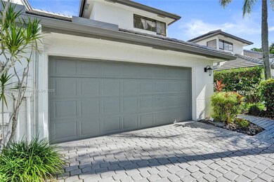
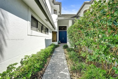
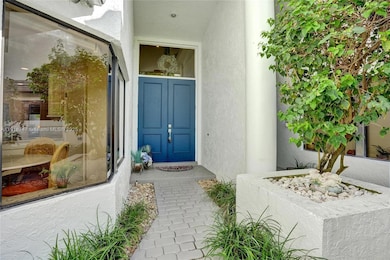
Stunning three-bedroom and two-and-a-half-bath townhome in the highly sought-after Sand Drift Villas of Breakers West! Cook in style in the kitchen with off-white cabinets, stainless steel appliances, eat-in area and wood-plank tile floors. Relax or entertain in the living and dining areas with soaring volume ceilings, wood-burning fireplace and built-in wall unit. Primary downstairs offers a walk-in closet plus two long closets, double vanities, makeup area, separate shower and tub. Upstairs, two generous bedrooms share a fully updated bath, and one bedroom features a rooftop deck. Step outside to the screened-in patio with sink, cabinets, and TV. Carpet throughout living, dining, and all bedrooms. Two-car garage and long driveway. Roof replaced 2023, A/C 2017 and maintained twice a year, water heater 2001, refrigerator 2 years old, washer 1 year old, all other kitchen appliances 2010. Live the luxurious lifestyle in this man-guard-gated community with optional club memberships which the amenites come with, just minutes away from West Palm Beach Airport, restaurants, entertainment, and 30 minutes to downtown West Palm Beach!
Townhouse Details
Home Type
- Townhome
Est. Annual Taxes
- $6,700
Year Built
- Built in 1988
Lot Details
- Waterfront
- South Facing Home
HOA Fees
- $1,105 Monthly HOA Fees
Parking
- 2 Car Attached Garage
- Secured Garage or Parking
Property Views
- Canal
- Garden
Home Design
- Split Level Home
- Entry on the 1st floor
- Concrete Block And Stucco Construction
Interior Spaces
- 1,797 Sq Ft Home
- 2-Story Property
- Built-In Features
- Vaulted Ceiling
- Ceiling Fan
- Skylights
- Fireplace
- Single Hung Metal Windows
- Drapes & Rods
- Blinds
- Picture Window
- Sliding Windows
- Entrance Foyer
- Combination Dining and Living Room
Kitchen
- Eat-In Kitchen
- Self-Cleaning Oven
- Electric Range
- Microwave
- Ice Maker
- Dishwasher
- Disposal
Flooring
- Carpet
- Tile
Bedrooms and Bathrooms
- 3 Bedrooms
- Primary Bedroom on Main
- Split Bedroom Floorplan
- Walk-In Closet
- Dual Sinks
- Roman Tub
- Separate Shower in Primary Bathroom
Laundry
- Laundry in Utility Room
- Dryer
- Washer
Outdoor Features
- Canal Width 1-80 Feet
Schools
- Benoist Farms Elementary School
- Jeaga Middle School
- Royal Palm Beach High School
Utilities
- Central Air
- Heating Available
- Electric Water Heater
Listing and Financial Details
- Assessor Parcel Number 00424330100070020
Community Details
Overview
- Sand Drift Villas Condos
- Breakers West 6,Breakers West Subdivision
- The community has rules related to no recreational vehicles or boats, no trucks or trailers
Recreation
- Community Pool
- Community Spa
Pet Policy
- Breed Restrictions
Security
- Security Guard
Map
Home Values in the Area
Average Home Value in this Area
Tax History
| Year | Tax Paid | Tax Assessment Tax Assessment Total Assessment is a certain percentage of the fair market value that is determined by local assessors to be the total taxable value of land and additions on the property. | Land | Improvement |
|---|---|---|---|---|
| 2024 | $6,345 | $319,967 | -- | -- |
| 2023 | $5,867 | $290,879 | $0 | $0 |
| 2022 | $5,248 | $264,435 | $0 | $0 |
| 2021 | $4,594 | $243,465 | $0 | $243,465 |
| 2020 | $4,222 | $218,541 | $0 | $218,541 |
| 2019 | $4,268 | $223,598 | $0 | $223,598 |
| 2018 | $3,718 | $195,264 | $0 | $195,264 |
| 2017 | $3,909 | $205,326 | $0 | $0 |
| 2016 | $4,204 | $216,388 | $0 | $0 |
| 2015 | $4,000 | $198,435 | $0 | $0 |
| 2014 | $3,956 | $193,901 | $0 | $0 |
Property History
| Date | Event | Price | List to Sale | Price per Sq Ft |
|---|---|---|---|---|
| 11/22/2025 11/22/25 | For Sale | $60,000 | -- | $33 / Sq Ft |
Purchase History
| Date | Type | Sale Price | Title Company |
|---|---|---|---|
| Special Warranty Deed | -- | -- | |
| Special Warranty Deed | -- | -- | |
| Warranty Deed | $120,000 | Standard Title Ins Agency In | |
| Warranty Deed | $140,000 | -- | |
| Warranty Deed | $145,000 | -- |
Mortgage History
| Date | Status | Loan Amount | Loan Type |
|---|---|---|---|
| Previous Owner | $90,000 | New Conventional |
Source: MIAMI REALTORS® MLS
MLS Number: A11918747
APN: 00-42-43-30-10-007-0020
Disclaimer: Certain information contained herein is derived from information provided by parties other than Homes.com. All information provided is deemed reliable, but is not guaranteed to be accurate and should be independently verified.
![]() IDX information is provided exclusively for personal, non-commercial use, and may not be used for any purpose other than to identify prospective properties consumers may be interested in purchasing. Information is deemed reliable but not guaranteed.
IDX information is provided exclusively for personal, non-commercial use, and may not be used for any purpose other than to identify prospective properties consumers may be interested in purchasing. Information is deemed reliable but not guaranteed.
- 1120 Sand Drift Way Unit D
- 1543 Breakers Blvd W
- 1504 Breakers Blvd W
- 10067 Yeoman Ln
- 10089 Penzance Ln
- 9741 Spray Dr
- 1810 Gulfstream Way
- 1797 Gulfstream Way
- 10290 Carmen Ln
- 1535 Fairway Terrace
- 1063 Concert Way
- 9333 Heathridge Dr
- 9302 Heathridge Dr
- 1761 Breakers Blvd W
- 9445 E Fairway Terrace
- 9453 E Fairway Terrace
- 1019 Lytham Ct
- 143 Catania Way
- 9190 Heathridge Dr
- 132 Catania Way
- 1504 Breakers Blvd W
- 10115 Patience Ln
- 10303 Pippin Ln
- 1103 Harmony Way
- 1367 Elmbank Way
- 10354 Fox Trail 1504 Rd S Unit 1504
- 9130 Nugent Trail
- 10342 Fox Trail Rd S
- 10354 Fox Trail Rd S Unit 1505
- 1371 Thornbank Ln
- 9183 Nugent Trail
- 179 Dove Cir
- 9833 Baywinds Dr Unit 7102
- 9833 Baywinds Dr Unit 7203
- 9833 Baywinds Dr Unit 7306
- 9833 Baywinds Dr Unit 7108
- 9845 Baywinds Dr Unit 6107
- 9825 Baywinds Dr Unit 1206
- 9857 Baywinds Dr Unit 4106
- 9873 Baywinds Dr Unit 3103
