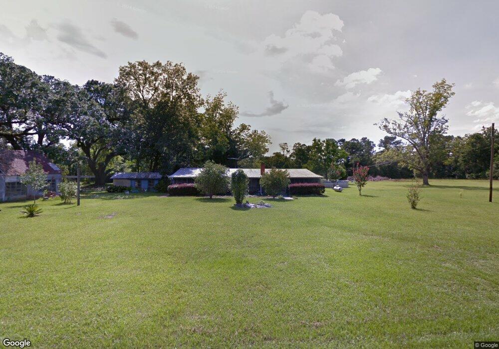
11405 Robert Walker Rd Vancleave, MS 39565
Estimated Value: $273,000
--
Bed
1
Bath
--
Sq Ft
3.71
Acres
About This Home
This home is located at 11405 Robert Walker Rd, Vancleave, MS 39565 and is currently estimated at $273,000. 11405 Robert Walker Rd is a home located in Jackson County with nearby schools including Vancleave Lower Elementary School, Vancleave Upper Elementary School, and Vancleave Middle School.
Ownership History
Date
Name
Owned For
Owner Type
Purchase Details
Closed on
Aug 17, 2023
Sold by
Ulmber Donna A
Bought by
Calton Charles Thomas and Calton Megan Rene
Current Estimated Value
Home Financials for this Owner
Home Financials are based on the most recent Mortgage that was taken out on this home.
Original Mortgage
$351,000
Outstanding Balance
$343,222
Interest Rate
6.96%
Mortgage Type
New Conventional
Estimated Equity
-$70,222
Purchase Details
Closed on
Dec 14, 2012
Sold by
Ulmer Dale H
Bought by
Ulmer Donna A
Create a Home Valuation Report for This Property
The Home Valuation Report is an in-depth analysis detailing your home's value as well as a comparison with similar homes in the area
Home Values in the Area
Average Home Value in this Area
Purchase History
| Date | Buyer | Sale Price | Title Company |
|---|---|---|---|
| Calton Charles Thomas | -- | None Listed On Document | |
| Calton Charles Thomas | -- | None Listed On Document | |
| Ulmer Donna A | -- | -- |
Source: Public Records
Mortgage History
| Date | Status | Borrower | Loan Amount |
|---|---|---|---|
| Open | Calton Charles Thomas | $351,000 | |
| Closed | Calton Charles Thomas | $351,000 |
Source: Public Records
Tax History Compared to Growth
Tax History
| Year | Tax Paid | Tax Assessment Tax Assessment Total Assessment is a certain percentage of the fair market value that is determined by local assessors to be the total taxable value of land and additions on the property. | Land | Improvement |
|---|---|---|---|---|
| 2024 | $11 | $86 | $86 | $0 |
| 2023 | $11 | $89 | $89 | $0 |
| 2022 | $11 | $92 | $92 | $0 |
| 2021 | $12 | $97 | $97 | $0 |
| 2020 | $12 | $99 | $99 | $0 |
| 2019 | $13 | $104 | $104 | $0 |
| 2018 | $17 | $134 | $134 | $0 |
| 2017 | $17 | $134 | $134 | $0 |
| 2016 | $658 | $8,052 | $1,897 | $6,155 |
| 2015 | $558 | $70,130 | $17,430 | $52,700 |
| 2014 | $541 | $7,056 | $1,781 | $5,275 |
| 2013 | $637 | $8,247 | $1,943 | $6,304 |
Source: Public Records
Map
Nearby Homes
- 8236 Stonehaven Dr
- 10115 Silverwood Dr
- 0 Box Rd
- 00 Humphrey Rd
- 9108 Box Rd
- 9158 Box Rd
- 0 Old Fort Bayou Rd Unit 4101335
- 6404 Humphrey Rd
- 10000 Cherokee Rose Rd
- 6305 Morningside Dr
- 13109 Little Bluff Dr
- 13700 Southern Pine Drive Central
- Tbd Seaman Rd
- 6001 Wooded Acres Rd
- 0 Ms 57 Unit 4122608
- 0 Ms 57 Unit 4117591
- 0 Ms-57 Unit 4107638
- 0 Ms-57 Unit 4097649
- 0 Morningside Dr Unit 4120736
- 0 Maple Cove
- 11320 Robert Walker Rd
- 11313 Robert Walker Rd
- 11301 Robert Walker Rd
- 11217 Robert Walker Rd
- 000 Robert Walker
- 11200 Robert Walker Rd
- 11520 Robert Walker Rd
- 9021 Richwood Dr
- 11525 Robert Walker Rd
- 9005 Richwood Dr
- 0 Ashburn Rd
- 8715 Richwood Dr
- 9007 Richwood Dr
- 9005 Ashburn Rd
- 0 Richwood
- 9017 Richwood Dr
- 9009 Richwood Dr
- 9017 Ashburn Rd
- 8675 Richwood Dr
- 11713 Bloomfield Rd