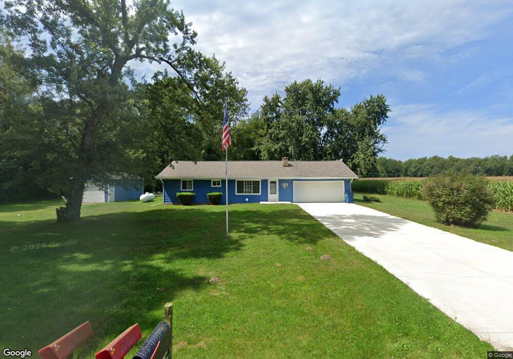
11407 11 Mile Rd Ceresco, MI 49033
Estimated Value: $225,000 - $321,000
3
Beds
2
Baths
1,440
Sq Ft
$189/Sq Ft
Est. Value
About This Home
This home is located at 11407 11 Mile Rd, Ceresco, MI 49033 and is currently estimated at $272,658, approximately $189 per square foot. 11407 11 Mile Rd is a home located in Calhoun County with nearby schools including Harper Creek Middle School and Harper Creek High School.
Ownership History
Date
Name
Owned For
Owner Type
Purchase Details
Closed on
Feb 9, 2024
Sold by
Melissa Taylor 2009 Trust
Bought by
Taylor Melissa
Current Estimated Value
Purchase Details
Closed on
Jul 27, 2021
Sold by
Endeavor Group Llc
Bought by
Taylor Melissa and Melissa Taylor 2009 Trust
Purchase Details
Closed on
Apr 29, 2010
Sold by
Taylor Melissa
Bought by
Endeavor Group Llc-11 Mile Road
Purchase Details
Closed on
Dec 4, 2001
Sold by
Taylor Norman
Bought by
Taylor Norman and Taylor Melissa
Purchase Details
Closed on
Apr 13, 1984
Bought by
Kunz-Sparks
Create a Home Valuation Report for This Property
The Home Valuation Report is an in-depth analysis detailing your home's value as well as a comparison with similar homes in the area
Home Values in the Area
Average Home Value in this Area
Purchase History
| Date | Buyer | Sale Price | Title Company |
|---|---|---|---|
| Taylor Melissa | -- | None Listed On Document | |
| Fulling Terry D | -- | None Listed On Document | |
| Taylor Melissa | -- | None Available | |
| Endeavor Group Llc-11 Mile Road | $63,000 | None Available | |
| Taylor Norman | -- | -- | |
| Kunz-Sparks | $20,900 | -- |
Source: Public Records
Tax History Compared to Growth
Tax History
| Year | Tax Paid | Tax Assessment Tax Assessment Total Assessment is a certain percentage of the fair market value that is determined by local assessors to be the total taxable value of land and additions on the property. | Land | Improvement |
|---|---|---|---|---|
| 2025 | $2,793 | $95,200 | $0 | $0 |
| 2024 | $1,788 | $79,000 | $0 | $0 |
| 2023 | $2,249 | $72,500 | $0 | $0 |
| 2022 | $2,249 | $68,700 | $0 | $0 |
| 2021 | $3,027 | $63,700 | $0 | $0 |
| 2020 | $2,984 | $58,300 | $0 | $0 |
| 2019 | $0 | $57,700 | $0 | $0 |
| 2018 | $0 | $55,100 | $10,100 | $45,000 |
| 2017 | $0 | $56,700 | $0 | $0 |
| 2016 | $0 | $54,300 | $0 | $0 |
| 2015 | -- | $54,300 | $16,399 | $37,901 |
| 2014 | -- | $54,200 | $16,399 | $37,801 |
Source: Public Records
Map
Nearby Homes
- 11506 11 Mile Rd
- 10047 11 Mile Rd
- 10660 D Dr S
- 11445 F Dr S
- 275 Battle Creek St
- 8295 D Dr S
- 12460 Beadle Lake Rd
- 11253 Wildwood Dr
- 1375 Woodland Beach
- 9304 I Dr S
- V/L 10 Mile Rd
- 14880 C Dr S
- 13028 Harper Crossing
- 323 Wattles Rd S
- 2851 Kistler Rd
- 4371 Council Crest Ln
- VL Beadle Lake Rd
- 159 Beadle Lake Dr
- 213 Wattles Rd S
- 6660 B Dr N
- 11457 11 Mile Rd
- 11487 11 Mile Rd
- 11505 11 Mile Rd
- 11555 11 Mile Rd
- 11725 11 Mile Rd
- 11468 11 Mile Rd
- 11745 11 Mile Rd
- 10981 B Dr S
- 11019 B Dr S
- 10951 B Dr S
- 11087 B Dr S
- 11887 11 Mile Rd
- 11199 B Dr S
- 11241 B Dr S
- 11112 B Dr S
- 10697 B Dr S
- 10925 11 Mile Rd
- 11343 B Dr S
- 10887 11 Mile Rd
- 11990 11 Mile Rd