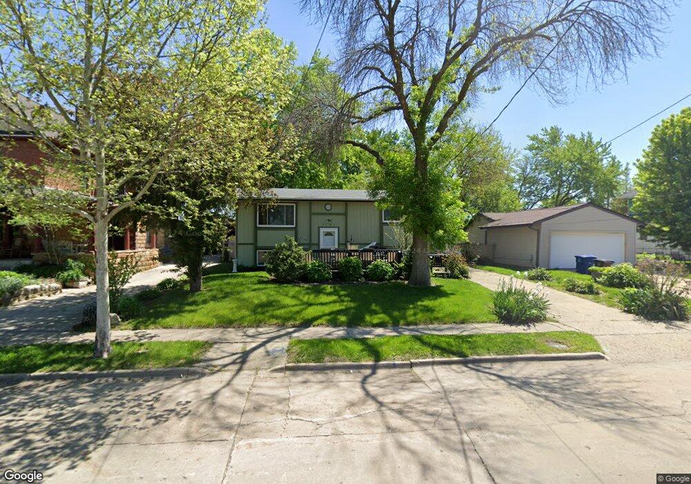
1141 10th St Des Moines, IA 50314
Cheatom Park NeighborhoodEstimated Value: $147,000 - $157,000
--
Bed
2
Baths
888
Sq Ft
$173/Sq Ft
Est. Value
About This Home
This home is located at 1141 10th St, Des Moines, IA 50314 and is currently estimated at $153,467, approximately $172 per square foot. 1141 10th St is a home located in Polk County with nearby schools including Moulton Elementary School, Harding Middle School, and North High School.
Ownership History
Date
Name
Owned For
Owner Type
Purchase Details
Closed on
Apr 28, 2003
Sold by
Northwest 10Th Avenue Condominiums Llc
Bought by
Looft Joel R
Current Estimated Value
Home Financials for this Owner
Home Financials are based on the most recent Mortgage that was taken out on this home.
Original Mortgage
$101,507
Outstanding Balance
$43,959
Interest Rate
5.86%
Mortgage Type
FHA
Estimated Equity
$109,508
Purchase Details
Closed on
May 18, 1998
Sold by
Dolinsek Marie E
Bought by
Stanley Harry William and Stanley Linda C
Create a Home Valuation Report for This Property
The Home Valuation Report is an in-depth analysis detailing your home's value as well as a comparison with similar homes in the area
Home Values in the Area
Average Home Value in this Area
Purchase History
| Date | Buyer | Sale Price | Title Company |
|---|---|---|---|
| Looft Joel R | $103,000 | -- | |
| Stanley Harry William | -- | -- |
Source: Public Records
Mortgage History
| Date | Status | Borrower | Loan Amount |
|---|---|---|---|
| Open | Looft Joel R | $101,507 |
Source: Public Records
Tax History Compared to Growth
Tax History
| Year | Tax Paid | Tax Assessment Tax Assessment Total Assessment is a certain percentage of the fair market value that is determined by local assessors to be the total taxable value of land and additions on the property. | Land | Improvement |
|---|---|---|---|---|
| 2025 | $1,916 | $132,800 | $14,900 | $117,900 |
| 2024 | $1,916 | $114,900 | $12,700 | $102,200 |
| 2023 | $1,778 | $114,900 | $12,700 | $102,200 |
| 2022 | $1,762 | $84,300 | $9,700 | $74,600 |
| 2021 | $1,662 | $84,300 | $9,700 | $74,600 |
| 2020 | $1,722 | $75,200 | $8,600 | $66,600 |
| 2019 | $1,618 | $75,200 | $8,600 | $66,600 |
| 2018 | $1,596 | $68,700 | $7,700 | $61,000 |
| 2017 | $1,654 | $68,700 | $7,700 | $61,000 |
| 2016 | $1,606 | $69,700 | $7,600 | $62,100 |
| 2015 | $1,606 | $69,700 | $7,600 | $62,100 |
| 2014 | $1,414 | $61,900 | $7,400 | $54,500 |
Source: Public Records
Map
Nearby Homes