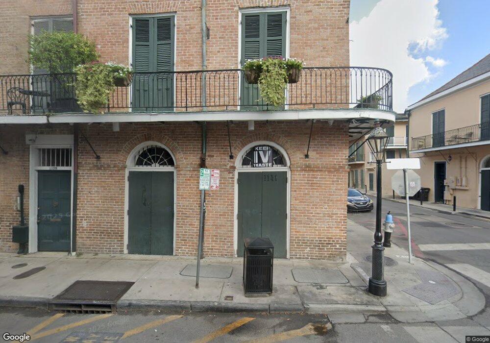
1141 Royal St Unit D New Orleans, LA 70116
French Quarter NeighborhoodEstimated Value: $300,000 - $388,000
1
Bed
1
Bath
688
Sq Ft
$518/Sq Ft
Est. Value
About This Home
This home is located at 1141 Royal St Unit D, New Orleans, LA 70116 and is currently estimated at $356,286, approximately $517 per square foot. 1141 Royal St Unit D is a home located in Orleans Parish with nearby schools including Phillis Wheatley Community School, Homer Plessy French Quarter Community School, and Mary Bethune Elementary School.
Ownership History
Date
Name
Owned For
Owner Type
Purchase Details
Closed on
Nov 12, 2004
Sold by
1141 Royal St Condo
Bought by
Latham Alvin E
Current Estimated Value
Home Financials for this Owner
Home Financials are based on the most recent Mortgage that was taken out on this home.
Original Mortgage
$220,800
Outstanding Balance
$110,847
Interest Rate
5.87%
Estimated Equity
$245,439
Create a Home Valuation Report for This Property
The Home Valuation Report is an in-depth analysis detailing your home's value as well as a comparison with similar homes in the area
Home Values in the Area
Average Home Value in this Area
Purchase History
| Date | Buyer | Sale Price | Title Company |
|---|---|---|---|
| Latham Alvin E | $276,000 | -- |
Source: Public Records
Mortgage History
| Date | Status | Borrower | Loan Amount |
|---|---|---|---|
| Open | Latham Alvin E | $220,800 |
Source: Public Records
Tax History Compared to Growth
Tax History
| Year | Tax Paid | Tax Assessment Tax Assessment Total Assessment is a certain percentage of the fair market value that is determined by local assessors to be the total taxable value of land and additions on the property. | Land | Improvement |
|---|---|---|---|---|
| 2025 | $3,696 | $34,850 | $2,660 | $32,190 |
| 2024 | $4,670 | $34,850 | $2,660 | $32,190 |
| 2023 | $3,719 | $34,850 | $2,660 | $32,190 |
| 2022 | $3,719 | $33,240 | $2,660 | $30,580 |
| 2021 | $4,034 | $34,850 | $2,660 | $32,190 |
| 2020 | $4,073 | $34,850 | $2,660 | $32,190 |
| 2019 | $4,229 | $34,850 | $2,660 | $32,190 |
| 2018 | $4,311 | $34,850 | $2,660 | $32,190 |
| 2017 | $4,102 | $34,850 | $2,660 | $32,190 |
| 2016 | $4,230 | $34,850 | $2,660 | $32,190 |
| 2015 | $5,181 | $34,850 | $2,660 | $32,190 |
| 2014 | -- | $34,850 | $2,660 | $32,190 |
| 2013 | -- | $34,850 | $1,550 | $33,300 |
Source: Public Records
Map
Nearby Homes
- 1133 Royal St Unit 7
- 716 Governor Nicholls St Unit C
- 1228 Royal St Unit 12
- 1116 Royal St Unit A
- 1116 Royal St Unit B
- 1114 Royal St Unit A
- 1109 Royal St Unit C
- 1112 Royal St Unit A
- 1101 Royal St
- 718 Barracks St Unit 7
- 718 Barracks St Unit 2
- 718 Barracks St Unit 6
- 609 Governor Nicholls St Unit 19
- 627 Ursulines Ave Unit 9
- 1119 Chartres St Unit 205
- 600 Governor Nicholls St
- 1141 Royal St Unit B1
- 1141 Royal St Unit C
- 1141 Royal St Unit B
- 1141 Royal St Unit A
- 1141 Royal St Unit E
- 1139 Royal St
- 1139 Royal St Unit A
- 1139 Royal St Unit C
- 1139 Royal St Unit B
- 1139 Royal St Unit D
- 1205 Royal St
- 702 Governor Nicholls St
- 702 Gov Nicholls St
- 1135 Royal St
- 1135 Royal St Unit LOWER
- 1135 Royal St Unit Back
- 1135 Royal St Unit 4
- 1135 Royal St Unit 2
- 1135 Royal St Unit 1
- 1135 Royal St Unit 3