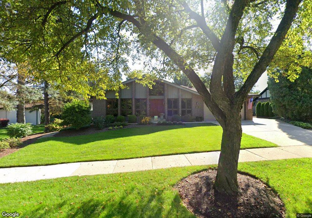
1141 Stoddard Ave Wheaton, IL 60187
Hawthorne NeighborhoodEstimated Value: $773,734 - $1,030,000
4
Beds
4
Baths
2,714
Sq Ft
$331/Sq Ft
Est. Value
About This Home
This home is located at 1141 Stoddard Ave, Wheaton, IL 60187 and is currently estimated at $897,184, approximately $330 per square foot. 1141 Stoddard Ave is a home located in DuPage County with nearby schools including Washington Elementary School, Franklin Middle School, and Wheaton North High School.
Ownership History
Date
Name
Owned For
Owner Type
Purchase Details
Closed on
Jan 13, 2012
Sold by
Stade James H and James H Stade Trust
Bought by
Hamann Allan
Current Estimated Value
Home Financials for this Owner
Home Financials are based on the most recent Mortgage that was taken out on this home.
Original Mortgage
$369,600
Outstanding Balance
$253,387
Interest Rate
3.98%
Mortgage Type
New Conventional
Estimated Equity
$643,797
Purchase Details
Closed on
Apr 14, 2006
Sold by
Stade James H and Stade Christine L
Bought by
Stade James H and Stade Christine L
Purchase Details
Closed on
Jan 29, 2001
Sold by
Kurkulis Albinas and Albinas Kurkulis Living Trust
Bought by
Stade James H and Stade Christine L
Purchase Details
Closed on
Nov 24, 1997
Sold by
Kurkulis Albinas
Bought by
Kurkulis Albinas and Albinas Kurkulis Living Trust
Create a Home Valuation Report for This Property
The Home Valuation Report is an in-depth analysis detailing your home's value as well as a comparison with similar homes in the area
Home Values in the Area
Average Home Value in this Area
Purchase History
| Date | Buyer | Sale Price | Title Company |
|---|---|---|---|
| Hamann Allan | $462,000 | Git | |
| Stade James H | -- | None Available | |
| Stade James H | $449,000 | -- | |
| Kurkulis Albinas | -- | -- |
Source: Public Records
Mortgage History
| Date | Status | Borrower | Loan Amount |
|---|---|---|---|
| Open | Hamann Allan | $369,600 |
Source: Public Records
Tax History
| Year | Tax Paid | Tax Assessment Tax Assessment Total Assessment is a certain percentage of the fair market value that is determined by local assessors to be the total taxable value of land and additions on the property. | Land | Improvement |
|---|---|---|---|---|
| 2024 | $12,469 | $209,468 | $41,185 | $168,283 |
| 2023 | $11,949 | $192,810 | $37,910 | $154,900 |
| 2022 | $11,857 | $182,210 | $35,820 | $146,390 |
| 2021 | $11,812 | $177,890 | $34,970 | $142,920 |
| 2020 | $11,772 | $176,230 | $34,640 | $141,590 |
| 2019 | $11,496 | $171,580 | $33,730 | $137,850 |
| 2018 | $11,497 | $169,730 | $31,780 | $137,950 |
| 2017 | $11,316 | $163,470 | $30,610 | $132,860 |
| 2016 | $11,155 | $156,940 | $29,390 | $127,550 |
| 2015 | $11,056 | $149,720 | $28,040 | $121,680 |
| 2014 | $11,486 | $147,660 | $33,830 | $113,830 |
| 2013 | $11,190 | $148,100 | $33,930 | $114,170 |
Source: Public Records
Map
Nearby Homes
- 820 Cherry St
- 1607 Stoddard Ave
- 582 Glendale Ave
- 412 Lawrence Ave
- 404 Lawrence Ave
- 1603 Ashton Ct
- 1906 N Summit St
- 808 Bridle Ln
- 328 Lorraine St
- 123 S Blanchard St
- 488 Newton Ave
- 110 Travers Ave
- 2009 Mackenzie Place
- 314 E Jefferson Ave
- 312 E Lincoln Ave
- 111 S Lorraine Rd
- 1017 Tartan Ct
- 213 S Summit St
- 404 Melrose Ave Unit 103
- 305 Maple St
- 1135 Stoddard Ave
- 1260 Shady Ln
- 1336 Shady Ln
- 1302 Shady Ln
- 1111 Stoddard Ave
- 1207 E Forest Ave
- 1130 Stoddard Ave
- 1160 Stoddard Ave
- 1311 E Forest Ave
- 1217 Shady Ln
- 1362 Shady Ln
- 1116 Stoddard Ave
- 1223 Shady Ln
- 1211 Shady Ln
- 1185 Stoddard Ave
- 1315 E Forest Ave
- 1307 Shady Ln
- 1140 Shady Ln
- 1390 Shady Ln Unit 3
- 1355 Shady Ln
Your Personal Tour Guide
Ask me questions while you tour the home.