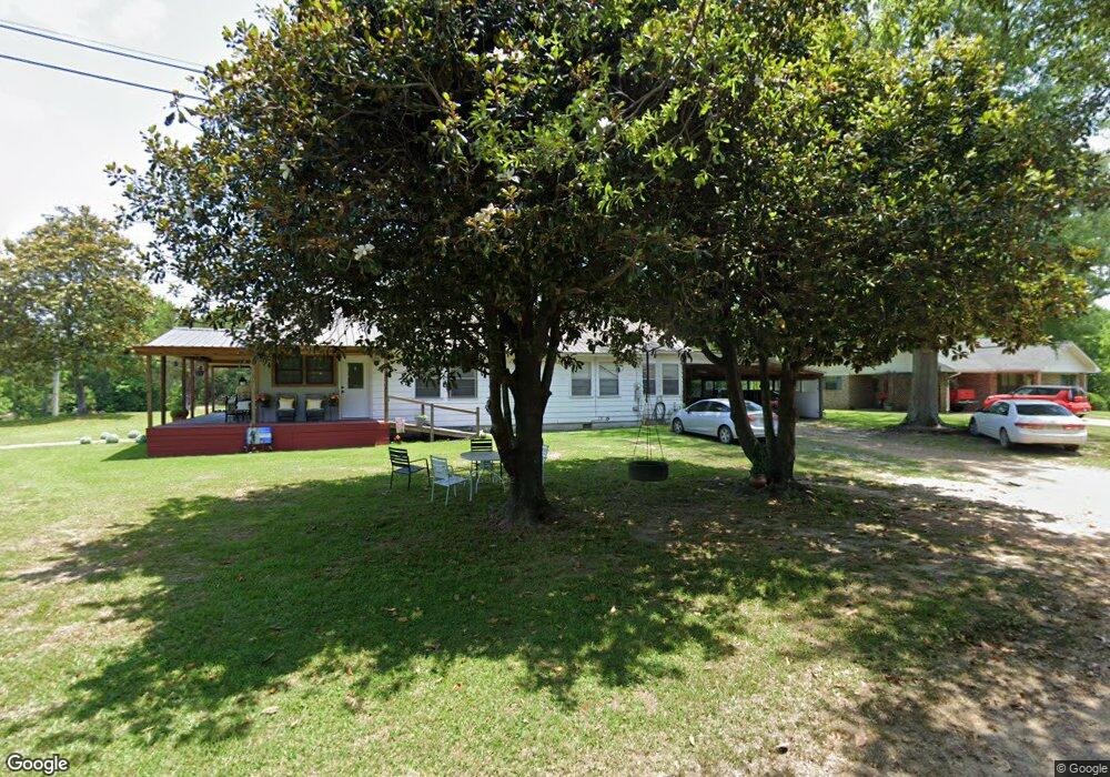
1142 E Railroad St Wesson, MS 39191
Estimated Value: $105,000 - $203,000
Studio
--
Bath
1,765
Sq Ft
$81/Sq Ft
Est. Value
About This Home
This home is located at 1142 E Railroad St, Wesson, MS 39191 and is currently estimated at $142,430, approximately $80 per square foot. 1142 E Railroad St is a home.
Ownership History
Date
Name
Owned For
Owner Type
Purchase Details
Closed on
Apr 2, 2024
Sold by
Vaughn Kimberly A
Bought by
Vaughn Kimberly A and Coleman Melvin
Current Estimated Value
Home Financials for this Owner
Home Financials are based on the most recent Mortgage that was taken out on this home.
Original Mortgage
$91,168
Outstanding Balance
$89,738
Interest Rate
6.94%
Mortgage Type
FHA
Estimated Equity
$52,692
Purchase Details
Closed on
Feb 25, 2010
Sold by
Tuneburg Dorothy C and Drye Dorothy C
Bought by
Vaughn Kimberly A
Create a Home Valuation Report for This Property
The Home Valuation Report is an in-depth analysis detailing your home's value as well as a comparison with similar homes in the area
Purchase History
| Date | Buyer | Sale Price | Title Company |
|---|---|---|---|
| Vaughn Kimberly A | -- | Vylla Title | |
| Vaughn Kimberly A | -- | -- |
Source: Public Records
Mortgage History
| Date | Status | Borrower | Loan Amount |
|---|---|---|---|
| Open | Vaughn Kimberly A | $91,168 |
Source: Public Records
Tax History
| Year | Tax Paid | Tax Assessment Tax Assessment Total Assessment is a certain percentage of the fair market value that is determined by local assessors to be the total taxable value of land and additions on the property. | Land | Improvement |
|---|---|---|---|---|
| 2025 | $548 | $6,652 | $0 | $0 |
| 2024 | $548 | $5,338 | $0 | $0 |
| 2023 | $555 | $5,338 | $0 | $0 |
| 2022 | $562 | $5,338 | $0 | $0 |
| 2021 | $543 | $5,338 | $0 | $0 |
| 2020 | $410 | $3,955 | $0 | $0 |
| 2019 | $416 | $3,955 | $0 | $0 |
| 2018 | $272 | $3,955 | $0 | $0 |
| 2017 | $249 | $3,955 | $0 | $0 |
| 2016 | $249 | $3,769 | $0 | $0 |
| 2015 | $255 | $3,769 | $0 | $0 |
| 2014 | $255 | $3,705 | $0 | $0 |
Source: Public Records
Map
Nearby Homes
- 0 Loom St
- 1079 Beech St
- 0 David Britt St
- 1119 Milltowne Dr
- 1001 Lumley Ln
- 0 00 Milltowne Dr
- 0 Milltownte Dr
- 0 Sawders Ln
- 596 Mount Zion Rd
- 589 Mount Zion Rd
- 594 Mount Zion Rd
- 0 Furrs Mill Dr NE
- 2038 Rocky Hill Rd
- 2548 Furrs Mill Dr NE
- 3085 Beauregard Rd
- 3066 New Sight Dr NE
- 0 Anderson Rd
- 4001 Stegall Rd
- 4069 Dixie Rd
- 4069 Dixie Garden Rd
- 1047 7th St
- 1047 Seventh St
- 1132 E Railroad St
- 1044 Seventh St
- 1132 E Railroad St
- 1126 E Railroad St
- 1017 W Railroad St
- 1002 6th St
- 106 Seventh St
- 1044 6th St
- 1007 Eighth St
- 1057 Seventh St
- 1007 8th St
- 1120 E Railroad St
- 1058 7th St
- 1015 Eighth St
- 1019 Seventh St
- 1026 Seventh St
- 1007 Sixth St
- 1042 W Sixth St
Your Personal Tour Guide
Ask me questions while you tour the home.