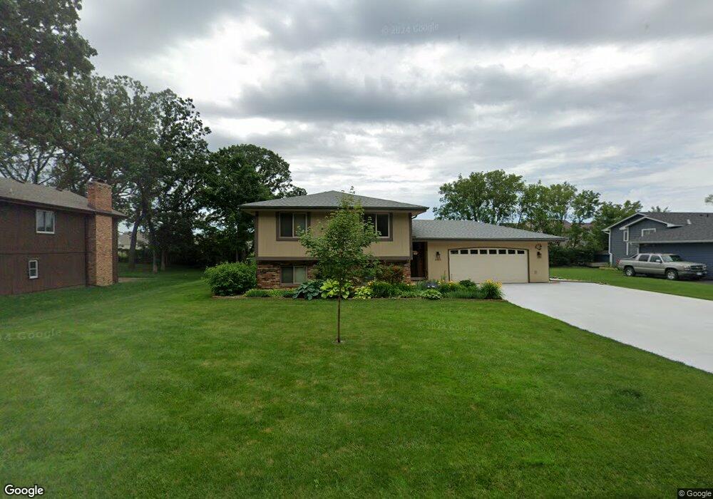
11421 133rd Ave N Dayton, MN 55327
Estimated Value: $371,904 - $429,000
4
Beds
2
Baths
1,356
Sq Ft
$293/Sq Ft
Est. Value
About This Home
This home is located at 11421 133rd Ave N, Dayton, MN 55327 and is currently estimated at $397,726, approximately $293 per square foot. 11421 133rd Ave N is a home located in Hennepin County with nearby schools including Dayton Elementary School, Jackson Middle School, and Champlin Park High School.
Ownership History
Date
Name
Owned For
Owner Type
Purchase Details
Closed on
May 29, 2018
Sold by
Hansen David P and Hansen Cheryi R
Bought by
Ross Thomas Gregory and Ross Lydia J
Current Estimated Value
Home Financials for this Owner
Home Financials are based on the most recent Mortgage that was taken out on this home.
Original Mortgage
$279,900
Outstanding Balance
$242,067
Interest Rate
4.5%
Mortgage Type
VA
Estimated Equity
$155,659
Purchase Details
Closed on
May 20, 2011
Sold by
Schiller Duane C and Schiller Joann
Bought by
Hansen David P and Hansen Cheryl R
Purchase Details
Closed on
Oct 6, 2006
Sold by
Spaneer Daniel and Spanier Holly A
Bought by
Schiller Duane C
Purchase Details
Closed on
Jun 13, 1997
Sold by
Bird Douglas and Bird Teresa
Bought by
Spanier Daniel and Spanier Holly Mclaughlin
Create a Home Valuation Report for This Property
The Home Valuation Report is an in-depth analysis detailing your home's value as well as a comparison with similar homes in the area
Home Values in the Area
Average Home Value in this Area
Purchase History
| Date | Buyer | Sale Price | Title Company |
|---|---|---|---|
| Ross Thomas Gregory | $279,900 | Edina Realty Title Inc | |
| Hansen David P | $140,000 | -- | |
| Schiller Duane C | $203,000 | -- | |
| Spanier Daniel | $131,225 | -- |
Source: Public Records
Mortgage History
| Date | Status | Borrower | Loan Amount |
|---|---|---|---|
| Open | Ross Thomas Gregory | $279,900 |
Source: Public Records
Tax History Compared to Growth
Tax History
| Year | Tax Paid | Tax Assessment Tax Assessment Total Assessment is a certain percentage of the fair market value that is determined by local assessors to be the total taxable value of land and additions on the property. | Land | Improvement |
|---|---|---|---|---|
| 2024 | $2,203 | $346,700 | $92,400 | $254,300 |
| 2023 | $2,142 | $343,400 | $88,000 | $255,400 |
| 2022 | $1,728 | $330,000 | $83,000 | $247,000 |
| 2021 | $1,651 | $280,000 | $64,000 | $216,000 |
| 2020 | $1,416 | $270,000 | $61,000 | $209,000 |
| 2019 | -- | $248,000 | $50,000 | $198,000 |
Source: Public Records
Map
Nearby Homes
- 11505 Pineridge Way N
- 11841 132nd Ave N
- 13172 Deerwood Ln N
- 11186 Balsam Pointe Trail
- 11205 Balsam Pointe Trail
- 13451 Yorktown Ln N
- 11117 Balsam Pointe Trail
- 13348 Linwood Forest Cir
- 11134 Balsam Pointe Trail
- 13611 Evergreen Ln N
- 13217 Valley Forge Ln N
- 13217 Union Terrace Ln N
- 13041 Union Terrace Ln N
- XXXXX Jonquil Ln N
- 12816 Cedar Ridge Ln
- 12941 Saratoga Ln N
- 1102 Benton St
- 307 Sunrise Ln
- 1032 Fremont St
- 535 W River Pkwy
- 11411 133rd Ave N
- 11501 133rd Ave N
- 11520 132nd Ave N
- 11540 132nd Ave N
- 11401 133rd Ave N
- 11511 133rd Ave N
- 11420 133rd Ave N
- 11500 133rd Ave N
- 11410 133rd Ave N
- 11500 132nd Ave N
- 11560 132nd Ave N
- 11525 Hayden Cir N
- 11510 133rd Ave N
- 11400 133rd Ave N
- 11311 133rd Ave N
- 11528 Hayden Cir N
- 11641 132nd Ave SE
- 11521 132nd Ave
- 11521 132nd Ave N
- XXXX 133rd Ave N