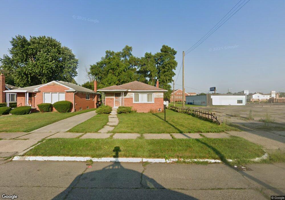
11421 Rutland St Detroit, MI 48227
Joy Community NeighborhoodEstimated Value: $56,000 - $118,000
--
Bed
1
Bath
1,071
Sq Ft
$76/Sq Ft
Est. Value
About This Home
This home is located at 11421 Rutland St, Detroit, MI 48227 and is currently estimated at $81,716, approximately $76 per square foot. 11421 Rutland St is a home located in Wayne County with nearby schools including Bates Academy, Charles L. Spain Elementary-Middle School, and Edward 'Duke' Ellington Conservatory of Music and Art.
Ownership History
Date
Name
Owned For
Owner Type
Purchase Details
Closed on
Apr 21, 2021
Sold by
Jones Sally
Bought by
Hill Kimberly
Current Estimated Value
Home Financials for this Owner
Home Financials are based on the most recent Mortgage that was taken out on this home.
Original Mortgage
$66,646
Outstanding Balance
$60,221
Interest Rate
3.05%
Mortgage Type
FHA
Estimated Equity
$21,495
Purchase Details
Closed on
Sep 25, 2007
Sold by
Jones Sally
Bought by
Jones Sally
Create a Home Valuation Report for This Property
The Home Valuation Report is an in-depth analysis detailing your home's value as well as a comparison with similar homes in the area
Home Values in the Area
Average Home Value in this Area
Purchase History
| Date | Buyer | Sale Price | Title Company |
|---|---|---|---|
| Hill Kimberly | $70,000 | Liberty Title | |
| Jones Sally | -- | None Available |
Source: Public Records
Mortgage History
| Date | Status | Borrower | Loan Amount |
|---|---|---|---|
| Open | Hill Kimberly | $66,646 |
Source: Public Records
Tax History Compared to Growth
Tax History
| Year | Tax Paid | Tax Assessment Tax Assessment Total Assessment is a certain percentage of the fair market value that is determined by local assessors to be the total taxable value of land and additions on the property. | Land | Improvement |
|---|---|---|---|---|
| 2025 | $1,634 | $33,300 | $0 | $0 |
| 2024 | $1,634 | $28,500 | $0 | $0 |
| 2023 | $1,585 | $22,500 | $0 | $0 |
| 2022 | $1,756 | $21,600 | $0 | $0 |
| 2021 | $1,633 | $16,400 | $0 | $0 |
| 2020 | $1,309 | $17,100 | $0 | $0 |
| 2019 | $1,296 | $15,200 | $0 | $0 |
| 2018 | $1,089 | $14,000 | $0 | $0 |
| 2017 | $205 | $12,400 | $0 | $0 |
| 2016 | $1,192 | $12,600 | $0 | $0 |
| 2015 | $1,260 | $12,600 | $0 | $0 |
| 2013 | $1,774 | $17,736 | $0 | $0 |
| 2010 | -- | $25,413 | $1,008 | $24,405 |
Source: Public Records
Map
Nearby Homes
- 11375 Grandmont Ave
- 11691 Archdale St
- 9996 Archdale St
- 9961 Rutland St
- 11676 Grandmont Ave
- 11387 Asbury Park
- 10086 Rosemont Ave
- 11394 Asbury Park
- 18110 Weaver St
- 9965 Asbury Park
- 9590 Memorial St
- 18250 Weaver St
- 9575 Longacre St
- 9661 Asbury Park
- 12251 Grandmont Ave
- 12094 Asbury Park
- 18541 Plymouth Rd
- 16911 W Chicago St
- 11690 Saint Marys St
- 12039 Faust Ave
- 11413 Rutland St
- 11403 Rutland St
- 11393 Rutland St
- 11420 Longacre St
- 11430 Longacre St
- 11410 Longacre St
- 17051 Plymouth Rd
- 11400 Longacre St
- 11385 Rutland St
- 11402 Rutland St
- 11392 Longacre St
- 11400 Rutland St
- 11377 Rutland St
- 11384 Longacre St
- 11392 Rutland St
- 11367 Rutland St
- 11374 Longacre St
- 11403 Memorial St
- 11384 Rutland St
- 11366 Longacre St