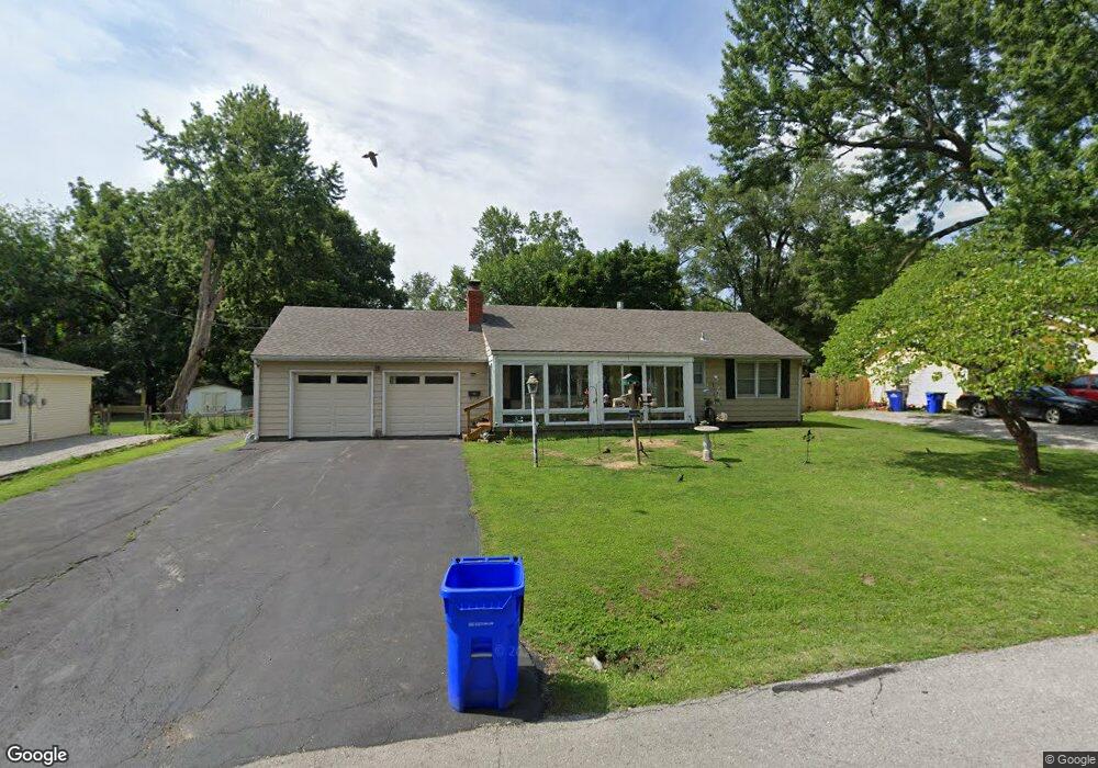
11421 W 61st Terrace Shawnee, KS 66203
Estimated Value: $266,000 - $315,000
3
Beds
2
Baths
960
Sq Ft
$304/Sq Ft
Est. Value
About This Home
This home is located at 11421 W 61st Terrace, Shawnee, KS 66203 and is currently estimated at $291,609, approximately $303 per square foot. 11421 W 61st Terrace is a home located in Johnson County with nearby schools including Bluejacket / Flint Elementary, Hocker Grove Middle School, and Shawnee Mission North High School.
Ownership History
Date
Name
Owned For
Owner Type
Purchase Details
Closed on
Mar 26, 2003
Sold by
Bergee Joan and Bergee Martha Elizabeth
Bought by
Flint John R and Flint Wanda R
Current Estimated Value
Home Financials for this Owner
Home Financials are based on the most recent Mortgage that was taken out on this home.
Original Mortgage
$99,200
Outstanding Balance
$42,490
Interest Rate
5.71%
Mortgage Type
Stand Alone First
Estimated Equity
$249,119
Create a Home Valuation Report for This Property
The Home Valuation Report is an in-depth analysis detailing your home's value as well as a comparison with similar homes in the area
Home Values in the Area
Average Home Value in this Area
Purchase History
| Date | Buyer | Sale Price | Title Company |
|---|---|---|---|
| Flint John R | -- | Stewart Title Inc |
Source: Public Records
Mortgage History
| Date | Status | Borrower | Loan Amount |
|---|---|---|---|
| Open | Flint John R | $99,200 |
Source: Public Records
Tax History Compared to Growth
Tax History
| Year | Tax Paid | Tax Assessment Tax Assessment Total Assessment is a certain percentage of the fair market value that is determined by local assessors to be the total taxable value of land and additions on the property. | Land | Improvement |
|---|---|---|---|---|
| 2024 | $3,222 | $30,671 | $5,233 | $25,438 |
| 2023 | $3,088 | $28,854 | $5,233 | $23,621 |
| 2022 | $2,716 | $25,300 | $4,802 | $20,498 |
| 2021 | $2,718 | $23,644 | $4,173 | $19,471 |
| 2020 | $2,350 | $20,148 | $3,792 | $16,356 |
| 2019 | $2,301 | $19,711 | $3,164 | $16,547 |
| 2018 | $2,125 | $18,124 | $2,846 | $15,278 |
| 2017 | $2,090 | $17,549 | $2,846 | $14,703 |
| 2016 | $1,928 | $15,962 | $2,846 | $13,116 |
| 2015 | $1,837 | $15,904 | $2,846 | $13,058 |
| 2013 | -- | $14,869 | $2,846 | $12,023 |
Source: Public Records
Map
Nearby Homes
- 12116 W 63rd Terrace
- 6420 Ballentine St
- 5845 Caenen St
- 12225 W 64th Terrace
- 6610 Halsey St
- 6556 Charles St
- 6564 Charles St
- 11637 W 68th Terrace
- 10924 W 67th St
- 11002 W 55th Terrace
- 5620 Monrovia St
- 10103 Johnson Dr
- 12300 W 67th Terrace
- 12508 W 56th St
- 5504 Monrovia St
- Ashwood Plan at Bristol Highlands - North
- The Fleetwood Plan at Bristol Highlands - The Villas
- Cypress II Plan at Bristol Highlands - North
- The Fleetwood Plan at Bristol Highlands - The Manors
- The Brentwood Plan at Bristol Highlands - The Villas
- 11415 W 61st Terrace
- 11505 W 61st Terrace
- 11424 W 61st Terrace
- 11416 W 61st Terrace
- 6120 Flint St
- 6130 Flint St
- 11504 W 61st Terrace
- 11515 W 61st Terrace
- 11400 W 61st Terrace
- 11425 W 61st St
- 6136 Flint St
- 6131 Lucille Ln
- 11503 W 61st St
- 11517 W 61st Terrace
- 6110 Flint St
- 6135 Lucille Ln
- 6152 Flint St
- 11516 W 61st Terrace
- 6121 Flint St
- 11520 W 61st Terrace