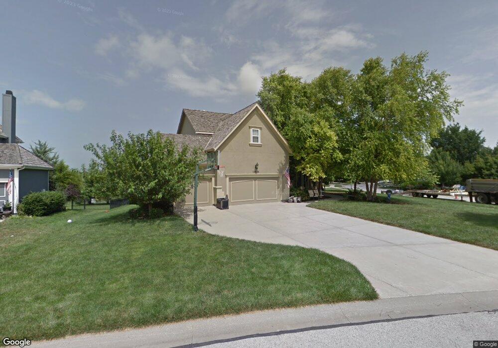
11436 S Wilder St Olathe, KS 66061
Estimated Value: $591,000 - $636,000
4
Beds
5
Baths
2,834
Sq Ft
$215/Sq Ft
Est. Value
About This Home
This home is located at 11436 S Wilder St, Olathe, KS 66061 and is currently estimated at $609,855, approximately $215 per square foot. 11436 S Wilder St is a home located in Johnson County with nearby schools including Cedar Creek Elementary School, Mission Trail Middle School, and Olathe West High School.
Ownership History
Date
Name
Owned For
Owner Type
Purchase Details
Closed on
Oct 12, 2007
Sold by
Pattison Jacqueline D and Pattison Michael D
Bought by
Us Bank Na
Current Estimated Value
Purchase Details
Closed on
May 14, 2002
Sold by
Pattison Construction
Bought by
Pattison Michael D and Pattison Jacqueline D
Home Financials for this Owner
Home Financials are based on the most recent Mortgage that was taken out on this home.
Original Mortgage
$175,000
Interest Rate
6.96%
Purchase Details
Closed on
Apr 25, 2002
Sold by
Cedar Creek Properties Inc
Bought by
Pattison Construction
Home Financials for this Owner
Home Financials are based on the most recent Mortgage that was taken out on this home.
Original Mortgage
$175,000
Interest Rate
6.96%
Create a Home Valuation Report for This Property
The Home Valuation Report is an in-depth analysis detailing your home's value as well as a comparison with similar homes in the area
Home Values in the Area
Average Home Value in this Area
Purchase History
| Date | Buyer | Sale Price | Title Company |
|---|---|---|---|
| Us Bank Na | $314,119 | None Available | |
| Pattison Michael D | -- | Security Land Title Company | |
| Pattison Construction | -- | Security Land Title Company |
Source: Public Records
Mortgage History
| Date | Status | Borrower | Loan Amount |
|---|---|---|---|
| Previous Owner | Pattison Michael D | $175,000 | |
| Closed | Pattison Michael D | $50,000 |
Source: Public Records
Tax History Compared to Growth
Tax History
| Year | Tax Paid | Tax Assessment Tax Assessment Total Assessment is a certain percentage of the fair market value that is determined by local assessors to be the total taxable value of land and additions on the property. | Land | Improvement |
|---|---|---|---|---|
| 2024 | $6,088 | $53,763 | $11,713 | $42,050 |
| 2023 | $6,231 | $54,073 | $10,642 | $43,431 |
| 2022 | $5,557 | $46,954 | $9,678 | $37,276 |
| 2021 | $5,924 | $47,759 | $9,678 | $38,081 |
| 2020 | $6,194 | $49,461 | $9,678 | $39,783 |
| 2019 | $5,966 | $47,334 | $8,410 | $38,924 |
| 2018 | $5,663 | $44,620 | $8,410 | $36,210 |
| 2017 | $5,139 | $40,100 | $7,309 | $32,791 |
| 2016 | $4,965 | $39,721 | $7,309 | $32,412 |
| 2015 | $4,856 | $38,870 | $7,309 | $31,561 |
| 2013 | -- | $40,434 | $6,961 | $33,473 |
Source: Public Records
Map
Nearby Homes
- 11320 S Cook St
- 11580 S Carbondale St
- 24843 W 112th St
- 24963 W 112th St
- 11165 S Brunswick St
- 25031 W 112th St
- 11176 S Violet St
- 11248 S Gleason Rd
- 24268 W 111th Place
- 11120 S Brunswick St
- 11160 S Violet St
- 11468 S Violet St
- 11263 S Gleason Rd
- 11275 S Gleason Rd
- 11287 S Gleason Rd
- 25064 W 112th St
- 11128 S Violet St
- 25086 W 112th St
- 11124 S Barth Rd
- 11717 S Barth Rd
- 11442 S Wilder St
- 11432 S Parish St
- 11427 S Parish St
- 11448 S Wilder St
- 11455 S Wilder St
- 11424 S Parish St
- 11421 S Parish St
- 11461 S Wilder St
- 11449 S Wilder St
- 11454 S Wilder St
- 11418 S Parish St
- 11416 S Wilder St
- 11456 S Parish St
- 11411 S Parish St
- 11443 S Wilder St
- 11467 S Wilder St
- 11460 S Wilder St
- 11412 S Parish St
- 11394 S Clare Rd
- 11455 S Parish St