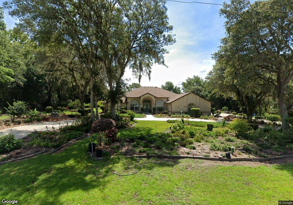
1145 N Annapolis Ave Hernando, FL 34442
Estimated Value: $564,000 - $662,000
3
Beds
3
Baths
3,659
Sq Ft
$167/Sq Ft
Est. Value
About This Home
This home is located at 1145 N Annapolis Ave, Hernando, FL 34442 and is currently estimated at $610,141, approximately $166 per square foot. 1145 N Annapolis Ave is a home located in Citrus County with nearby schools including Hernando Elementary School, Inverness Middle School, and Citrus High School.
Ownership History
Date
Name
Owned For
Owner Type
Purchase Details
Closed on
Jun 9, 2022
Sold by
Garcia Family Living Trust
Bought by
Garcia Joel G and Garcia Mary Beth
Current Estimated Value
Purchase Details
Closed on
Aug 29, 2011
Sold by
Garcia Manuel G and Garcia Nilda G
Bought by
Garcia Manuel G and Garcia Nilda G
Purchase Details
Closed on
Mar 12, 2001
Sold by
Pimental Pimental Paul P Paul P and Pimental Joan C
Bought by
Garcia Manuel and Garcia Nilda
Purchase Details
Closed on
Jun 1, 1994
Bought by
Garcia Manuel G and Co Trustees
Create a Home Valuation Report for This Property
The Home Valuation Report is an in-depth analysis detailing your home's value as well as a comparison with similar homes in the area
Home Values in the Area
Average Home Value in this Area
Purchase History
| Date | Buyer | Sale Price | Title Company |
|---|---|---|---|
| Garcia Joel G | -- | None Listed On Document | |
| Garcia Manuel G | -- | Attorney | |
| Garcia Manuel | $28,500 | Crystal River Title | |
| Garcia Manuel G | $25,500 | -- |
Source: Public Records
Tax History Compared to Growth
Tax History
| Year | Tax Paid | Tax Assessment Tax Assessment Total Assessment is a certain percentage of the fair market value that is determined by local assessors to be the total taxable value of land and additions on the property. | Land | Improvement |
|---|---|---|---|---|
| 2025 | $3,417 | $264,977 | -- | -- |
| 2024 | $7,904 | $257,509 | -- | -- |
| 2023 | $7,904 | $514,106 | $25,500 | $488,606 |
| 2022 | $3,124 | $242,727 | $0 | $0 |
| 2021 | $3,000 | $235,657 | $0 | $0 |
| 2020 | $2,903 | $316,366 | $15,950 | $300,416 |
| 2019 | $2,869 | $306,861 | $12,500 | $294,361 |
| 2018 | $2,846 | $283,704 | $11,480 | $272,224 |
| 2017 | $2,840 | $218,357 | $11,480 | $206,877 |
| 2016 | $2,880 | $213,866 | $11,510 | $202,356 |
| 2015 | $2,925 | $212,379 | $8,410 | $203,969 |
| 2014 | $2,993 | $210,693 | $9,658 | $201,035 |
Source: Public Records
Map
Nearby Homes
- 1323 N Annapolis Ave
- 631 E Liberty St
- 869 N Kensington Ave
- 787 E Reehill St
- 751 E Reehill St
- 1495 N Man o War Dr
- 636 N Cherry Pop Dr
- 1037 E Hartford St
- 1464 N Hambletonian Dr
- 640 E Hartford St
- 715 E Hartford St Unit 4A
- 771 E Hartford St
- 612 E Hartford St
- 810 E Gilchrist Ct Unit 2A
- 760 E Gilchrist Ct Unit 4A
- 1302 E Hartford St
- 375 E Liberty St
- 451 E Ireland Ct
- 700 N Cherry Pop Dr
- 295 E Keller Ct
- 1109 N Annapolis Ave
- 1196 N Man o War Dr
- 820 E Keller Ct
- 1218 N Man o War Dr
- 1217 N Annapolis Ave
- 1200 N Annapolis Ave
- 1246 N Man o War Dr
- 845 E Liberty St
- 817 E Keller Ct
- 1251 N Annapolis Ave
- 1264 N Man o War Dr
- 811 E Liberty St
- 782 E Keller Ct
- 930 E Liberty St
- 785 E Keller Ct
- 1183 N Man o War Dr
- 898 E Liberty St
- 1211 N Man o War Dr