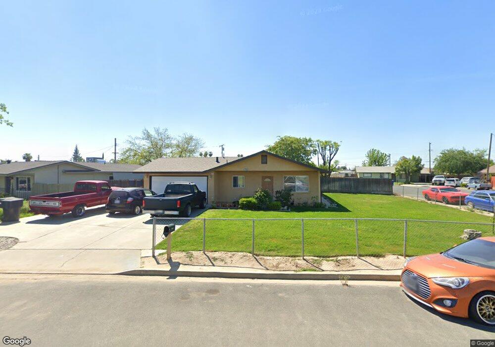
11464 Shepard Dr Hanford, CA 93230
Estimated Value: $256,999 - $295,000
3
Beds
2
Baths
1,100
Sq Ft
$246/Sq Ft
Est. Value
About This Home
This home is located at 11464 Shepard Dr, Hanford, CA 93230 and is currently estimated at $270,750, approximately $246 per square foot. 11464 Shepard Dr is a home located in Kings County with nearby schools including Martin Luther King Jr. Elementary School, John F. Kennedy Junior High School, and Hanford High School.
Ownership History
Date
Name
Owned For
Owner Type
Purchase Details
Closed on
Feb 16, 2012
Sold by
Moreno Jose Angel and Moreno Rosa
Bought by
Tdh Land & Cattle Llc
Current Estimated Value
Purchase Details
Closed on
Mar 27, 2006
Sold by
Bao Yang Kia Neng and Bao Thaoyang
Bought by
Moreno Jose Angel and Moreno Rosa
Home Financials for this Owner
Home Financials are based on the most recent Mortgage that was taken out on this home.
Original Mortgage
$138,750
Interest Rate
6.25%
Mortgage Type
Fannie Mae Freddie Mac
Purchase Details
Closed on
Jun 16, 2003
Sold by
Yang Kia Neng and Yang Bao Taho
Bought by
Yang Kia Neng and Yang Bao Taho
Home Financials for this Owner
Home Financials are based on the most recent Mortgage that was taken out on this home.
Original Mortgage
$52,500
Interest Rate
5.37%
Mortgage Type
Purchase Money Mortgage
Create a Home Valuation Report for This Property
The Home Valuation Report is an in-depth analysis detailing your home's value as well as a comparison with similar homes in the area
Home Values in the Area
Average Home Value in this Area
Purchase History
| Date | Buyer | Sale Price | Title Company |
|---|---|---|---|
| Tdh Land & Cattle Llc | $52,200 | None Available | |
| Moreno Jose Angel | $185,000 | Stewart Title Of California | |
| Yang Kia Neng | -- | Chicago Title Company | |
| Yang Kia Neng | -- | Chicago Title Company |
Source: Public Records
Mortgage History
| Date | Status | Borrower | Loan Amount |
|---|---|---|---|
| Previous Owner | Moreno Jose Angel | $138,750 | |
| Previous Owner | Yang Kia Neng | $52,500 |
Source: Public Records
Tax History Compared to Growth
Tax History
| Year | Tax Paid | Tax Assessment Tax Assessment Total Assessment is a certain percentage of the fair market value that is determined by local assessors to be the total taxable value of land and additions on the property. | Land | Improvement |
|---|---|---|---|---|
| 2025 | $700 | $65,940 | $25,119 | $40,821 |
| 2023 | $700 | $63,382 | $24,145 | $39,237 |
| 2022 | $685 | $62,140 | $23,672 | $38,468 |
| 2021 | $671 | $60,922 | $23,208 | $37,714 |
| 2020 | $678 | $60,297 | $22,970 | $37,327 |
| 2019 | $666 | $59,115 | $22,520 | $36,595 |
| 2018 | $647 | $57,955 | $22,078 | $35,877 |
| 2017 | $637 | $56,819 | $21,645 | $35,174 |
| 2016 | $629 | $55,705 | $21,221 | $34,484 |
| 2015 | $625 | $54,868 | $20,902 | $33,966 |
| 2014 | $613 | $53,794 | $20,493 | $33,301 |
Source: Public Records
Map
Nearby Homes
- 10876 Abby Ln
- 3 Jones St
- 2 Jones St
- 1 Jones St
- 10949 Hume Ave
- 11431 11th Ave
- 11071 Hume Ave
- 1823 W Sunset Ln
- 1936 S Red Rock Dr
- 400 Scott St
- 11741 S 11th Ave
- 1577 S Barberry Place
- 1577 S Barberry Place Unit Ho53
- 10050 Camino Ramon
- 1589 S Barberry Place Unit Ho54
- 650 S 11th Ave
- 11544 S 10th Ave
- 670 Grant St
- 604 S Phillips St
- 11474 Shepard Dr
- 11450 Shepard Dr
- 11484 Shepard Dr
- 11454 Lee Cir
- 11452 Lee Cir
- 11440 Shepard Dr
- 10816 Hume Ave
- 10828 Hume Ave
- 11430 Shepard Dr
- 10840 Hume Ave
- 11465 Jones St
- 11455 Jones St
- 11473 Jones St
- 10850 Hume Ave
- 11483 Jones St
- 11437 Jones St
- 10811 Hume Ave
- 10823 Hume Ave
- 10799 Hume Ave
- 10835 Hume Ave