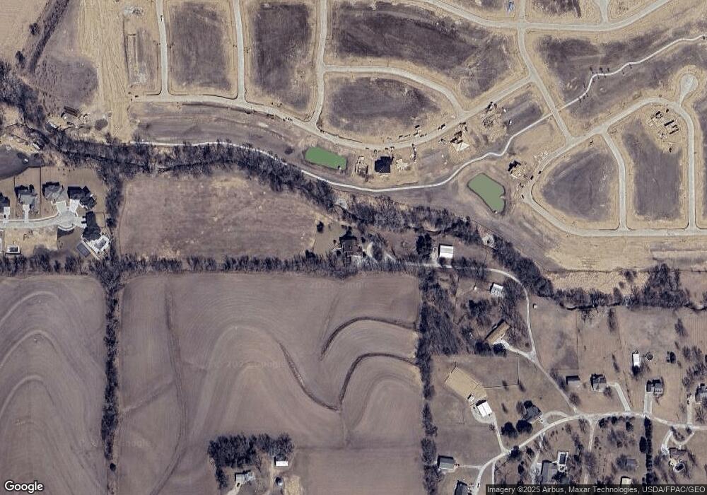
11474 S 182nd Cir Gretna, NE 68028
Estimated Value: $1,235,318
6
Beds
4
Baths
4,858
Sq Ft
$254/Sq Ft
Est. Value
About This Home
This home is located at 11474 S 182nd Cir, Gretna, NE 68028 and is currently estimated at $1,235,318, approximately $254 per square foot. 11474 S 182nd Cir is a home located in Sarpy County with nearby schools including Squire John Thomas Elementary School, Gretna Middle School, and Gretna High School.
Ownership History
Date
Name
Owned For
Owner Type
Purchase Details
Closed on
Sep 14, 2023
Sold by
Flor John C and Flor Debra Lynn
Bought by
John C Flor And Debra Lynn Flor Joint Trust and Flor
Current Estimated Value
Purchase Details
Closed on
Oct 13, 2010
Sold by
Flor John C and Flor Debra L
Bought by
Flor John C and Flor Debra L
Home Financials for this Owner
Home Financials are based on the most recent Mortgage that was taken out on this home.
Original Mortgage
$402,000
Interest Rate
4.39%
Mortgage Type
New Conventional
Purchase Details
Closed on
Mar 13, 2007
Sold by
Shepard Gregory A and Shepard Kelley A
Bought by
Flor John C and Sullivan Debra L
Home Financials for this Owner
Home Financials are based on the most recent Mortgage that was taken out on this home.
Original Mortgage
$416,500
Interest Rate
6.3%
Mortgage Type
Purchase Money Mortgage
Create a Home Valuation Report for This Property
The Home Valuation Report is an in-depth analysis detailing your home's value as well as a comparison with similar homes in the area
Home Values in the Area
Average Home Value in this Area
Purchase History
| Date | Buyer | Sale Price | Title Company |
|---|---|---|---|
| John C Flor And Debra Lynn Flor Joint Trust | -- | None Listed On Document | |
| Flor John C | -- | Nebraska Title Company | |
| Flor John C | $560,000 | Prestige Title |
Source: Public Records
Mortgage History
| Date | Status | Borrower | Loan Amount |
|---|---|---|---|
| Previous Owner | Flor John C | $402,000 | |
| Previous Owner | Flor John C | $416,500 |
Source: Public Records
Tax History Compared to Growth
Tax History
| Year | Tax Paid | Tax Assessment Tax Assessment Total Assessment is a certain percentage of the fair market value that is determined by local assessors to be the total taxable value of land and additions on the property. | Land | Improvement |
|---|---|---|---|---|
| 2025 | $12,113 | $914,676 | $159,481 | $755,195 |
| 2024 | $13,602 | $818,446 | $139,547 | $678,899 |
| 2023 | $13,602 | $739,158 | $137,945 | $601,213 |
| 2022 | $12,030 | $643,573 | $136,695 | $506,878 |
| 2021 | $10,861 | $593,015 | $130,559 | $462,456 |
| 2020 | $10,358 | $528,275 | $115,511 | $412,764 |
| 2019 | $9,314 | $471,163 | $110,050 | $361,113 |
| 2018 | $9,065 | $502,852 | $96,596 | $406,256 |
| 2017 | $8,641 | $478,162 | $94,482 | $383,680 |
| 2016 | $8,506 | $473,241 | $92,167 | $381,074 |
| 2015 | $8,357 | $468,969 | $100,076 | $368,893 |
| 2014 | $8,346 | $473,083 | $97,886 | $375,197 |
| 2012 | -- | $459,995 | $96,228 | $363,767 |
Source: Public Records
Map
Nearby Homes
- 18314 Schirra St
- 18509 Acorn Dr
- 11366 S 184th St
- 11308 S 182nd Cir
- 11307 S 182nd Cir
- Lot 153 Magnolia
- Albany Plan at Magnolia
- Lansing Plan at Magnolia
- Lincoln Plan at Magnolia
- Madison Plan at Magnolia
- Harrisburg Plan at Magnolia
- Jackson Plan at Magnolia
- Montgomery 1734 Plan at Magnolia
- Montgomery 1922 Plan at Magnolia
- Pierre 1934 Plan at Magnolia
- Montgomery 1892 Plan at Magnolia
- Pierre 1889 Plan at Magnolia
- 18213 Sycamore Dr
- 18209 Sycamore Dr
- Lot 120 Magnoli
- 11504 S 182nd Cir
- TBD S 184th St
- 18318 Schirra St
- 18111 Hazelnut Dr
- Lot 119 Magnolia
- 11516 S 182nd Cir
- 18107 Hazelnut Dr
- 18502 Schram Rd
- 18603 Hazelnut Cir
- 182nd & Cooper St Unit 11
- 182nd & Cooper St Unit 10
- 182nd & Cooper St Unit 8
- 182nd & Cooper St Unit 7
- 182nd & Cooper St Unit 9
- 182nd & Cooper St Unit 6
- 182nd & Cooper St Unit 5
- 182nd & Cooper St Unit 3
- 182nd & Cooper St Unit 4
- 182nd & Cooper St Unit 2
- 182nd & Cooper St Unit 1
