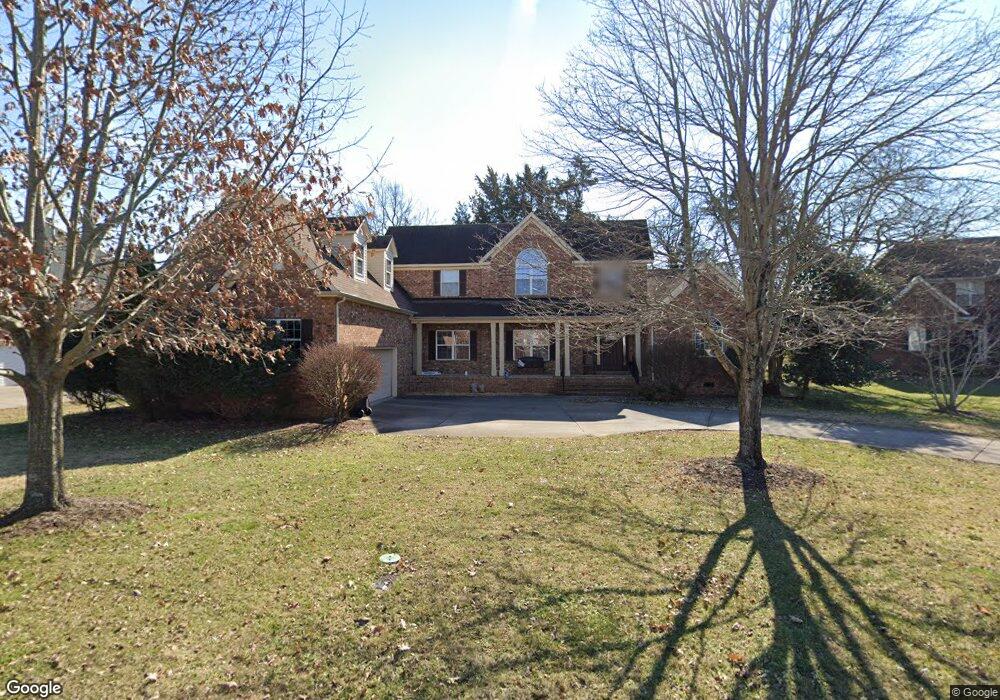
1148 Blake Ct Murfreesboro, TN 37130
Estimated Value: $593,128 - $722,000
Studio
4
Baths
3,180
Sq Ft
$206/Sq Ft
Est. Value
About This Home
This home is located at 1148 Blake Ct, Murfreesboro, TN 37130 and is currently estimated at $655,032, approximately $205 per square foot. 1148 Blake Ct is a home located in Rutherford County with nearby schools including John Pittard Elementary School, Oakland Middle School, and Oakland High School.
Ownership History
Date
Name
Owned For
Owner Type
Purchase Details
Closed on
Oct 5, 2000
Sold by
Parke Green Llc
Bought by
Hein Michael B and Hein Judith L
Current Estimated Value
Create a Home Valuation Report for This Property
The Home Valuation Report is an in-depth analysis detailing your home's value as well as a comparison with similar homes in the area
Home Values in the Area
Average Home Value in this Area
Purchase History
| Date | Buyer | Sale Price | Title Company |
|---|---|---|---|
| Hein Michael B | $35,375 | -- |
Source: Public Records
Tax History
| Year | Tax Paid | Tax Assessment Tax Assessment Total Assessment is a certain percentage of the fair market value that is determined by local assessors to be the total taxable value of land and additions on the property. | Land | Improvement |
|---|---|---|---|---|
| 2025 | -- | $134,175 | $15,625 | $118,550 |
| 2024 | $3,795 | $134,175 | $15,625 | $118,550 |
| 2023 | $2,517 | $134,175 | $15,625 | $118,550 |
| 2022 | $2,169 | $134,175 | $15,625 | $118,550 |
| 2021 | $2,173 | $97,925 | $15,625 | $82,300 |
| 2020 | $2,173 | $97,925 | $15,625 | $82,300 |
| 2019 | $2,173 | $97,925 | $15,625 | $82,300 |
| 2018 | $2,986 | $97,925 | $0 | $0 |
| 2017 | $3,030 | $77,950 | $0 | $0 |
| 2016 | $3,030 | $77,950 | $0 | $0 |
| 2015 | $3,030 | $77,950 | $0 | $0 |
| 2014 | $1,938 | $77,950 | $0 | $0 |
| 2013 | -- | $77,975 | $0 | $0 |
Source: Public Records
Map
Nearby Homes
- 1021 Shoreham St
- 2904 Pomoa Place
- 1180 Ithaca St
- 1005 Ithaca St
- 718 Dallas Ct
- 3202 Folcroft Dr
- 710 Fenwick Close
- 2403 Franklin Ln
- 2418 Taylor Close
- 3207 Livermore Ln
- 2926 Roellen Rd
- 707 Bradford Place
- 3306 Rift Ln
- 2719 Rocking Horse Ln
- 3227 Blue Sky Dr
- 2722 Crowne Pointe Dr
- 2308 Alexander Blvd
- 723 Black Colt Dr
- 3327 Vintage Grove Pkwy
- 2422 English Hill Dr
Your Personal Tour Guide
Ask me questions while you tour the home.