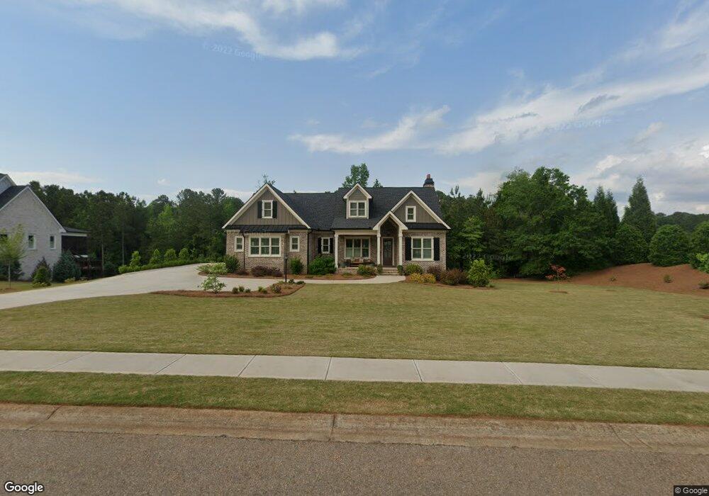
1148 Wade Dr Bogart, GA 30622
Estimated Value: $939,000 - $1,120,000
--
Bed
--
Bath
3,529
Sq Ft
$293/Sq Ft
Est. Value
About This Home
This home is located at 1148 Wade Dr, Bogart, GA 30622 and is currently estimated at $1,032,844, approximately $292 per square foot. 1148 Wade Dr is a home with nearby schools including Rocky Branch Elementary School, Malcom Bridge Middle School, and North Oconee High School.
Ownership History
Date
Name
Owned For
Owner Type
Purchase Details
Closed on
Apr 17, 2020
Sold by
Src Homes Llc
Bought by
Rutherford Randy Joe and Rutherford Cynthis Morris
Current Estimated Value
Home Financials for this Owner
Home Financials are based on the most recent Mortgage that was taken out on this home.
Original Mortgage
$519,282
Outstanding Balance
$461,742
Interest Rate
3.6%
Mortgage Type
New Conventional
Estimated Equity
$571,102
Purchase Details
Closed on
Sep 27, 2019
Sold by
D & B Land Ventures Llc
Bought by
Src Homes Llc
Home Financials for this Owner
Home Financials are based on the most recent Mortgage that was taken out on this home.
Original Mortgage
$412,500
Interest Rate
3.5%
Mortgage Type
Commercial
Purchase Details
Closed on
Aug 28, 2018
Sold by
Somerset Of Oconee Homeowners Associatio
Bought by
D
Create a Home Valuation Report for This Property
The Home Valuation Report is an in-depth analysis detailing your home's value as well as a comparison with similar homes in the area
Home Values in the Area
Average Home Value in this Area
Purchase History
| Date | Buyer | Sale Price | Title Company |
|---|---|---|---|
| Rutherford Randy Joe | $577,045 | -- | |
| Src Homes Llc | $80,000 | -- | |
| D | $65,000 | -- |
Source: Public Records
Mortgage History
| Date | Status | Borrower | Loan Amount |
|---|---|---|---|
| Open | Rutherford Randy Joe | $519,282 | |
| Previous Owner | Src Homes Llc | $412,500 |
Source: Public Records
Tax History Compared to Growth
Tax History
| Year | Tax Paid | Tax Assessment Tax Assessment Total Assessment is a certain percentage of the fair market value that is determined by local assessors to be the total taxable value of land and additions on the property. | Land | Improvement |
|---|---|---|---|---|
| 2024 | $3,916 | $366,771 | $45,000 | $321,771 |
| 2023 | $4,438 | $356,714 | $44,000 | $312,714 |
| 2022 | $5,068 | $291,264 | $40,000 | $251,264 |
| 2021 | $5,297 | $256,497 | $30,000 | $226,497 |
| 2020 | $2,671 | $115,190 | $30,000 | $85,190 |
| 2019 | $603 | $30,000 | $30,000 | $0 |
| 2018 | $711 | $30,000 | $30,000 | $0 |
Source: Public Records
Map
Nearby Homes
- 2082 Wade Dr
- 0 Clotfelter Rd Unit 1025303
- 2163 Heather Ln
- 2479 Eisenhower Ave
- 1665 Eisenhower Ave
- 2165 Harperfield Dr
- 0 Ruth Jackson Rd Unit 10582108
- 00 Ruth Jackson Rd
- 1105 Harperfield Dr
- 1021 Bedford Trail
- 1640 Madison Ct
- 0 Monroe Hwy Unit 1025452
- 2934 Horseshoe Bend Ln
- 2548 E Princeton Dr
- 1120 Liberty Ln
- 6601 Hog Mountain Hwy - Hwy 53 Unit PARCEL B
- 1496 Malcom Estates
- 1224 Malcom Estates
- 1010 Garland Dr
- 3164 Malcom Estates Dr
- 1308 Wade Dr
- 1426 Wade Dr
- 1113 Wade Dr
- 1239 Wade Dr
- 1351 Wade Dr
- 1582 Wade Dr
- 1569 Wade Dr
- 1991 Clotfelter Rd
- 2001 Clotfelter Rd
- 1675 Wade Dr
- 1864 Wade Dr
- 1940 Clotfelter Rd
- 1212 Heather Ln
- 1638 Stanley Ave
- 1306 Heather Ln
- 1108 Heather Ln
- 1400 Heather Ln
- 1500 Stanley Ave
- 1492 Heather Ln
- 1372 Stanley Ave