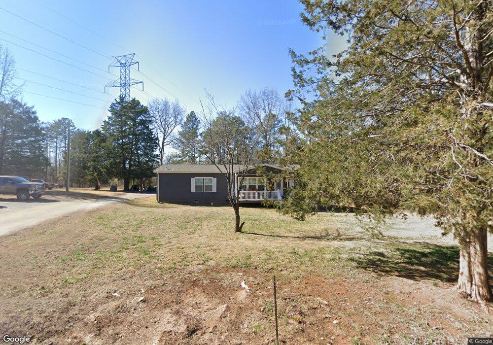
1149 C E Stewart Rd Clover, SC 29710
Estimated Value: $295,769 - $398,000
Studio
--
Bath
2,112
Sq Ft
$167/Sq Ft
Est. Value
About This Home
This home is located at 1149 C E Stewart Rd, Clover, SC 29710 and is currently estimated at $351,942, approximately $166 per square foot. 1149 C E Stewart Rd is a home with nearby schools including Bethany Elementary School, Clover Middle School, and Clover High School.
Ownership History
Date
Name
Owned For
Owner Type
Purchase Details
Closed on
May 3, 2023
Sold by
Whitesides Patsy Y
Bought by
Blanton Michael David and Blanton Tina Waldrop
Current Estimated Value
Home Financials for this Owner
Home Financials are based on the most recent Mortgage that was taken out on this home.
Original Mortgage
$220,288
Outstanding Balance
$214,599
Interest Rate
6.42%
Mortgage Type
FHA
Estimated Equity
$137,343
Purchase Details
Closed on
Sep 23, 1998
Sold by
Whitesides Robert E
Bought by
Blanton Michael D
Create a Home Valuation Report for This Property
The Home Valuation Report is an in-depth analysis detailing your home's value as well as a comparison with similar homes in the area
Home Values in the Area
Average Home Value in this Area
Purchase History
| Date | Buyer | Sale Price | Title Company |
|---|---|---|---|
| Blanton Michael David | -- | None Listed On Document | |
| Blanton Michael D | $24,000 | -- |
Source: Public Records
Mortgage History
| Date | Status | Borrower | Loan Amount |
|---|---|---|---|
| Open | Blanton Michael David | $220,288 |
Source: Public Records
Tax History
| Year | Tax Paid | Tax Assessment Tax Assessment Total Assessment is a certain percentage of the fair market value that is determined by local assessors to be the total taxable value of land and additions on the property. | Land | Improvement |
|---|---|---|---|---|
| 2025 | $1,307 | $10,403 | $2,988 | $7,415 |
| 2024 | $5,280 | $13,569 | $2,400 | $11,169 |
| 2023 | $236 | $1,660 | $1,600 | $60 |
| 2022 | $340 | $3,028 | $1,600 | $1,428 |
| 2021 | -- | $3,028 | $1,600 | $1,428 |
| 2020 | $334 | $3,028 | $0 | $0 |
| 2019 | $374 | $3,100 | $0 | $0 |
| 2018 | $377 | $3,100 | $0 | $0 |
| 2017 | $350 | $3,080 | $0 | $0 |
| 2016 | $343 | $3,100 | $0 | $0 |
| 2014 | $385 | $3,100 | $1,520 | $1,580 |
| 2013 | $385 | $3,290 | $1,520 | $1,770 |
Source: Public Records
Map
Nearby Homes
- 2979 Greenleaf Rd
- 2992 Greenleaf Rd
- 1217 Woodpecker Dr
- 9080 Kings Dr
- Crossland Road Unit: 2
- 13546 State Highway 55
- 10+/-AC Ramah Church Rd Unit LOT D
- 10+/-AC Ramah Church Rd Unit LOT A
- 10+/-AC Ramah Church Rd Unit LOT C
- 13+/-AC Ramah Church Rd Unit LOT B
- 14+/-AC Canipe Rd Unit LOT E
- 00 Forest View Rd
- TBD Crossland Rd Unit 2
- 0 Ramah Church Rd Unit 25893369
- 3625 Black Hwy
- 1895 Templeton Rd
- 1845 State Road S-46-149
- 4698 Forest View Rd
- 2180 Lawrence Rd
- 1014 Willow Grove Ln
- 1102 C E Stewart Rd
- 1122 C E Stewart Rd
- 1052 C E Stewart Rd
- 1136 C E Stewart Rd
- 1173 C E Stewart Rd
- 1152 C E Stewart Rd
- 1020 C E Stewart Rd
- 1185 C E Stewart Rd
- 1170 C E Stewart Rd
- 440 Double Eagle Trace
- 432 Double Eagle Trace
- 3035 Greenleaf Rd
- 3019 Greenleaf Rd
- 424 Double Eagle Trace
- 3005 Greenleaf Rd
- 1212 C E Stewart Rd
- 2993 Greenleaf Rd
- 2993 Greenleaf Rd Unit 4
- 412 Double Eagle Trace
- 3051 Greenleaf Rd
Your Personal Tour Guide
Ask me questions while you tour the home.