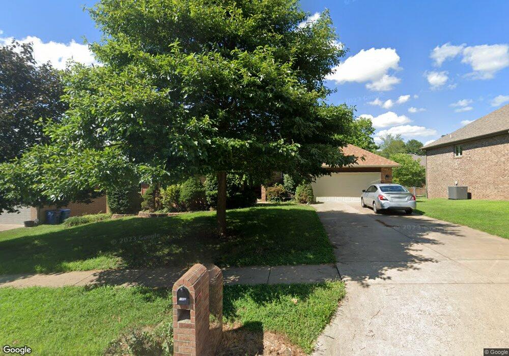
1149 W Highpoint St Springfield, MO 65810
Southwest Springfield NeighborhoodEstimated Value: $392,328 - $452,000
4
Beds
3
Baths
3,328
Sq Ft
$126/Sq Ft
Est. Value
About This Home
This home is located at 1149 W Highpoint St, Springfield, MO 65810 and is currently estimated at $417,832, approximately $125 per square foot. 1149 W Highpoint St is a home located in Greene County with nearby schools including Gray Elementary School, Wilson's Creek Intermediate School, and Cherokee Middle School.
Ownership History
Date
Name
Owned For
Owner Type
Purchase Details
Closed on
Mar 20, 2023
Sold by
Diffey Lynda M
Bought by
Lynda M Diffey Trust
Current Estimated Value
Purchase Details
Closed on
Aug 29, 2008
Sold by
Chinnery Richard C and Chinnery Jacqueline
Bought by
Diffey Lynda M
Home Financials for this Owner
Home Financials are based on the most recent Mortgage that was taken out on this home.
Original Mortgage
$196,000
Interest Rate
6.66%
Mortgage Type
New Conventional
Purchase Details
Closed on
Nov 28, 2005
Sold by
Lemons Otho K and Lemons Stephanee C
Bought by
Chinnery Richard C and Chinnery Jacqueline
Home Financials for this Owner
Home Financials are based on the most recent Mortgage that was taken out on this home.
Original Mortgage
$41,200
Interest Rate
5.59%
Mortgage Type
Stand Alone Second
Create a Home Valuation Report for This Property
The Home Valuation Report is an in-depth analysis detailing your home's value as well as a comparison with similar homes in the area
Home Values in the Area
Average Home Value in this Area
Purchase History
| Date | Buyer | Sale Price | Title Company |
|---|---|---|---|
| Lynda M Diffey Trust | -- | -- | |
| Diffey Lynda M | -- | None Available | |
| Chinnery Richard C | -- | None Available |
Source: Public Records
Mortgage History
| Date | Status | Borrower | Loan Amount |
|---|---|---|---|
| Previous Owner | Diffey Lynda M | $196,000 | |
| Previous Owner | Chinnery Richard C | $41,200 |
Source: Public Records
Tax History Compared to Growth
Tax History
| Year | Tax Paid | Tax Assessment Tax Assessment Total Assessment is a certain percentage of the fair market value that is determined by local assessors to be the total taxable value of land and additions on the property. | Land | Improvement |
|---|---|---|---|---|
| 2025 | $2,621 | $53,950 | $7,130 | $46,820 |
| 2024 | $2,621 | $47,330 | $4,750 | $42,580 |
| 2023 | $2,607 | $47,330 | $4,750 | $42,580 |
| 2022 | $2,363 | $43,970 | $4,750 | $39,220 |
| 2021 | $2,362 | $43,970 | $4,750 | $39,220 |
| 2020 | $2,322 | $40,980 | $4,750 | $36,230 |
| 2019 | $2,255 | $40,980 | $4,750 | $36,230 |
| 2018 | $2,089 | $37,870 | $4,750 | $33,120 |
| 2017 | $2,068 | $34,730 | $4,750 | $29,980 |
| 2016 | $1,898 | $34,730 | $4,750 | $29,980 |
| 2015 | $1,883 | $34,730 | $4,750 | $29,980 |
| 2014 | $1,830 | $33,480 | $4,750 | $28,730 |
Source: Public Records
Map
Nearby Homes
- 1173 W Highpoint St
- 5393 S Newton Ave
- 5381 S Newton Ave
- 5228 S Nettleton Ave
- 5216 S Nettleton Ave
- 5204 S Nettleton Ave
- 5964 S Nettleton Ave
- 5044 S Nettleton Ave
- 5537 S Pinehurst Ave
- 5783 S Franklin Ave
- 5333 S Dayton Ave
- 5337 S Dayton Ave
- 5341 S Dayton Ave
- 1257 W Gaslight Dr
- 5558 S Dayton Ave
- 5336 S Dayton Ave
- 5332 S Dayton Ave
- 5328 S Dayton Ave
- 5425 S Westwood Ave
- 5881 S Franklin Ave
- 1169 W Highpoint St
- 1129 W Highpoint St
- 1128 W Pheasant Run St
- 1134 W Pheasant Run St
- 1111 W Highpoint St
- 1108 W Pheasant Run St
- 1146 W Pheasant Run St
- 1150 W Highpoint St
- 1134 W Highpoint St
- 1166 W Highpoint St
- 1177 W Highpoint St
- 1096 W Pheasant Run St
- 1118 W Highpoint St
- 1091 W Highpoint St
- 1170 W Highpoint St
- 1158 W Pheasant Run St
- 1178 W High Point St
- 1102 W Highpoint St
- 1178 W Highpoint St
- 1084 W Pheasant Run St