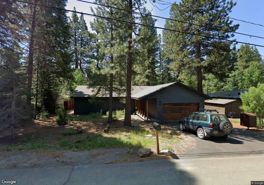
11495 Silverfir Dr Truckee, CA 96161
South Truckee NeighborhoodEstimated Value: $833,000 - $1,117,000
3
Beds
2
Baths
1,442
Sq Ft
$660/Sq Ft
Est. Value
About This Home
This home is located at 11495 Silverfir Dr, Truckee, CA 96161 and is currently estimated at $951,213, approximately $659 per square foot. 11495 Silverfir Dr is a home located in Placer County with nearby schools including Truckee Elementary School, Alder Creek Middle School, and Tahoe Truckee High School.
Ownership History
Date
Name
Owned For
Owner Type
Purchase Details
Closed on
Aug 22, 2023
Sold by
Foote Brad L
Bought by
Yaworsky Peter
Current Estimated Value
Home Financials for this Owner
Home Financials are based on the most recent Mortgage that was taken out on this home.
Original Mortgage
$672,000
Outstanding Balance
$654,604
Interest Rate
6.78%
Mortgage Type
New Conventional
Estimated Equity
$296,609
Create a Home Valuation Report for This Property
The Home Valuation Report is an in-depth analysis detailing your home's value as well as a comparison with similar homes in the area
Home Values in the Area
Average Home Value in this Area
Purchase History
| Date | Buyer | Sale Price | Title Company |
|---|---|---|---|
| Yaworsky Peter | $848,000 | Fidelity National Title |
Source: Public Records
Mortgage History
| Date | Status | Borrower | Loan Amount |
|---|---|---|---|
| Open | Yaworsky Peter | $672,000 |
Source: Public Records
Tax History
| Year | Tax Paid | Tax Assessment Tax Assessment Total Assessment is a certain percentage of the fair market value that is determined by local assessors to be the total taxable value of land and additions on the property. | Land | Improvement |
|---|---|---|---|---|
| 2025 | $9,324 | $864,960 | $229,500 | $635,460 |
| 2023 | $9,324 | $178,611 | $31,260 | $147,351 |
| 2022 | $2,336 | $175,110 | $30,648 | $144,462 |
| 2021 | $2,072 | $171,678 | $30,048 | $141,630 |
| 2020 | $2,094 | $169,918 | $29,740 | $140,178 |
| 2019 | $2,105 | $166,587 | $29,157 | $137,430 |
| 2018 | $2,025 | $163,322 | $28,586 | $134,736 |
| 2017 | $1,995 | $160,121 | $28,026 | $132,095 |
| 2016 | $1,984 | $156,982 | $27,477 | $129,505 |
| 2015 | $1,940 | $154,625 | $27,065 | $127,560 |
| 2014 | $1,865 | $151,597 | $26,535 | $125,062 |
Source: Public Records
Map
Nearby Homes
- 10529 Aspen Wood Rd
- 11902 & 11912 Rio Vista Dr
- 10335 Old Brockway Rd
- 000 Rue Hilltop
- 10191 W River St
- 10336 Palisades Dr
- 9264 Heartwood Dr
- 11212 Star Pine Rd
- 9270 Brae Rd
- 9278 Brae Rd
- 10008 High St
- 9240 Heartwood Dr
- 9195 Tarn Cir
- 9234 Heartwood Dr
- 9337 Heartwood Dr
- 9309 Gaston Ct
- 9313 Gaston Ct
- 9188 Tarn Cir
- 10209 Modane Place
- 9308 Nine Bark Rd
- 11505 Silverfir Dr
- 11463 Silverfir Dr
- 11463 Silver Fir Dr
- 11443 Silver Fir Dr
- 11515 Silverfir Dr
- 11443 Silverfir Dr
- 11502 Silver Fir Dr
- 11490 Silverfir Dr
- 11502 Silverfir Dr
- 11462 Silverfir Dr
- 11525 Silverfir Dr
- 11512 Silverfir Dr
- 11423 Silverfir Dr
- 11442 Silver Fir Dr
- 11442 Silverfir Dr
- 11912 Ceinosis St
- 10752 Aspen Wood Rd
- 11515 Purple Sage Rd
- 11535 Silverfir Dr
- 11422 Silverfir Dr
Your Personal Tour Guide
Ask me questions while you tour the home.