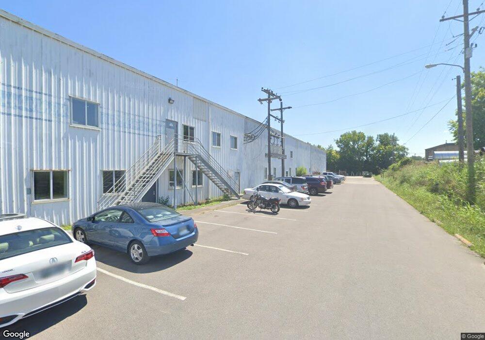
115 Carr Ave Franklin, TN 37064
Southall NeighborhoodEstimated Value: $5,794,752
--
Bed
3
Baths
27,240
Sq Ft
$213/Sq Ft
Est. Value
About This Home
This home is located at 115 Carr Ave, Franklin, TN 37064 and is currently estimated at $5,794,752, approximately $212 per square foot. 115 Carr Ave is a home located in Williamson County with nearby schools including Franklin Elementary School, Freedom Intermediate School, and Freedom Middle School.
Ownership History
Date
Name
Owned For
Owner Type
Purchase Details
Closed on
Mar 8, 2024
Sold by
Centuristone Inc
Bought by
Carr Ave Llc
Current Estimated Value
Home Financials for this Owner
Home Financials are based on the most recent Mortgage that was taken out on this home.
Original Mortgage
$5,375,000
Outstanding Balance
$5,281,426
Interest Rate
6.69%
Mortgage Type
Credit Line Revolving
Estimated Equity
$513,326
Purchase Details
Closed on
Nov 1, 2012
Sold by
Cb&I Inc
Bought by
Intellistone Inc
Home Financials for this Owner
Home Financials are based on the most recent Mortgage that was taken out on this home.
Original Mortgage
$380,000
Interest Rate
3.43%
Mortgage Type
Commercial
Purchase Details
Closed on
Feb 7, 2001
Sold by
Hydrostorage Inc
Bought by
Cb & J Constructors Inc
Create a Home Valuation Report for This Property
The Home Valuation Report is an in-depth analysis detailing your home's value as well as a comparison with similar homes in the area
Home Values in the Area
Average Home Value in this Area
Purchase History
| Date | Buyer | Sale Price | Title Company |
|---|---|---|---|
| Carr Ave Llc | $5,375,000 | None Listed On Document | |
| Intellistone Inc | $780,000 | None Available | |
| Cb & J Constructors Inc | $671,200 | -- |
Source: Public Records
Mortgage History
| Date | Status | Borrower | Loan Amount |
|---|---|---|---|
| Open | Carr Ave Llc | $5,375,000 | |
| Previous Owner | Intellistone Inc | $380,000 |
Source: Public Records
Tax History Compared to Growth
Tax History
| Year | Tax Paid | Tax Assessment Tax Assessment Total Assessment is a certain percentage of the fair market value that is determined by local assessors to be the total taxable value of land and additions on the property. | Land | Improvement |
|---|---|---|---|---|
| 2025 | $25,297 | $1,992,560 | $1,713,000 | $279,560 |
| 2024 | $25,297 | $893,480 | $740,000 | $153,480 |
| 2023 | $24,314 | $893,480 | $740,000 | $153,480 |
| 2022 | $24,314 | $893,480 | $740,000 | $153,480 |
| 2021 | $24,314 | $893,480 | $740,000 | $153,480 |
| 2020 | $21,752 | $674,160 | $493,360 | $180,800 |
| 2019 | $21,752 | $674,160 | $493,360 | $180,800 |
| 2018 | $21,280 | $674,160 | $493,360 | $180,800 |
| 2017 | $20,943 | $674,160 | $493,360 | $180,800 |
| 2016 | $0 | $674,160 | $493,360 | $180,800 |
| 2015 | -- | $567,160 | $411,120 | $156,040 |
| 2014 | -- | $567,160 | $411,120 | $156,040 |
Source: Public Records
Map
Nearby Homes
- 456 Herringbone Ct
- 450 Herringbone Ct
- 444 Herringbone Ct
- 468 Herringbone Ct
- 514 Herringbone Ct
- 508 Herringbone Ct
- 520 Herringbone Ct
- 402 Herringbone Ct
- 425 Herringbone Ct
- 219 Ribbon Ln
- 409 Herringbone Ct
- 207 Ribbon Ln
- 437 Herringbone Ct
- 453 Herringbone Ct
- 314 James Ave
- 200 James Ave
- 1557 Kinnard Dr
- 108 Carolyn Ave
- 301 Mercury Dr
- 1408 Adams St
- 438 Herringbone Ct
- 243 Ribbon Ln
- 432 Herringbone Ct
- 237 Ribbon Ln
- 426 Herringbone Ct
- 231 Ribbon Ln
- 420 Hornsby Dr
- 420 Herringbone Ct
- 225 Ribbon Ln
- 462 Herringbone Ct
- 414 Herringbone Ct
- 213 Ribbon Ln
- 408 Herringbone Ct
- 201 Ribbon Ln
- 474 Herringbone Ct
- 502 Herringbone Ct
- 115 Confederate Dr
- 405 Herringbone Ct
- 401 Herringbone Ct
- 417 Herringbone Ct