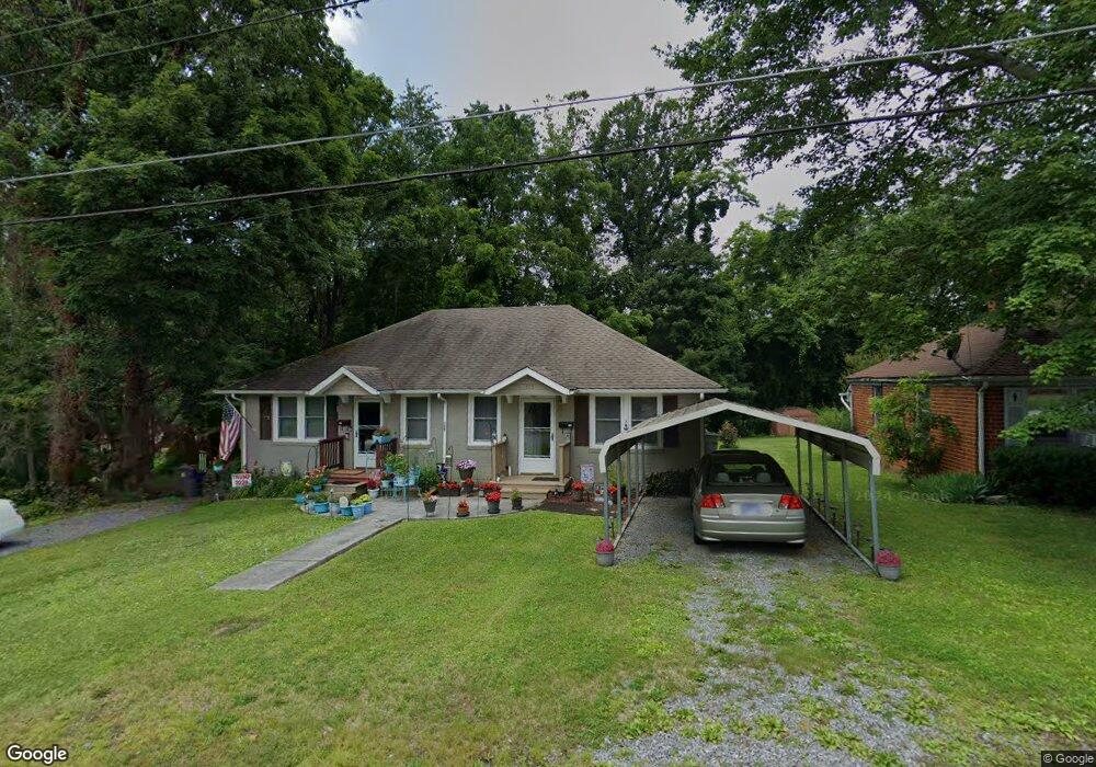
115 Carson Ln Unit 117 Bristol, TN 37620
Estimated Value: $116,000 - $180,000
--
Bed
2
Baths
1,350
Sq Ft
$109/Sq Ft
Est. Value
About This Home
This home is located at 115 Carson Ln Unit 117, Bristol, TN 37620 and is currently estimated at $146,875, approximately $108 per square foot. 115 Carson Ln Unit 117 is a home located in Sullivan County with nearby schools including Anderson Elementary School, Vance Middle School, and Tennessee High School.
Ownership History
Date
Name
Owned For
Owner Type
Purchase Details
Closed on
Nov 7, 2019
Sold by
Lavinder Development Inc
Bought by
Davis Emily Danielle and Davis John Ellis
Current Estimated Value
Home Financials for this Owner
Home Financials are based on the most recent Mortgage that was taken out on this home.
Original Mortgage
$108,500
Outstanding Balance
$95,452
Interest Rate
3.6%
Mortgage Type
New Conventional
Estimated Equity
$51,423
Purchase Details
Closed on
Jan 4, 2008
Sold by
Barker Williams Phyllis L
Bought by
Fritts Charles E
Create a Home Valuation Report for This Property
The Home Valuation Report is an in-depth analysis detailing your home's value as well as a comparison with similar homes in the area
Home Values in the Area
Average Home Value in this Area
Purchase History
| Date | Buyer | Sale Price | Title Company |
|---|---|---|---|
| Davis Emily Danielle | $112,500 | None Available | |
| Fritts Charles E | $30,000 | -- |
Source: Public Records
Mortgage History
| Date | Status | Borrower | Loan Amount |
|---|---|---|---|
| Open | Davis Emily Danielle | $108,500 |
Source: Public Records
Tax History Compared to Growth
Tax History
| Year | Tax Paid | Tax Assessment Tax Assessment Total Assessment is a certain percentage of the fair market value that is determined by local assessors to be the total taxable value of land and additions on the property. | Land | Improvement |
|---|---|---|---|---|
| 2024 | -- | $28,760 | $5,600 | $23,160 |
| 2023 | $1,263 | $28,760 | $5,600 | $23,160 |
| 2022 | $1,263 | $28,760 | $5,600 | $23,160 |
| 2021 | $1,263 | $28,760 | $5,600 | $23,160 |
| 2020 | $1,315 | $28,760 | $5,600 | $23,160 |
| 2019 | $1,315 | $27,800 | $5,600 | $22,200 |
| 2018 | $1,310 | $27,800 | $5,600 | $22,200 |
| 2017 | $1,310 | $27,800 | $5,600 | $22,200 |
| 2016 | $1,442 | $29,880 | $5,600 | $24,280 |
| 2014 | $1,360 | $29,856 | $0 | $0 |
Source: Public Records
Map
Nearby Homes
- 000 Hemlock Dr
- 2641 Anderson St
- 2461 Bradley St
- 2400 Bradley St
- 2412,14,16 Bradley St
- 2000 Euclid Ave
- 129 Grove Park Dr
- 2413 Catherine St
- 2241 Bradley St
- 2177 Randolph St
- 113 Neal Dr
- 548 Floyd St
- 1614 Broad St
- 1443 Windsor Ave
- 2121 2123 Randolph St
- 1057 Moorland Ave
- 460 Vance St
- 2909 Bay St
- 60 Peters St
- 401 Crockett St
- 111 Carson Ln Unit 113
- 107 Carson Ln Unit 109
- 107 Carson Ln Unit 2
- 209 Carson Ln Unit 211
- 209 Carson Ln Unit 9,11
- 217 Carson Ln Unit 219
- 112 Carson Ln Unit 114
- 219 Carson Ln
- 105 Carson Ln
- 116 Carson Ln Unit 118
- 110 Carson Ln Unit 108110
- 204 Carson Ln
- 101 Carson Ln
- 213 Carson Ln Unit 215
- 208 Carson Ln
- 221 Carson Ln Unit 223
- 102 Carson Ln
- 103 Carson Ln
- 210 Carson Ln
- 235 Carson Ln