Estimated Value: $178,955 - $194,000
3
Beds
2
Baths
1,321
Sq Ft
$139/Sq Ft
Est. Value
About This Home
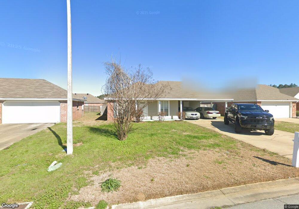
This home is located at 115 Cedar Spring Cir Unit (Lot 82 ), Pearl, MS 39208 and is currently estimated at $183,739, approximately $139 per square foot. 115 Cedar Spring Cir Unit (Lot 82 ) is a home located in Rankin County with nearby schools including McLaurin Elementary School.
Ownership History
Date
Name
Owned For
Owner Type
Purchase Details
Closed on
Feb 16, 2013
Sold by
Choe Hyoun S and Choe Rebecca C
Bought by
2008 Hyoun And Rebecca Choe Revocable Tr
Current Estimated Value
Purchase Details
Closed on
Oct 26, 2007
Sold by
Woodbridge Inc
Bought by
Choe Hyoun S and Choe Rebecca C
Home Financials for this Owner
Home Financials are based on the most recent Mortgage that was taken out on this home.
Original Mortgage
$98,400
Interest Rate
6.37%
Create a Home Valuation Report for This Property
The Home Valuation Report is an in-depth analysis detailing your home's value as well as a comparison with similar homes in the area
Home Values in the Area
Average Home Value in this Area
Purchase History
| Date | Buyer | Sale Price | Title Company |
|---|---|---|---|
| 2008 Hyoun And Rebecca Choe Revocable Tr | -- | -- | |
| Choe Hyoun S | -- | -- |
Source: Public Records
Mortgage History
| Date | Status | Borrower | Loan Amount |
|---|---|---|---|
| Previous Owner | Choe Hyoun S | $98,400 |
Source: Public Records
Tax History Compared to Growth
Tax History
| Year | Tax Paid | Tax Assessment Tax Assessment Total Assessment is a certain percentage of the fair market value that is determined by local assessors to be the total taxable value of land and additions on the property. | Land | Improvement |
|---|---|---|---|---|
| 2024 | $1,571 | $15,921 | $0 | $0 |
| 2023 | $1,567 | $15,873 | $0 | $0 |
| 2022 | $1,543 | $15,873 | $0 | $0 |
| 2021 | $1,543 | $15,873 | $0 | $0 |
| 2020 | $1,543 | $15,873 | $0 | $0 |
| 2019 | $1,431 | $14,313 | $0 | $0 |
| 2018 | $1,403 | $14,313 | $0 | $0 |
| 2017 | $1,403 | $14,313 | $0 | $0 |
| 2016 | $1,277 | $13,727 | $0 | $0 |
| 2015 | $1,277 | $13,727 | $0 | $0 |
| 2014 | $1,247 | $13,727 | $0 | $0 |
| 2013 | $1,247 | $13,727 | $0 | $0 |
Source: Public Records
Map
Nearby Homes
- Aldridge Plan at Cedar Lane
- Freeport Plan at Cedar Lane
- 605 Cedar Hill Dr
- 606 Cedar Hill Dr
- 406 Cedar Hill Dr
- 103 Cedar Ridge Blvd
- 305 Cedar Crest Dr
- 304 Cedar Hill Dr
- 307 Cedar Crest Dr
- 508 Ridgecrest Dr
- 607 Cedar Place
- 603 Cedar Place
- 605 Cedar Place
- 308 London Way
- 320 Cedar Hill Dr
- 00 Whitfield Rd
- 243 Trace Dr
- 241 Trace Dr
- 505 Arden Dr
- 317 Willow Run
- 115 Cedar Spring Cir
- 113 Cedar Spring Cir
- 117 Cedar Spring Cir
- 117 Cedar Spring Cir Unit (Lot 83 )
- 308 Cedar Grove Ln
- 0 Cedar Spring Cir Unit Lot 79 (109 1175220
- 111 Cedar Spring Cir
- 111 Cedar Spring Cir Unit ( Lot 80 )
- 119 Cedar Spring Cir
- 306 Cedar Grove Ln
- 310 Cedar Grove Ln
- 304 Cedar Grove Ln
- 114 Cedar Spring Cir
- 114 Cedar Spring Cir Unit ( Lot 72 )
- 312 Cedar Grove Ln
- 116 Cedar Springs Cir
- 116 Cedar Spring Cir
- 116 Cedar Spring Cir Unit (LOT71)
- 109 Cedar Spring Cir
- 112 Cedar Spring Cir