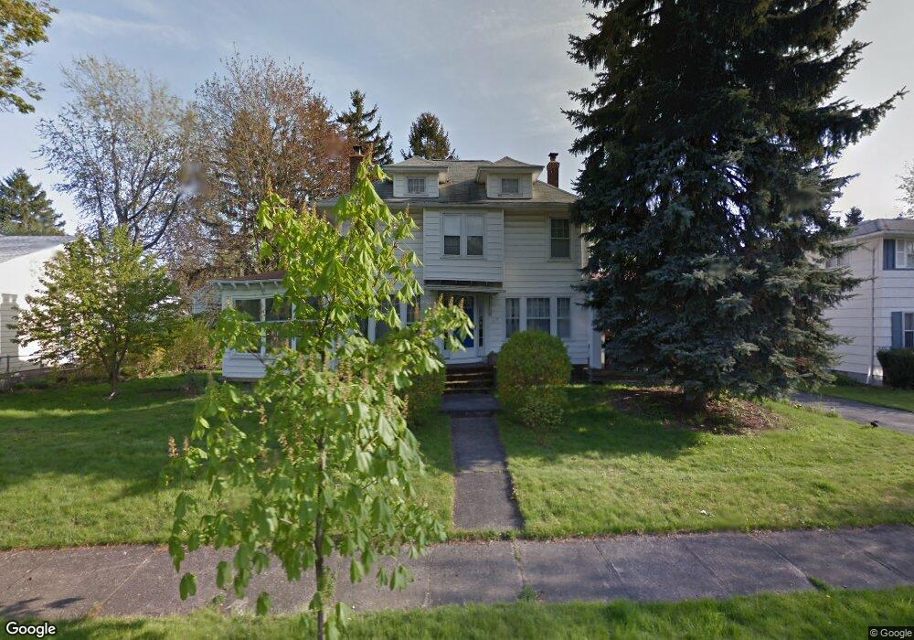
115 Cherry Rd Rochester, NY 14612
Charlotte NeighborhoodEstimated Value: $204,000 - $232,000
3
Beds
2
Baths
1,416
Sq Ft
$152/Sq Ft
Est. Value
About This Home
This home is located at 115 Cherry Rd, Rochester, NY 14612 and is currently estimated at $214,773, approximately $151 per square foot. 115 Cherry Rd is a home located in Monroe County with nearby schools including Abelard Reynolds School No. 42, Virgil Grissom School No. 7, and Dr. Louis A. Cerulli School No. 34.
Ownership History
Date
Name
Owned For
Owner Type
Purchase Details
Closed on
Nov 17, 2006
Sold by
Muhs Richard
Bought by
Kelly Brian M
Current Estimated Value
Home Financials for this Owner
Home Financials are based on the most recent Mortgage that was taken out on this home.
Original Mortgage
$88,200
Outstanding Balance
$52,610
Interest Rate
6.36%
Mortgage Type
New Conventional
Estimated Equity
$162,163
Purchase Details
Closed on
Jul 2, 2002
Create a Home Valuation Report for This Property
The Home Valuation Report is an in-depth analysis detailing your home's value as well as a comparison with similar homes in the area
Home Values in the Area
Average Home Value in this Area
Purchase History
| Date | Buyer | Sale Price | Title Company |
|---|---|---|---|
| Kelly Brian M | $98,000 | -- | |
| -- | $71,000 | -- |
Source: Public Records
Mortgage History
| Date | Status | Borrower | Loan Amount |
|---|---|---|---|
| Open | Kelly Brian M | $88,200 |
Source: Public Records
Tax History
| Year | Tax Paid | Tax Assessment Tax Assessment Total Assessment is a certain percentage of the fair market value that is determined by local assessors to be the total taxable value of land and additions on the property. | Land | Improvement |
|---|---|---|---|---|
| 2024 | $1,603 | $168,600 | $13,500 | $155,100 |
| 2023 | $1,356 | $106,700 | $10,700 | $96,000 |
| 2022 | $1,349 | $106,700 | $10,700 | $96,000 |
| 2021 | $1,315 | $106,700 | $10,700 | $96,000 |
| 2020 | $1,307 | $106,700 | $10,700 | $96,000 |
| 2019 | $1,207 | $95,000 | $10,700 | $84,300 |
| 2018 | $2,381 | $95,000 | $10,700 | $84,300 |
| 2017 | $0 | $95,000 | $10,700 | $84,300 |
| 2016 | $1,207 | $95,000 | $10,700 | $84,300 |
| 2015 | $2,486 | $98,000 | $10,700 | $87,300 |
| 2014 | $2,486 | $98,000 | $10,700 | $87,300 |
Source: Public Records
Map
Nearby Homes
- 87 Leander Rd
- 29 W Boulevard Pkwy
- 6 Calvin Rd
- 271 Sheppler St
- 115 Burley Rd
- 762 Bennington Dr
- 514 Bennington Dr
- 65 Wheeldon Dr
- 92 Wheeldon Dr
- 64 Chippendale Rd
- 21 Sheraton Dr
- 3482-3484 Lake Ave
- 101 Freemont Rd
- 369 Stone Rd
- 43 Britton Rd
- 343 Stonewood Ave
- 128 Wendhurst Dr
- 3583 Lake Ave
- 20 Florida Ave
- 188 Estall Rd